Laclede County

Log in to your account

AroundUs is a community-driven map of interesting places, built by curious explorers like you. It grows with every review, story, and photo you share.
Connect to save your favorite spots, contribute locations, and create personalized routes.
Continue with Google
Continue with Apple
Continue with X
Continue with Facebook
Continue with email
By continuing, you accept our Terms and Conditions and our Privacy Policy
Create an account
Add to collection
Map
Suggest a change
Share

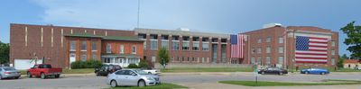
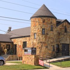
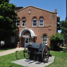
Laclede County, County administration center in Lebanon, Missouri, United States.

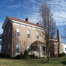
Laclede County is an administrative area in south-central Missouri with Lebanon serving as its county seat. The area includes protected forest lands and several communities that together form the county's character.

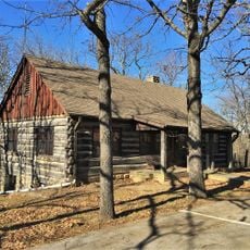
The county was established in 1849 and named after Pierre Laclede, the founder of St. Louis. Its first courthouse, completed in 1851, marked the formal beginning of the area's government operations.

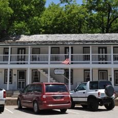
The Cowan Civic Center in Lebanon serves as the gathering place where the county's residents come together for events and performances. Throughout the year, this venue hosts the public meetings and celebrations that shape community life.

Schools and colleges throughout the area, including Lebanon R-III Schools and local branches of Ozark Technical College, provide educational resources. These institutions help visitors and residents learn about the county and its opportunities.

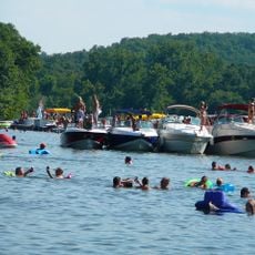
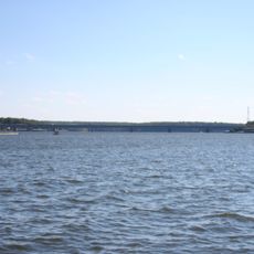
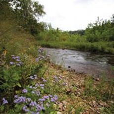
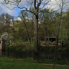
Sections of the Mark Twain National Forest lie within the county, offering natural woodland areas. These forests attract visitors interested in experiencing Missouri's native plants and outdoor surroundings.

Location: Missouri

Inception: 1849

Capital city: Lebanon

Shares border with: Camden County, Wright County, Texas County, Webster County, Pulaski County, Dallas County

Website: http://lacledecountymissouri.org

GPS coordinates: 37.66000,-92.59000

Latest update: December 7, 2025 20:45

Photos
Around this place
Lake of the Ozarks
United States of America

Lake of the Ozarks

60.6 km
Party Cove
United States of America

Party Cove

49.6 km
Bagnell Dam
United States of America

Bagnell Dam

60.7 km
Ha Ha Tonka State Park
United States of America

Ha Ha Tonka State Park

37.7 km
Uranus Missouri
United States of America

Uranus Missouri

46.6 km
Bennett Spring State Park
United States of America

Bennett Spring State Park

24.4 km
Lake of the Ozarks State Park
United States of America

Lake of the Ozarks State Park

49.5 km
United States of America

Marine Corps Detachment, Fort Leonard Wood

41.8 km
Grand Glaize Bridge
United States of America

Grand Glaize Bridge

52.9 km
Bridal Cave
United States of America

Bridal Cave

48 km
Rainey Funeral Home Building
United States of America

Rainey Funeral Home Building

45.3 km
Old Stagecoach Stop
United States of America

Old Stagecoach Stop

39.2 km
Ralph E. Burley House
United States of America

Ralph E. Burley House

6.5 km
Wallace House
United States of America

Wallace House

7 km
Calloway Manes Homestead
United States of America

Calloway Manes Homestead

30 km
Ploger-Moneymaker Place
United States of America

Ploger-Moneymaker Place

7 km
Fiery Fork Conservation Area
United States of America

Fiery Fork Conservation Area

57.5 km
Big Surf Waterpark
United States of America

Big Surf Waterpark

46.6 km
Col. Thomas C. Love House
United States of America

Col. Thomas C. Love House

53.9 km
Pulaski County Courthouse
United States of America

Pulaski County Courthouse

39.1 km
Boegel and Hine Flour Mill-Wommack Mill
United States of America

Boegel and Hine Flour Mill-Wommack Mill

58.3 km
Bennett Spring Dining Lodge
United States of America

Bennett Spring Dining Lodge

24.6 km
Camden County Historical Society
United States of America

Camden County Historical Society

43.1 km
Uranus
United States of America

Uranus

46.7 km
Sonic
United States of America

Sonic

6 km
Lake of the Ozarks State Park Highway 134 Historic District
United States of America

Lake of the Ozarks State Park Highway 134 Historic District

51.7 km
Bennett Spring State Park Shelter House and Water Gauge Station
United States of America

Bennett Spring State Park Shelter House and Water Gauge Station

24.4 km
Devils Elbow Bridge
United States of America

Devils Elbow Bridge

51 km
Show the full map
Reviews

Visited this place? Tap the stars to rate it and share your experience / photos with the community! Try now! You can cancel it anytime.

Administrative divisions
« Laclede County - County administration center in Lebanon, Missouri, United States » is provided by Around Us (aroundus.com). Images and texts are derived from Wikimedia project under a Creative Commons license. You are allowed to copy, distribute, and modify copies of this page, under the conditions set by the license, as long as this note is clearly visible.

Discover hidden gems everywhere you go!

From secret cafés to breathtaking viewpoints, skip the crowded tourist spots and find places that match your style. Our app makes it easy with voice search, smart filtering, route optimization, and insider tips from travelers worldwide. Download now for the complete mobile experience.

Around Us App Screenshot

A unique approach to discovering new places

Le Figaro

All the places worth exploring

France Info

A tailor-made excursion in just a few clicks

20 Minutes