Lawrence County

Log in to your account

AroundUs is a community-driven map of interesting places, built by curious explorers like you. It grows with every review, story, and photo you share.
Connect to save your favorite spots, contribute locations, and create personalized routes.
By continuing, you accept our Terms and Conditions and our Privacy Policy
Add to collection
Map
Suggest a change
Share

Lawrence County, Administrative division in Indiana, United States

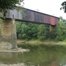
Lawrence County is an administrative division in southern Indiana with Bedford serving as the county seat and main population center. The area is crossed by major roads including U.S. Route 50 and State Road 37, connecting to nearby Orange and Monroe counties.

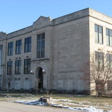
The county was established in 1818 after being divided from Orange County, with Palestine initially serving as the county seat. In 1825, Bedford became the new seat when a settlement program offered relocating residents from Palestine new plots of land.

The county is named after Captain James Lawrence, a naval officer from the War of 1812 whose legacy remains part of the local identity. This naval connection runs through the region's sense of place, even if most visitors don't immediately recognize it.

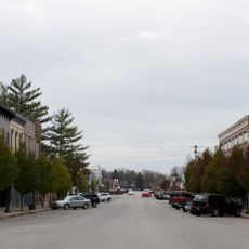
Visitors should expect the main routes crossing through the area to be the primary way to navigate between towns and neighboring regions. The local road system makes it straightforward to travel across the county or connect to areas beyond its borders.

The move of the county seat from Palestine to Bedford in 1825 was not just an administrative change but an active settlement program. Residents were given new plots to relocate, which fundamentally shaped how Bedford grew and became the hub it remains today.

Location: Indiana

Inception: January 7, 1818

Capital city: Bedford

Shares border with: Monroe County, Jackson County, Washington County, Orange County, Martin County, Greene County

Website: https://lawrencecounty.in.gov

GPS coordinates: 38.84000,-86.49000

Latest update: December 7, 2025 19:30

Photos
Around this place
Spring Mill State Park
United States of America

Spring Mill State Park

13.3 km
Bluespring Caverns
United States of America

Bluespring Caverns

6.9 km
Medora Covered Bridge
United States of America

Medora Covered Bridge

29.8 km
Hickory Ridge Fire Tower
United States of America

Hickory Ridge Fire Tower

26.2 km
Williams Bridge
United States of America

Williams Bridge

15.9 km
Twin caves
United States of America

Twin caves

14.6 km
Madden School
United States of America

Madden School

4 km
Otis Park and Golf Course
United States of America

Otis Park and Golf Course

3.7 km
Indiana Limestone Company Building
United States of America

Indiana Limestone Company Building

4 km
Bedford Courthouse Square Historic District
United States of America

Bedford Courthouse Square Historic District

2.5 km
Mitchell Opera House
United States of America

Mitchell Opera House

11.8 km
Cavanaugh Bridge
United States of America

Cavanaugh Bridge

31.8 km
C.S. Norton Mansion
United States of America

C.S. Norton Mansion

2.5 km
Zahn Historic District
United States of America

Zahn Historic District

2.1 km
Joseph Mitchell House
United States of America

Joseph Mitchell House

26.4 km
Mitchell Downtown Historic District
United States of America

Mitchell Downtown Historic District

12 km
Thomas Newby Braxtan House
United States of America

Thomas Newby Braxtan House

31.5 km
Carr High School
United States of America

Carr High School

23.1 km
Jenkins Place
United States of America

Jenkins Place

20.7 km
William A. Ragsdale House
United States of America

William A. Ragsdale House

3.3 km
John F. and Malissa Koontz House
United States of America

John F. and Malissa Koontz House

28 km
Orleans Historic District
United States of America

Orleans Historic District

20.1 km
Newberry Friends Meeting House
United States of America

Newberry Friends Meeting House

30.6 km
St. Vincent de Paul Catholic Church
United States of America

St. Vincent de Paul Catholic Church

2.5 km
Kappa V Archaeological Site
United States of America

Kappa V Archaeological Site

28.1 km
Lindley House
United States of America

Lindley House

31.5 km
Bakers Junction Haunted Train OPEN in Oct.
United States of America

Bakers Junction Haunted Train OPEN in Oct.

24.2 km
Ketcham Travis House
United States of America

Ketcham Travis House

26.8 km
Show the full map
Reviews

Visited this place? Tap the stars to rate it and share your experience / photos with the community! Try now! You can cancel it anytime.

Administrative divisions
« Lawrence County - Administrative division in Indiana, United States » is provided by Around Us (aroundus.com). Images and texts are derived from Wikimedia project under a Creative Commons license. You are allowed to copy, distribute, and modify copies of this page, under the conditions set by the license, as long as this note is clearly visible.

Discover hidden gems everywhere you go!

From secret cafés to breathtaking viewpoints, skip the crowded tourist spots and find places that match your style. Our app makes it easy with voice search, smart filtering, route optimization, and insider tips from travelers worldwide. Download now for the complete mobile experience.

Around Us App Screenshot

A unique approach to discovering new places

Le Figaro

All the places worth exploring

France Info

A tailor-made excursion in just a few clicks

20 Minutes