Enable Location

We need your location to show you interesting places around you

Discover nearby places

Find interesting locations and hidden gems around you

Precise directions

Get accurate directions and distances to places

Your location is never shared with other users. It's only used when you tap the location button.

High Point

Log in to your account

Start exploring — it's free

Trusted by 62,043 travelers worldwide

Continue with Google
Continue with Apple
or

We will send you a code to connect

By continuing, you accept our Terms and Conditions and our Privacy Policy

Check your inbox

We've sent a pincode in your inbox. Please enter the code below.

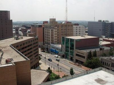
High Point, Industrial city in Piedmont Triad, North Carolina, US.

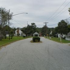
High Point is an industrial city in the Piedmont Triad region of North Carolina that stretches across four counties: Davidson, Forsyth, Guilford, and Randolph. The urban area sits at an elevation of 286 meters (938 feet) and spreads through gentle hills and wooded areas of the Piedmont.

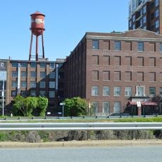
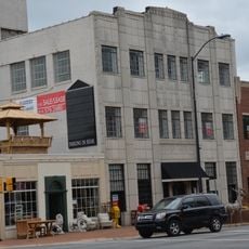
The place received its charter in 1859 and owes its name to its location at the highest point on the North Carolina Railroad route, which was laid out here in 1856. The furniture industry developed from the late 19th century onward and continues to shape economic life today.

Twice each year, the city transforms into a center of the furniture trade when thousands of visitors from around the world arrive for the spring and fall markets. The exhibition halls and showrooms then open their doors to professionals who examine new collections and trends.

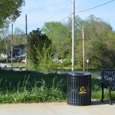
The municipal administration offers residents online services for bill payments, waste collection schedules, and access to public meetings through video streaming. Visitors can find information about events and public facilities on the city website.

On the outskirts stands an 11-meter (36-foot) tall chest of drawers, considered the tallest in the world and a reminder of centuries of furniture production. The piece was originally built as advertising for a furniture company and is now a popular photo spot.

The community of curious travelers

AroundUs brings together thousands of curated places, local tips, and hidden gems, enriched daily by 60,000 contributors worldwide.

Start exploring
Location
Location
Location
Location
Elevation above the sea
286 m
Shares border with
Archdale, Jamestown
GPS coordinates
35.97056,-79.99750
Latest update
December 15, 2025 00:38
Around this place
Millis Athletic Convocation Center
United States of America

Millis Athletic Convocation Center

366 m
Market Square
United States of America

Market Square

2 km
Richard Mendenhall Plantation Buildings
United States of America

Richard Mendenhall Plantation Buildings

5 km
Oakdale Cotton Mill Village
United States of America

Oakdale Cotton Mill Village

6.2 km
First Baptist Church
United States of America

First Baptist Church

1 km
United States of America

Deep River Friends Meeting House and Cemetery

7.4 km
Allen Jay School Rock Gymnasium
United States of America

Allen Jay School Rock Gymnasium

6 km
Lucy and J. Vassie Wilson House
United States of America

Lucy and J. Vassie Wilson House

2.7 km
John H. Adams House
United States of America

John H. Adams House

1.6 km
United States of America

Model Farm

4 km
Enterprise Building
United States of America

Enterprise Building

1.5 km
Kilby Hotel
United States of America

Kilby Hotel

1.1 km
Dr. C. S. Grayson House
United States of America

Dr. C. S. Grayson House

1.6 km
O. Arthur Kirkman House and Outbuildings
United States of America

O. Arthur Kirkman House and Outbuildings

2.3 km
John Haley House
United States of America

John Haley House

1.1 km
Wiley and Elizabeth Forbus House
United States of America

Wiley and Elizabeth Forbus House

5.8 km
Former Jamestown High School
United States of America

Former Jamestown High School

5.8 km
Washington Street Historic District
United States of America

Washington Street Historic District

1.1 km
United States of America

Spring Hill Methodist Protestant Church Cemetery

5.2 km
United States of America

Eli Moore House

5.9 km
West High Street Historic District
United States of America

West High Street Historic District

2.1 km
A. E. Taplin Apartment Building
United States of America

A. E. Taplin Apartment Building

2 km
Moses Hammond House
United States of America

Moses Hammond House

6.6 km
Hardee Apartments
United States of America

Hardee Apartments

1.6 km
United States of America

Col. Isaac Beeson House

11.8 km
United States of America

Jamestown Historic District

5.4 km
Uptown Suburbs Historic District
United States of America

Uptown Suburbs Historic District

2.3 km
Oakwood Historic District
United States of America

Oakwood Historic District

2.1 km
Show the full map
« High Point - Industrial city in Piedmont Triad, North Carolina, US » is provided by Around Us (aroundus.com). Images and texts are derived from Wikimedia project under a Creative Commons license. You are allowed to copy, distribute, and modify copies of this page, under the conditions set by the license, as long as this note is clearly visible.

Discover hidden gems everywhere you go!

From secret cafés to breathtaking viewpoints, skip the crowded tourist spots and find places that match your style. Our app makes it easy with voice search, smart filtering, route optimization, and insider tips from travelers worldwide. Download now for the complete mobile experience.

Around Us App Screenshot

A unique approach to discovering new places

Le Figaro

All the places worth exploring

France Info

A tailor-made excursion in just a few clicks

20 Minutes

Around Us
Travel Guide & Maps
Download

Send to your phone

QR Code
1

Open the camera app on your mobile.

2

Point at the QR code with your camera. A notification will appear.

3

Tap the notification to open the link.