Chest opened
+${chestReward.xp} XP
Explorer
NOUVEAU ×${chestReward.collectible.quantity}
tapez pour fermer
Chest locked

Open chests in the app

Around Us is built for your phone — chests unlock when you walk, explore and capture nearby places.

Enable Location

We need your location to show you interesting places around you

Discover nearby places

Find interesting locations and hidden gems around you

Precise directions

Get accurate directions and distances to places

Your location is never shared with other users. It's only used when you tap the location button.

Catawba River

Log in to your account

Start exploring — it's free

Trusted by 72,893 travelers worldwide

Continue with Google
Continue with Apple
or

We will send you a code to connect

By continuing, you accept our Terms and Conditions and our Privacy Policy

Check your inbox

We've sent a pincode in your inbox. Please enter the code below.

Catawba River
Discussion Reviews 2 Photos
31.9k Popularity

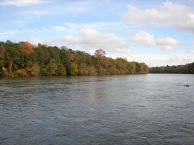
Catawba River, River system in North Carolina and South Carolina, United States

The Catawba River is a waterway that flows 225 miles from the Blue Ridge Mountains through Charlotte across two states, creating eleven lakes along the way. The river eventually transforms into the Wateree River as it continues its course downstream.

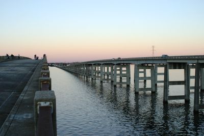
The river sustained the Catawba people for thousands of years before European settlement brought major changes to the landscape. In 1904, the first hydroelectric dam was built, beginning a transformation that would reshape the entire waterway.

The river takes its name from the Catawba people who made this waterway central to their way of life for thousands of years. Today, the surrounding communities gather at the lakes and parks along the river for recreation and celebration.

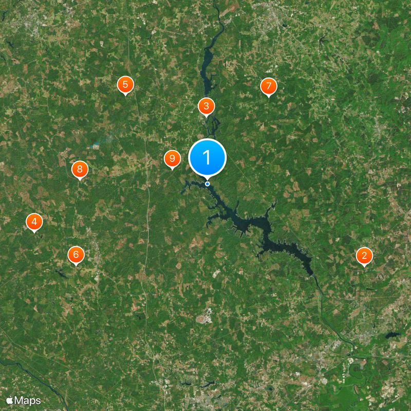
The waterway supplies drinking water to millions of residents and generates power for the surrounding region through multiple dams. Visitors can access the river at various parks, boat launches, and recreation areas spread throughout both states.

The river basin is home to the world's largest population of Rocky Shoals Spider Lilies, delicate water flowers that bloom in spring. Landsford Canal State Park offers the best viewing experience for these rare flowers.

The community of curious travelers

AroundUs brings together thousands of curated places, local tips, and hidden gems, enriched daily by 60,000 contributors worldwide.

Start exploring
Location
Location
GPS coordinates
34.46694,-80.88889
Latest update
December 20, 2025 00:57
Around this place
Camden Battlefield
United States of America

Camden Battlefield

29.1 km
Republic Theatre
United States of America

Republic Theatre

11.2 km
Old Stone House
United States of America

Old Stone House

29.4 km
Catholic Presbyterian Church
United States of America

Catholic Presbyterian Church

19.9 km
Furman Institution Faculty Residence
United States of America

Furman Institution Faculty Residence

25.3 km
Mount Carmel A.M.E. Zion Campground
United States of America

Mount Carmel A.M.E. Zion Campground

17.6 km
White Oak Historic District
United States of America

White Oak Historic District

20.9 km
Camp Welfare
United States of America

Camp Welfare

6.2 km
George P. Hoffman House
United States of America

George P. Hoffman House

29.1 km
Valencia
United States of America

Valencia

17.8 km
Liberty Hill Historic District
United States of America

Liberty Hill Historic District

7.8 km
The Oaks
United States of America

The Oaks

29.4 km
Century House
United States of America

Century House

19.3 km
Wade-Beckham House
United States of America

Wade-Beckham House

22 km
Blink Bonnie
United States of America

Blink Bonnie

15.7 km
Great Falls Downtown Historic District
United States of America

Great Falls Downtown Historic District

11.2 km
Russell-Heath House
United States of America

Russell-Heath House

15.9 km
Clinton AME Zion Church
United States of America

Clinton AME Zion Church

29.1 km
Dr. William Columbus Cauthen House
United States of America

Dr. William Columbus Cauthen House

24.7 km
Ridgeway Historic District
United States of America

Ridgeway Historic District

19 km
Ruff's Chapel
United States of America

Ruff's Chapel

19.2 km
Tocaland
United States of America

Tocaland

21.9 km
Winnsboro Historic District
United States of America

Winnsboro Historic District

20.5 km
Concord Presbyterian Church
United States of America

Concord Presbyterian Church

26.5 km
Perry-McIlwain-McDow House
United States of America

Perry-McIlwain-McDow House

24.1 km
Matson Street Historic District
United States of America

Matson Street Historic District

29.3 km
Monroe Wilson House
United States of America

Monroe Wilson House

19 km
Rural Point
United States of America

Rural Point

20.6 km
Show the full map
Reviews
Share your experience

No review yet

Discussions
Start a discussion...

No discussion yet

« Catawba River - River system in North Carolina and South Carolina, United States » is provided by Around Us (aroundus.com). Images and texts are derived from Wikimedia project under a Creative Commons license. You are allowed to copy, distribute, and modify copies of this page, under the conditions set by the license, as long as this note is clearly visible.

Discover hidden gems everywhere you go!

From secret cafés to breathtaking viewpoints, skip the crowded tourist spots and find places that match your style. Our app makes it easy with voice search, smart filtering, route optimization, and insider tips from travelers worldwide. Download now for the complete mobile experience.

Around Us App Screenshot

A unique approach to discovering new places

Le Figaro

All the places worth exploring

France Info

A tailor-made excursion in just a few clicks

20 Minutes

Around Us
Travel Guide & Maps
Download

Send to your phone

QR Code
1

Open the camera app on your mobile.

2

Point at the QR code with your camera. A notification will appear.

3

Tap the notification to open the link.