Chest opened
+${chestReward.xp} XP
Explorer
NOUVEAU ×${chestReward.collectible.quantity}
tapez pour fermer
Chest locked

Open chests in the app

Around Us is built for your phone — chests unlock when you walk, explore and capture nearby places.

Enable Location

We need your location to show you interesting places around you

Discover nearby places

Find interesting locations and hidden gems around you

Precise directions

Get accurate directions and distances to places

Your location is never shared with other users. It's only used when you tap the location button.

Mantoloking

Log in to your account

Start exploring — it's free

Trusted by 72,888 travelers worldwide

Continue with Google
Continue with Apple
or

We will send you a code to connect

By continuing, you accept our Terms and Conditions and our Privacy Policy

Check your inbox

We've sent a pincode in your inbox. Please enter the code below.

Discussion Reviews 1 Photos
17.3k Popularity

Mantoloking, borough of New Jersey, United States

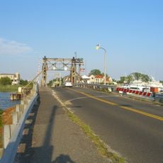
Mantoloking is a small borough in Ocean County, New Jersey, situated on the narrow Barnegat Peninsula between the Atlantic Ocean and Barnegat Bay. It borders Bay Head to the north and Brick Township to the south, and most properties on the peninsula have water on one or both sides.

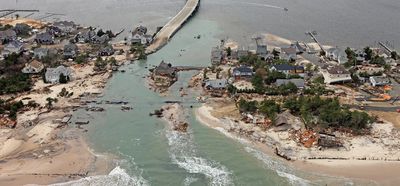
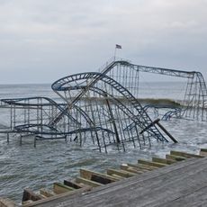
Mantoloking separated from Brick Township in 1911 to become its own borough. In 2012, Hurricane Sandy caused widespread destruction here, damaging or destroying the large majority of homes along the peninsula.

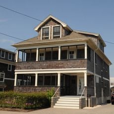
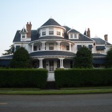
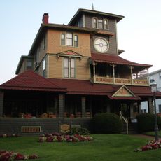
Mantoloking takes its name from the Lenape people who lived along this shore long before European settlement. Life here still revolves around the water, and visitors can see this in the way homes face the bay or the ocean rather than the street.

The streets here are narrow and easy to walk or cycle along, especially close to the waterfront. Parking can be hard to find in summer, so arriving early in the day makes a visit more comfortable.

After the 2012 storm, nearly every home in the borough had to be torn down or rebuilt from scratch, which means the Mantoloking visible today is almost entirely new construction. This makes it one of the few places on the Jersey Shore where the built environment is younger than the community itself.

The community of curious travelers

AroundUs brings together thousands of curated places, local tips, and hidden gems, enriched daily by 60,000 contributors worldwide.

Start exploring
Location
Inception
April 10, 1911
Shares border with
Bay Head, Point Pleasant, Brick Township
GPS coordinates
40.04694,-74.04972
Latest update
March 3, 2026 08:23
Around this place
Star Jet
United States of America

Star Jet

11.7 km
Casino Pier
United States of America

Casino Pier

11.7 km
Allaire State Park
United States of America

Allaire State Park

14.6 km
Jenkinson's South Amusement Park
United States of America

Jenkinson's South Amusement Park

5.1 km
Jet Star
United States of America

Jet Star

11.7 km
Hydrus
United States of America

Hydrus

11.8 km
Allaire Village
United States of America

Allaire Village

13.9 km
Cattus Island Park
United States of America

Cattus Island Park

10.5 km
Thomas A. Mathis and J. Stanley Tunney Bridges
United States of America

Thomas A. Mathis and J. Stanley Tunney Bridges

12.3 km
Glimmer Glass Bridge
United States of America

Glimmer Glass Bridge

7.2 km
New Jersey Museum of Transportation
United States of America

New Jersey Museum of Transportation

14.3 km
L. Ron Hubbard Residence at Bay Head
United States of America

L. Ron Hubbard Residence at Bay Head

2 km
United States of America

Shore Region

11.6 km
Sea Girt Light
United States of America

Sea Girt Light

10.2 km
United States of America

National Guard Militia Museum of New Jersey

8.4 km
Martin Maloney Cottage
United States of America

Martin Maloney Cottage

11.8 km
Strand Theater
United States of America

Strand Theater

15.1 km
United States of America

St. Catharine Church, Spring Lake

11.3 km
Audenried Cottage
United States of America

Audenried Cottage

12.6 km
Manasquan Friends Meetinghouse and Burying Ground
United States of America

Manasquan Friends Meetinghouse and Burying Ground

9.6 km
Bay Head Historic District
United States of America

Bay Head Historic District

2.8 km
Belmar Public Library
United States of America

Belmar Public Library

14.8 km
U.S. Life Saving Station No. 14
United States of America

U.S. Life Saving Station No. 14

12.8 km
Breakwater Beach
United States of America

Breakwater Beach

11.7 km
Insectropolis
United States of America

Insectropolis

14.6 km
Orient Baptist Church
United States of America

Orient Baptist Church

7.1 km
Island Heights Historic District
United States of America

Island Heights Historic District

14.4 km
L Street Bathing Beach
United States of America

L Street Bathing Beach

14.8 km
Show the full map
Reviews
Share your experience

No review yet

Discussions
Start a discussion...

No discussion yet

« Mantoloking - borough of New Jersey, United States » is provided by Around Us (aroundus.com). Images and texts are derived from Wikimedia project under a Creative Commons license. You are allowed to copy, distribute, and modify copies of this page, under the conditions set by the license, as long as this note is clearly visible.

Discover hidden gems everywhere you go!

From secret cafés to breathtaking viewpoints, skip the crowded tourist spots and find places that match your style. Our app makes it easy with voice search, smart filtering, route optimization, and insider tips from travelers worldwide. Download now for the complete mobile experience.

Around Us App Screenshot

A unique approach to discovering new places

Le Figaro

All the places worth exploring

France Info

A tailor-made excursion in just a few clicks

20 Minutes

Around Us
Travel Guide & Maps
Download

Send to your phone

QR Code
1

Open the camera app on your mobile.

2

Point at the QR code with your camera. A notification will appear.

3

Tap the notification to open the link.