Isle La Motte

Log in to your account

AroundUs is a community-driven map of interesting places, built by curious explorers like you. It grows with every review, story, and photo you share.
Connect to save your favorite spots, contribute locations, and create personalized routes.
Continue with Google
Continue with Apple
Continue with X
Continue with Facebook
Continue with email
By continuing, you accept our Terms and Conditions and our Privacy Policy
Create an account
Add to collection
Map
Suggest a change
Share

Isle La Motte, Lake island and town in Grand Isle County, Vermont.

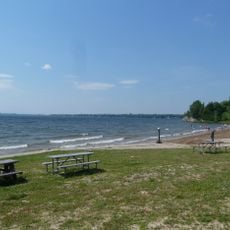
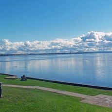
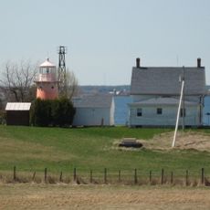
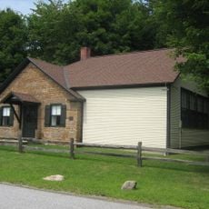
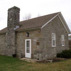
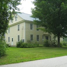
Isle La Motte is an island and town situated at the northern end of Lake Champlain where it flows toward the Richelieu River. The landscape features water views, shorelines, and the characteristics typical of a New England island community.

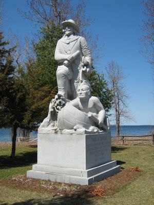
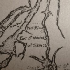
Pierre La Motte, a French soldier, founded Fort Sainte Anne in 1666 as the first European settlement in what is now Vermont. This early French presence marked an important chapter in the region's early colonial history.

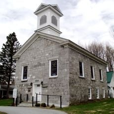
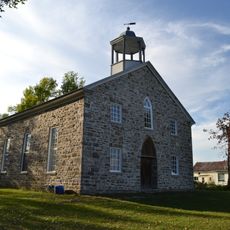
Saint Anne's Shrine reflects the island's role as an early spiritual center where people gathered for worship and reflection. The site continues to draw visitors seeking connection to this religious heritage.

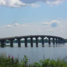
The island connects to the mainland by bridge, making it accessible by car or on foot. Visitors should note this is a rural island community, so having a map or local directions is helpful when exploring.

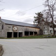
A quarry on the island once produced black marble that was used in important national buildings. This local industry played a surprising role in supplying materials for major construction projects beyond the region.

Location: Grand Isle County

Elevation above the sea: 29 m

GPS coordinates: 44.87722,-73.33917

Latest update: December 10, 2025 15:55

Photos
Around this place
Fort Montgomery
United States of America

Fort Montgomery

14.3 km
Point Au Roche State Park
United States of America

Point Au Roche State Park

11.6 km
Rouses Point–Lacolle 223 Border Crossing
Canada

Rouses Point–Lacolle 223 Border Crossing

15 km
Missisquoi Valley Union Middle/High School
United States of America

Missisquoi Valley Union Middle/High School

19.5 km
Missisquoi National Wildlife Refuge
United States of America

Missisquoi National Wildlife Refuge

16.9 km
Fort Sainte Anne
Canada

Fort Sainte Anne

2.6 km
Rouses Point Bridge
United States of America

Rouses Point Bridge

13.5 km
Cumberland Head Light
United States of America

Cumberland Head Light

21 km
Point Aux Roches Light
United States of America

Point Aux Roches Light

8.8 km
Plattsburgh Bay
United States of America

Plattsburgh Bay

20.8 km
Knight Point State Park
United States of America

Knight Point State Park

12.3 km
Isle La Motte Light
United States of America

Isle La Motte Light

3.3 km
Alice T. Miner Colonial Collection
United States of America

Alice T. Miner Colonial Collection

7.7 km
Holy Trinity Episcopal Church
United States of America

Holy Trinity Episcopal Church

17.5 km
Methodist Episcopal Church
United States of America

Methodist Episcopal Church

17.5 km
United Methodist Church of Isle La Motte
United States of America

United Methodist Church of Isle La Motte

91 m
United Methodist Church
United States of America

United Methodist Church

17.6 km
Rutland Railroad Pumping Station
United States of America

Rutland Railroad Pumping Station

11.1 km
Ira Hill House
United States of America

Ira Hill House

62 m
St. Albans Town Hall
United States of America

St. Albans Town Hall

17.6 km
Richwood Estate
United States of America

Richwood Estate

19.2 km
District No. 2 School
United States of America

District No. 2 School

19.7 km
Crown Point Green Historic District
United States of America

Crown Point Green Historic District

11.1 km
South Stone School House
United States of America

South Stone School House

2.8 km
Swanton School
United States of America

Swanton School

17.5 km
Evarts-McWilliams House
United States of America

Evarts-McWilliams House

18.8 km
Église d'Odelltown
Canada

Église d'Odelltown

18.8 km
Hyde Log Cabin
United States of America

Hyde Log Cabin

17.6 km
Show the full map
Reviews

Visited this place? Tap the stars to rate it and share your experience / photos with the community! Try now! You can cancel it anytime.

« Isle La Motte - Lake island and town in Grand Isle County, Vermont » is provided by Around Us (aroundus.com). Images and texts are derived from Wikimedia project under a Creative Commons license. You are allowed to copy, distribute, and modify copies of this page, under the conditions set by the license, as long as this note is clearly visible.

Discover hidden gems everywhere you go!

From secret cafés to breathtaking viewpoints, skip the crowded tourist spots and find places that match your style. Our app makes it easy with voice search, smart filtering, route optimization, and insider tips from travelers worldwide. Download now for the complete mobile experience.

Around Us App Screenshot

A unique approach to discovering new places

Le Figaro

All the places worth exploring

France Info

A tailor-made excursion in just a few clicks

20 Minutes