Chest opened
+${chestReward.xp} XP
Explorer
NOUVEAU ×${chestReward.collectible.quantity}
tapez pour fermer
Chest locked

Open chests in the app

Around Us is built for your phone — chests unlock when you walk, explore and capture nearby places.

Enable Location

We need your location to show you interesting places around you

Discover nearby places

Find interesting locations and hidden gems around you

Precise directions

Get accurate directions and distances to places

Your location is never shared with other users. It's only used when you tap the location button.

Wallkill River

Log in to your account

Start exploring — it's free

Trusted by 72,881 travelers worldwide

Continue with Google
Continue with Apple
or

We will send you a code to connect

By continuing, you accept our Terms and Conditions and our Privacy Policy

Check your inbox

We've sent a pincode in your inbox. Please enter the code below.

Wallkill River
Discussion Reviews 1 Photos
12.6k Popularity

Wallkill River, River system between New York and New Jersey, United States.

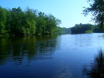
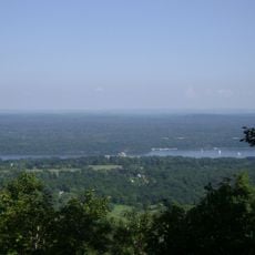
The Wallkill River is a waterway stretching from Lake Mohawk in New Jersey northward to the Rondout Creek in New York, passing through forests, wetlands, and open valleys. The water flows slowly through varied terrain, creating calm sections suitable for paddling and shallow areas for wading.

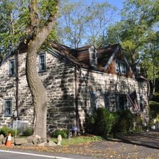
Dutch settlers in the 17th century renamed this waterway after the Waal river in the Netherlands, replacing its indigenous name. The shift in naming marked the arrival of European influence and settlement in the region.

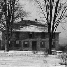
The river held importance for local indigenous groups who gathered stone materials along its banks for tool-making. Walking along its banks today, visitors pass through landscapes shaped by these communities for generations.

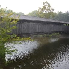
Access to the river is available through public areas including the National Wildlife Refuge with marked trails for hiking. Visitors should prepare for wet conditions near wetlands and wear appropriate footwear for uneven ground along the water.

Unlike the Hudson and Delaware Rivers nearby, this waterway flows northward rather than toward the ocean. The unusual direction results from the landscape geography between mountain ranges on either side.

The community of curious travelers

AroundUs brings together thousands of curated places, local tips, and hidden gems, enriched daily by 60,000 contributors worldwide.

Start exploring
Location
Location
Elevation above the sea
10 m
GPS coordinates
41.85361,-74.04861
Latest update
December 7, 2025 20:44
Around this place
Rosendale Trestle
United States of America

Rosendale Trestle

3.5 km
Joppenbergh Mountain
United States of America

Joppenbergh Mountain

3.2 km
Perrine's Bridge
United States of America

Perrine's Bridge

4 km
Snyder Estate Natural Cement Historic District
United States of America

Snyder Estate Natural Cement Historic District

4.1 km
Rosendale Theatre
United States of America

Rosendale Theatre

3 km
High Falls Historic District
United States of America

High Falls Historic District

7.1 km
Binnewater Historic District
United States of America

Binnewater Historic District

3.1 km
Bevier House Museum
United States of America

Bevier House Museum

6.1 km
Shaupeneak Ridge Cooperative Recreation Area
United States of America

Shaupeneak Ridge Cooperative Recreation Area

4.9 km
Rosendale Library
United States of America

Rosendale Library

2.4 km
Delaware and Hudson Canal Museum
United States of America

Delaware and Hudson Canal Museum

7.1 km
Reformed Protestant Dutch Church of Klyne Esopus
United States of America

Reformed Protestant Dutch Church of Klyne Esopus

6.6 km
Poppletown Farmhouse
United States of America

Poppletown Farmhouse

7.1 km
DuBois-Deyo House
United States of America

DuBois-Deyo House

6.3 km
United States of America

Headless Horseman Hayrides and Haunted Houses

6.3 km
United States of America

Hudson River Overlook

5.4 km
United States of America

Table Rocks

7 km
United States of America

Scenic viewpoint

5.1 km
United States of America

White Dot

4.2 km
United States of America

Scenic viewpoint

4.8 km
United States of America

Scenic viewpoint

4.6 km
United States of America

Scenic viewpoint

4.2 km
United States of America

Scenic viewpoint

4.8 km
United States of America

Scenic viewpoint

4.6 km
United States of America

Scenic viewpoint

4.7 km
United States of America

Scenic viewpoint

4.9 km
United States of America

Windy Nook

5.3 km
United States of America

Scenic viewpoint

5.4 km
Show the full map
Reviews
Share your experience

No review yet

Discussions
Start a discussion...

No discussion yet

« Wallkill River - River system between New York and New Jersey, United States » is provided by Around Us (aroundus.com). Images and texts are derived from Wikimedia project under a Creative Commons license. You are allowed to copy, distribute, and modify copies of this page, under the conditions set by the license, as long as this note is clearly visible.

Discover hidden gems everywhere you go!

From secret cafés to breathtaking viewpoints, skip the crowded tourist spots and find places that match your style. Our app makes it easy with voice search, smart filtering, route optimization, and insider tips from travelers worldwide. Download now for the complete mobile experience.

Around Us App Screenshot

A unique approach to discovering new places

Le Figaro

All the places worth exploring

France Info

A tailor-made excursion in just a few clicks

20 Minutes

Around Us
Travel Guide & Maps
Download

Send to your phone

QR Code
1

Open the camera app on your mobile.

2

Point at the QR code with your camera. A notification will appear.

3

Tap the notification to open the link.