Enable Location

We need your location to show you interesting places around you

Discover nearby places

Find interesting locations and hidden gems around you

Precise directions

Get accurate directions and distances to places

Your location is never shared with other users. It's only used when you tap the location button.

Log in to your account

Start exploring — it's free

Trusted by 62,806 travelers worldwide

Continue with Google
Continue with Apple
or

We will send you a code to connect

By continuing, you accept our Terms and Conditions and our Privacy Policy

Check your inbox

We've sent a pincode in your inbox. Please enter the code below.

Bluffton Mound Site

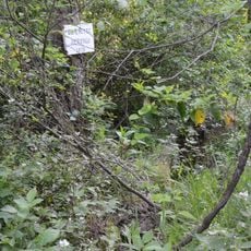
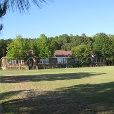
Bluffton Mound Site, Archaeological site in Yell County, Arkansas, United States.

Bluffton Mound Site is an archaeological site situated near the Fourche La Fave River in the Ouachita Mountains region. The location contains substantial earthen mounds constructed by early inhabitants and now protected to preserve the remains.

The site dates to the Woodland and Mississippian periods when indigenous peoples constructed mounds for ceremony and burial. This construction reflects how communities remained in place over long spans of time with generations living one after another.

The site reveals how ancient peoples organized their settlements and valued certain activities in daily life. The artifacts found here tell stories about communities that invested time in craftsmanship and ceremony.

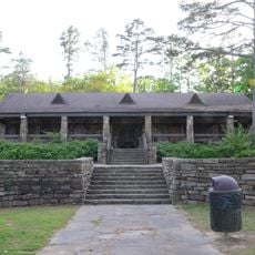
Visitors need permission to access this location as preservation measures protect the archaeological remains. It is essential to contact the managing authorities beforehand and follow all guidelines for entry.

Pottery and stone tools from the site show that people here possessed skilled craftsmanship in making everyday goods. This long-standing tradition of handwork points to stable and well-organized community life across generations.

The community of curious travelers

AroundUs brings together thousands of curated places, local tips, and hidden gems, enriched daily by 60,000 contributors worldwide.

Start exploring
Location
GPS coordinates
34.91110,-93.60770
Latest update
December 12, 2025 17:45
Around this place
Mount Magazine
United States of America

Mount Magazine

28.7 km
Mount Magazine State Park
United States of America

Mount Magazine State Park

29.4 km
Blue Mountain Lake
United States of America

Blue Mountain Lake

22.8 km
Arkansas Tuberculosis Sanatorium Historic District
United States of America

Arkansas Tuberculosis Sanatorium Historic District

34.8 km
Spring Lake Recreation Area
United States of America

Spring Lake Recreation Area

31.7 km
First Presbyterian Church
United States of America

First Presbyterian Church

23.3 km
Cove Lake Spillway Dam-Bridge
United States of America

Cove Lake Spillway Dam-Bridge

35.9 km
Spring Lake Bridge
United States of America

Spring Lake Bridge

31.2 km
Ward's Crossing Bridge
United States of America

Ward's Crossing Bridge

25.8 km
Farmers and Merchants Bank-Masonic Lodge
United States of America

Farmers and Merchants Bank-Masonic Lodge

38.3 km
Mountain View Farm
United States of America

Mountain View Farm

29.4 km
Cove Creek Bridge
United States of America

Cove Creek Bridge

31.4 km
Montgomery County Courthouse
United States of America

Montgomery County Courthouse

39.4 km
Cove Creek Tributary Bridge
United States of America

Cove Creek Tributary Bridge

36.9 km
Mitchell House
United States of America

Mitchell House

8.2 km
Mount Pleasant Methodist Church
United States of America

Mount Pleasant Methodist Church

38 km
Burnett Springs
United States of America

Burnett Springs

34.1 km
Petit Jean River Bridge
United States of America

Petit Jean River Bridge

38.3 km
Hawks Schoolhouse
United States of America

Hawks Schoolhouse

36.8 km
Bank of Booneville Building
United States of America

Bank of Booneville Building

38.3 km
Parks School
United States of America

Parks School

34.3 km
Cove Lake Bathhouse
United States of America

Cove Lake Bathhouse

35.4 km
John Gabriel Fort House
United States of America

John Gabriel Fort House

34.9 km
Evans-Neuhart House
United States of America

Evans-Neuhart House

30.1 km
Booneville Commercial Historic District
United States of America

Booneville Commercial Historic District

38.3 km
Booneville Methodist Episcopal Church South
United States of America

Booneville Methodist Episcopal Church South

38.6 km
Jack Creek Bathhouse
United States of America

Jack Creek Bathhouse

25.7 km
Logan County Courthouse, Southern Judicial District
United States of America

Logan County Courthouse, Southern Judicial District

38.4 km
Show the full map
« Bluffton Mound Site - Archaeological site in Yell County, Arkansas, United States » is provided by Around Us (aroundus.com). Images and texts are derived from Wikimedia project under a Creative Commons license. You are allowed to copy, distribute, and modify copies of this page, under the conditions set by the license, as long as this note is clearly visible.

Discover hidden gems everywhere you go!

From secret cafés to breathtaking viewpoints, skip the crowded tourist spots and find places that match your style. Our app makes it easy with voice search, smart filtering, route optimization, and insider tips from travelers worldwide. Download now for the complete mobile experience.

Around Us App Screenshot

A unique approach to discovering new places

Le Figaro

All the places worth exploring

France Info

A tailor-made excursion in just a few clicks

20 Minutes

Around Us
Travel Guide & Maps
Download

Send to your phone

QR Code
1

Open the camera app on your mobile.

2

Point at the QR code with your camera. A notification will appear.

3

Tap the notification to open the link.