Enable Location

We need your location to show you interesting places around you

Discover nearby places

Find interesting locations and hidden gems around you

Precise directions

Get accurate directions and distances to places

Your location is never shared with other users. It's only used when you tap the location button.

Log in to your account

Start exploring — it's free

Trusted by 62,532 travelers worldwide

Continue with Google
Continue with Apple
or

We will send you a code to connect

By continuing, you accept our Terms and Conditions and our Privacy Policy

Check your inbox

We've sent a pincode in your inbox. Please enter the code below.

Falls Reservoir

Falls Reservoir, reservoir in North Carolina, United States

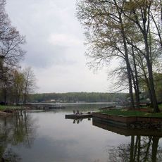
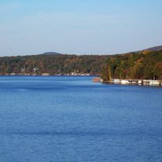
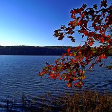
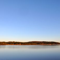
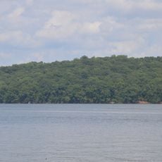
Falls Reservoir is a small body of water in North Carolina located between Narrows Dam and Falls Dam along the Yadkin River. Its narrow shape and still surface are framed by tree-lined shores and views toward the nearby Uwharrie National Forest.

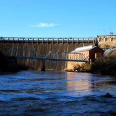
The reservoir was created through the construction of two dams as part of a water management project on the Yadkin River designed to provide hydroelectric power and control flooding. Over time, the series of lakes became central to local recreation and regional development.

The reservoir holds significance for local communities as a place where fishing and river travel have been part of life for generations. Its minimal development around the shoreline keeps it distinct from other lakes in the chain, maintaining a feeling of connection to the natural landscape.

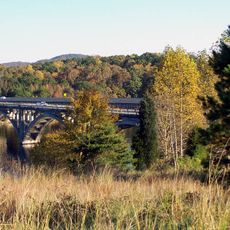
The reservoir is accessible from Albemarle via Highway 740 toward Badin, then right onto Falls Road to reach a boat landing about 2 miles down. The calm water and light boat traffic make it suitable for kayaking, canoeing, and relaxed water activities.

Unlike other lakes along the Yadkin chain, this reservoir has minimal development around its shoreline and is treasured by locals as a hidden spot. The absence of residential areas and golf courses creates a more undeveloped feel compared to neighboring lakes.

The community of curious travelers

AroundUs brings together thousands of curated places, local tips, and hidden gems, enriched daily by 60,000 contributors worldwide.

Start exploring
Location
GPS coordinates
35.39528,-80.07472
Latest update
February 9, 2026 08:21
Around this place
High Rock Lake
United States of America

High Rock Lake

30.5 km
Lake Tillery
United States of America

Lake Tillery

21 km
Badin Lake
United States of America

Badin Lake

3.2 km
Town Creek Indian Mound
United States of America

Town Creek Indian Mound

27.1 km
Pisgah Covered Bridge
United States of America

Pisgah Covered Bridge

23.1 km
Tuckertown Reservoir
United States of America

Tuckertown Reservoir

15 km
Hardaway Site
United States of America

Hardaway Site

4 km
United States of America

North Carolina Aviation Museum

32.8 km
James B. Garrison Bridge
United States of America

James B. Garrison Bridge

9.7 km
Narrows Dam and Power Plant Complex
United States of America

Narrows Dam and Power Plant Complex

3.1 km
Downtown Albemarle Historic District
United States of America

Downtown Albemarle Historic District

12.4 km
Five Points Historic District
United States of America

Five Points Historic District

12 km
Isaiah Wilson Snugs House
United States of America

Isaiah Wilson Snugs House

12.1 km
Montgomery County Courthouse
United States of America

Montgomery County Courthouse

17 km
Mount Pleasant Collegiate Institute Historic District
United States of America

Mount Pleasant Collegiate Institute Historic District

32.9 km
Thomas Marcellus Denning House
United States of America

Thomas Marcellus Denning House

12 km
Mount Pleasant Historic District
United States of America

Mount Pleasant Historic District

32.7 km
Pee Dee Avenue Historic District
United States of America

Pee Dee Avenue Historic District

11.2 km
Randle House
United States of America

Randle House

15 km
First Congregational Church
United States of America

First Congregational Church

32 km
Denton Farmpark
United States of America

Denton Farmpark

21.2 km
Mount Ebal Methodist Protestant Church
United States of America

Mount Ebal Methodist Protestant Church

25.7 km
Liberty Hill School
United States of America

Liberty Hill School

34.4 km
Albemarle Opera House
United States of America

Albemarle Opera House

12.3 km
Mount Gilead Downtown Historic District
United States of America

Mount Gilead Downtown Historic District

21.1 km
Second Street Historic District
United States of America

Second Street Historic District

12.2 km
Town Creek Indian Mound State Historic Site
United States of America

Town Creek Indian Mound State Historic Site

27.1 km
Morrow Mountain State Park
United States of America

Morrow Mountain State Park

792 m
Show the full map
« Falls Reservoir - reservoir in North Carolina, United States » is provided by Around Us (aroundus.com). Images and texts are derived from Wikimedia project under a Creative Commons license. You are allowed to copy, distribute, and modify copies of this page, under the conditions set by the license, as long as this note is clearly visible.

Discover hidden gems everywhere you go!

From secret cafés to breathtaking viewpoints, skip the crowded tourist spots and find places that match your style. Our app makes it easy with voice search, smart filtering, route optimization, and insider tips from travelers worldwide. Download now for the complete mobile experience.

Around Us App Screenshot

A unique approach to discovering new places

Le Figaro

All the places worth exploring

France Info

A tailor-made excursion in just a few clicks

20 Minutes

Around Us
Travel Guide & Maps
Download

Send to your phone

QR Code
1

Open the camera app on your mobile.

2

Point at the QR code with your camera. A notification will appear.

3

Tap the notification to open the link.