Chest opened
+${chestReward.xp} XP
Explorer
NOUVEAU ×${chestReward.collectible.quantity}
tapez pour fermer
Chest locked

Open chests in the app

Around Us is built for your phone — chests unlock when you walk, explore and capture nearby places.

Enable Location

We need your location to show you interesting places around you

Discover nearby places

Find interesting locations and hidden gems around you

Precise directions

Get accurate directions and distances to places

Your location is never shared with other users. It's only used when you tap the location button.

Log in to your account

Start exploring — it's free

Trusted by 72,945 travelers worldwide

Continue with Google
Continue with Apple
or

We will send you a code to connect

By continuing, you accept our Terms and Conditions and our Privacy Policy

Check your inbox

We've sent a pincode in your inbox. Please enter the code below.

Gratiot's Grove
Discussion Reviews Photo
1.8k Popularity

Gratiot's Grove, Mining settlement in Lafayette County, Wisconsin.

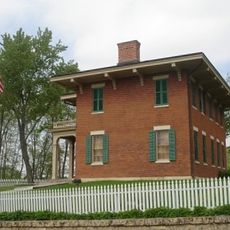
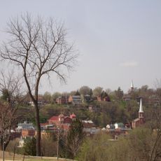
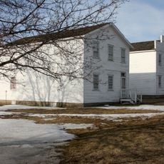
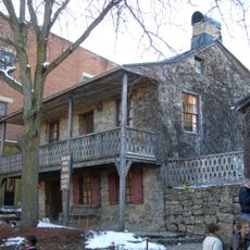
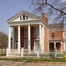
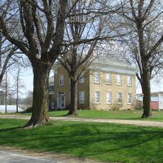
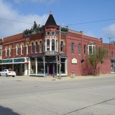
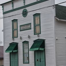
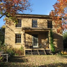
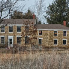
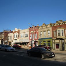
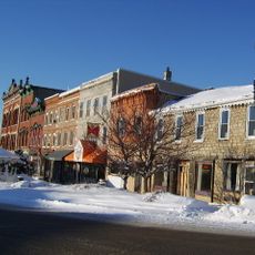
Gratiot's Grove is a historic settlement in Lafayette County featuring original limestone buildings including Gratiot House and Berry Tavern. These structures show what frontier life looked like during the 1800s, located near the Pecatonica River.

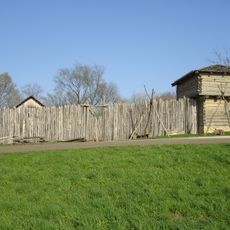
Henry Gratiot founded the settlement in 1824 to work the local lead mines. During the Black Hawk War, the location became significant as a site where negotiations took place between government officials and tribal leaders.

The settlement served as a meeting point between European settlers and Winnebago tribes, facilitating trade and diplomatic relations in the Wisconsin Territory.

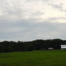
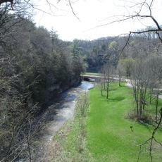
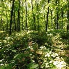
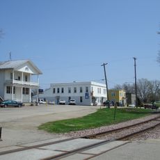
The settlement is located in rural surroundings and is best reached by car, with several trails connecting through the area. The riverside location offers opportunities for outdoor activities and exploration on foot.

The settlement marks the location where Colonel Henry Gratiot negotiated peace agreements between United States authorities and Native American tribes.

The community of curious travelers

AroundUs brings together thousands of curated places, local tips, and hidden gems, enriched daily by 60,000 contributors worldwide.

Start exploring
GPS coordinates
42.53778,-90.24167
Latest update
December 14, 2025 12:24
Around this place
Charles Mound
United States of America

Charles Mound

3.8 km
Ulysses S. Grant Home
United States of America

Ulysses S. Grant Home

20.5 km
Platte Mound M
United States of America

Platte Mound M

28.5 km
Apple River Canyon State Park
United States of America

Apple River Canyon State Park

18.6 km
Galena Historic District
United States of America

Galena Historic District

20.6 km
First Capitol Historic Site
United States of America

First Capitol Historic Site

27.6 km
Apple River Fort
United States of America

Apple River Fort

24.6 km
Dowling House
United States of America

Dowling House

20.3 km
Elihu Benjamin Washburne House
United States of America

Elihu Benjamin Washburne House

20.8 km
Belmont Mound State Park
United States of America

Belmont Mound State Park

27.2 km
Saint Michael's Catholic Church
United States of America

Saint Michael's Catholic Church

20.6 km
Saint Augustine Church
United States of America

Saint Augustine Church

7.6 km
Townsend Home
United States of America

Townsend Home

24.1 km
W.E. White Building
United States of America

W.E. White Building

28.4 km
Saint Patrick's Church
United States of America

Saint Patrick's Church

11.7 km
Grace Episcopal Church
United States of America

Grace Episcopal Church

20.5 km
Benton Stone Water Tower
United States of America

Benton Stone Water Tower

12.1 km
Scales Mound Historic District
United States of America

Scales Mound Historic District

6.3 km
Hazel Green Town Hall
United States of America

Hazel Green Town Hall

15.8 km
Charles Wenner House
United States of America

Charles Wenner House

16.3 km
Gratiot House
United States of America

Gratiot House

1.9 km
Water Street Commercial Historic District
United States of America

Water Street Commercial Historic District

4.2 km
Main Street Historic District
United States of America

Main Street Historic District

18.8 km
Henry W. Miller House
United States of America

Henry W. Miller House

20.6 km
Warren Commercial Historic District
United States of America

Warren Commercial Historic District

21.4 km
Galena - Jo Daviess County Historical Society
United States of America

Galena - Jo Daviess County Historical Society

20.6 km
Old Market House
United States of America

Old Market House

20.4 km
Lafayette County Courthouse
United States of America

Lafayette County Courthouse

19 km
Show the full map
Reviews
Share your experience

No review yet

Discussions
Start a discussion...

No discussion yet

« Gratiot's Grove - Mining settlement in Lafayette County, Wisconsin » is provided by Around Us (aroundus.com). Images and texts are derived from Wikimedia project under a Creative Commons license. You are allowed to copy, distribute, and modify copies of this page, under the conditions set by the license, as long as this note is clearly visible.

Discover hidden gems everywhere you go!

From secret cafés to breathtaking viewpoints, skip the crowded tourist spots and find places that match your style. Our app makes it easy with voice search, smart filtering, route optimization, and insider tips from travelers worldwide. Download now for the complete mobile experience.

Around Us App Screenshot

A unique approach to discovering new places

Le Figaro

All the places worth exploring

France Info

A tailor-made excursion in just a few clicks

20 Minutes

Around Us
Travel Guide & Maps
Download

Send to your phone

QR Code
1

Open the camera app on your mobile.

2

Point at the QR code with your camera. A notification will appear.

3

Tap the notification to open the link.