Enable Location

We need your location to show you interesting places around you

Discover nearby places

Find interesting locations and hidden gems around you

Precise directions

Get accurate directions and distances to places

Your location is never shared with other users. It's only used when you tap the location button.

Log in to your account

Start exploring — it's free

Trusted by 62,171 travelers worldwide

Continue with Google
Continue with Apple
or

We will send you a code to connect

By continuing, you accept our Terms and Conditions and our Privacy Policy

Check your inbox

We've sent a pincode in your inbox. Please enter the code below.

Harry "Babe" Woodyard State Natural Area

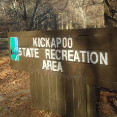
Harry "Babe" Woodyard State Natural Area, Natural area and Illinois state park near Georgetown, United States.

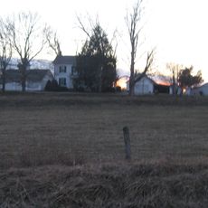
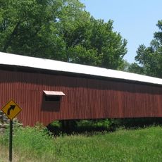
Harry Babe Woodyard State Natural Area is a large protected landscape covering over 1,100 acres along the Little Vermilion River in Vermilion County, Illinois. The property features wooded sections, riverside corridors, and open natural areas connected by hiking paths throughout the grounds.

The land was originally Camp Cherokee Hills, a scout camp operated by the Boy Scouts of America, until the state purchased it in 1996. This acquisition transformed the property into a public natural area for conservation and recreation.

The name comes from Harry Woodyard, a local farmer and longtime political figure in the region. He dedicated his career to public service and land stewardship, which inspired the naming of this space.

The site has hiking trails for different abilities and river sections where visitors can fish or explore by foot. Spring and fall offer the most comfortable weather for spending time outdoors and spotting wildlife.

The property shelters several rare animal species found in few other places across the state. This concentration of native wildlife makes it an important location for conservation efforts in the region.

The community of curious travelers

AroundUs brings together thousands of curated places, local tips, and hidden gems, enriched daily by 60,000 contributors worldwide.

Start exploring
Location
GPS coordinates
39.96390,-87.57360
Latest update
December 13, 2025 11:47
Around this place
Kickapoo State Recreation Area
United States of America

Kickapoo State Recreation Area

21.9 km
Danville National Cemetery
United States of America

Danville National Cemetery

18.2 km
Fischer Theater
United States of America

Fischer Theater

18.9 km
West Union Covered Bridge
United States of America

West Union Covered Bridge

23.7 km
Fountain County Courthouse
United States of America

Fountain County Courthouse

24.4 km
Possum Bottom Covered Bridge
United States of America

Possum Bottom Covered Bridge

21.2 km
Carnegie Library of Covington
United States of America

Carnegie Library of Covington

24.9 km
Danville Public Library
United States of America

Danville Public Library

19.1 km
Paris Carnegie Public Library
United States of America

Paris Carnegie Public Library

13.9 km
Mill Creek Covered Bridge
United States of America

Mill Creek Covered Bridge

19.2 km
Marshall Covered Bridge
United States of America

Marshall Covered Bridge

22.9 km
Bowsher Ford Covered Bridge
United States of America

Bowsher Ford Covered Bridge

19.3 km
Asher Morton Farmstead
United States of America

Asher Morton Farmstead

13.9 km
Stone Arch Bridge
United States of America

Stone Arch Bridge

18.3 km
Danville Branch, National Home for Disabled Volunteer Soldiers Historic District
United States of America

Danville Branch, National Home for Disabled Volunteer Soldiers Historic District

17.9 km
Fithian House
United States of America

Fithian House

19 km
United States of America

First National Bank Building

18.5 km
Holland Apartments
United States of America

Holland Apartments

19.1 km
Adams Building
United States of America

Adams Building

18.8 km
Vermillion County Jail and Sheriff's Residence
United States of America

Vermillion County Jail and Sheriff's Residence

18.6 km
W. H. York Round Barn
United States of America

W. H. York Round Barn

15.3 km
Rush Creek Covered Bridge
United States of America

Rush Creek Covered Bridge

23.3 km
Eugene Covered Bridge
United States of America

Eugene Covered Bridge

8.6 km
Vermillion County Courthouse
United States of America

Vermillion County Courthouse

16.6 km
Fountain County Clerk's Building
United States of America

Fountain County Clerk's Building

24.6 km
Newport Covered Bridge
United States of America

Newport Covered Bridge

14.5 km
Covington Courthouse Square Historic District
United States of America

Covington Courthouse Square Historic District

24.4 km
Covington Residential Historic District
United States of America

Covington Residential Historic District

24.7 km
Show the full map
« Harry "Babe" Woodyard State Natural Area - Natural area and Illinois state park near Georgetown, United States » is provided by Around Us (aroundus.com). Images and texts are derived from Wikimedia project under a Creative Commons license. You are allowed to copy, distribute, and modify copies of this page, under the conditions set by the license, as long as this note is clearly visible.

Discover hidden gems everywhere you go!

From secret cafés to breathtaking viewpoints, skip the crowded tourist spots and find places that match your style. Our app makes it easy with voice search, smart filtering, route optimization, and insider tips from travelers worldwide. Download now for the complete mobile experience.

Around Us App Screenshot

A unique approach to discovering new places

Le Figaro

All the places worth exploring

France Info

A tailor-made excursion in just a few clicks

20 Minutes

Around Us
Travel Guide & Maps
Download

Send to your phone

QR Code
1

Open the camera app on your mobile.

2

Point at the QR code with your camera. A notification will appear.

3

Tap the notification to open the link.