Enable Location

We need your location to show you interesting places around you

Discover nearby places

Find interesting locations and hidden gems around you

Precise directions

Get accurate directions and distances to places

Your location is never shared with other users. It's only used when you tap the location button.

Harvard Shaker Village Historic District

Log in to your account

Start exploring — it's free

Trusted by 61,909 travelers worldwide

Continue with Google
Continue with Apple
or

We will send you a code to connect

By continuing, you accept our Terms and Conditions and our Privacy Policy

Check your inbox

We've sent a pincode in your inbox. Please enter the code below.

Harvard Shaker Village Historic District

Harvard Shaker Village Historic District, Historic Shaker community in Harvard, Massachusetts.

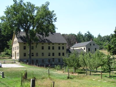
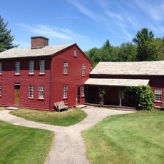
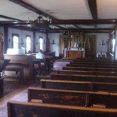
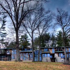
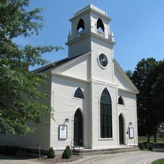
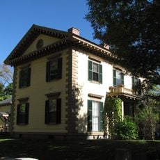
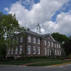
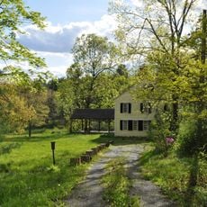
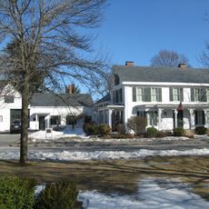
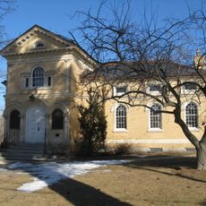
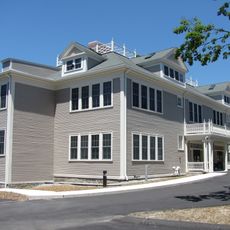
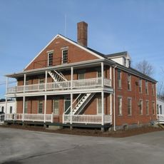
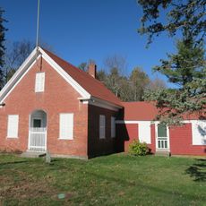
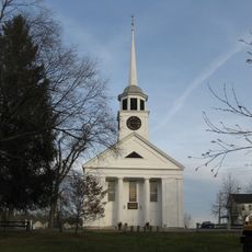
Harvard Shaker Village Historic District is a historic settlement in Massachusetts comprising four residential complexes spread across Shaker Road. The main structures include a 1791 Meetinghouse and a 1840s administrative building, both built in the traditional Shaker architectural style.

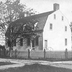
The settlement was founded in 1769 with the construction of the Square House, making it the second Shaker community in the United States and the first in Massachusetts. The site grew to become a significant center for the Shaker movement in New England during the 1800s.

The buildings show separate entrances for men and women, reflecting the community's beliefs about gender roles. These design choices shaped how people moved through and used the spaces in daily life.

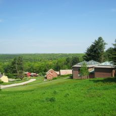
The site is easy to explore on foot and most structures are visible from the road. Many buildings serve as private residences today, so visitors should approach from a distance and respect the boundaries of occupied properties.

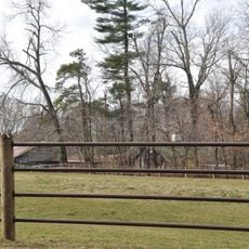
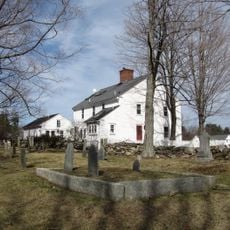
The South Family cemetery holds more than 300 grave markers from community members, with the first burial dating to 1792. This burial ground tells the story of the community's long existence through the generations who lived and died here.

The community of curious travelers

AroundUs brings together thousands of curated places, local tips, and hidden gems, enriched daily by 60,000 contributors worldwide.

Start exploring
Location
GPS coordinates
42.53250,-71.55917
Latest update
December 11, 2025 18:08
Around this place
Fruitlands
United States of America

Fruitlands

5.1 km
Fruitlands Museum
United States of America

Fruitlands Museum

6.2 km
Bancroft's castle
United States of America

Bancroft's castle

8.5 km
St. Benedict Abbey
United States of America

St. Benedict Abbey

7.2 km
Oxbow National Wildlife Refuge
United States of America

Oxbow National Wildlife Refuge

6.6 km
Oak Ridge Observatory
United States of America

Oak Ridge Observatory

3.1 km
Shirley Shaker Village
United States of America

Shirley Shaker Village

7.6 km
Forge Village Historic District
United States of America

Forge Village Historic District

8.3 km
Indian Hill House
United States of America

Indian Hill House

6.6 km
Still River Baptist Church
United States of America

Still River Baptist Church

6.6 km
Gov. George S. Boutwell House
United States of America

Gov. George S. Boutwell House

8.5 km
Fort Devens Historic District
United States of America

Fort Devens Historic District

4.7 km
James Parker House
United States of America

James Parker House

8.7 km
Groton Leatherboard Company
United States of America

Groton Leatherboard Company

9.6 km
Reed-Wood Place
United States of America

Reed-Wood Place

7.3 km
Houghton Memorial Building
United States of America

Houghton Memorial Building

6.2 km
Shirley Village Historic District
United States of America

Shirley Village Historic District

7.7 km
Pleasant Street School
United States of America

Pleasant Street School

4.2 km
Frederick Fiske and Gretchen Osgood Warren House
United States of America

Frederick Fiske and Gretchen Osgood Warren House

5.3 km
Westford Town Farm
United States of America

Westford Town Farm

8.9 km
Ayer Main Street Historic District
United States of America

Ayer Main Street Historic District

3.9 km
Shirley Center Historic District
United States of America

Shirley Center Historic District

8.7 km
Sandy Pond School
United States of America

Sandy Pond School

3.4 km
Whitcomb Inn and Farm
United States of America

Whitcomb Inn and Farm

9.9 km
Boxborough Old Town Center
United States of America

Boxborough Old Town Center

4.8 km
First Parish Church of Groton
United States of America

First Parish Church of Groton

8.2 km
Harvard Center Historic District
United States of America

Harvard Center Historic District

4.4 km
U.S. Army Fort Devens Bataan & Corregidor Memorial Theater
United States of America

U.S. Army Fort Devens Bataan & Corregidor Memorial Theater

4.5 km
Show the full map
« Harvard Shaker Village Historic District - Historic Shaker community in Harvard, Massachusetts » is provided by Around Us (aroundus.com). Images and texts are derived from Wikimedia project under a Creative Commons license. You are allowed to copy, distribute, and modify copies of this page, under the conditions set by the license, as long as this note is clearly visible.

Discover hidden gems everywhere you go!

From secret cafés to breathtaking viewpoints, skip the crowded tourist spots and find places that match your style. Our app makes it easy with voice search, smart filtering, route optimization, and insider tips from travelers worldwide. Download now for the complete mobile experience.

Around Us App Screenshot

A unique approach to discovering new places

Le Figaro

All the places worth exploring

France Info

A tailor-made excursion in just a few clicks

20 Minutes

Around Us
Travel Guide & Maps
Download

Send to your phone

QR Code
1

Open the camera app on your mobile.

2

Point at the QR code with your camera. A notification will appear.

3

Tap the notification to open the link.