Shirley Shaker Village

Log in to your account

AroundUs is a community-driven map of interesting places, built by curious explorers like you. It grows with every review, story, and photo you share.
Connect to save your favorite spots, contribute locations, and create personalized routes.
Continue with Google
Continue with Apple
Continue with X
Continue with Facebook
Continue with email
By continuing, you accept our Terms and Conditions and our Privacy Policy
Create an account
Add to collection
Map
Suggest a change
Share

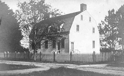
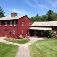
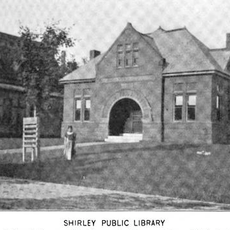
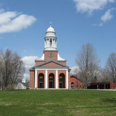
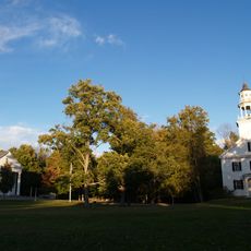
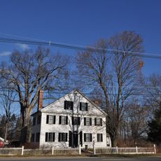
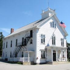
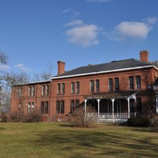
Shirley Shaker Village, Religious historic district in Shirley, Massachusetts, United States.

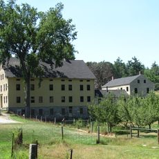
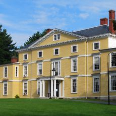
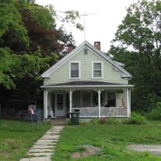
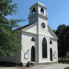
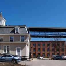
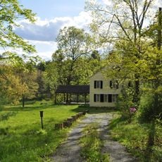
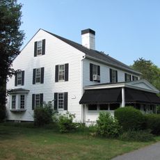
Shirley Shaker Village is a historic district in Shirley, Massachusetts, founded by a religious community and now containing 13 surviving structures from the original 26. The remaining buildings display yellow and white wooden siding alongside brick construction dating to the 1840s, representing the architectural continuity of the settlement.

The village was established in 1793 after four benefactors donated land, and it grew into a community of about 150 members divided into three organized family groups. The settlement lasted until 1908, shaping over a century of religious and economic life in the area.

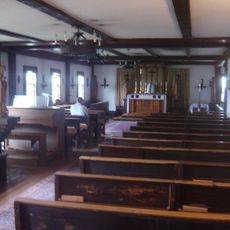
The community lived according to principles of simplicity and shared purpose, with each member occupying a modest private room containing only essential furniture like beds, chairs, and heating stoves. This style of living reflected their broader values about what mattered most in daily life and how people should relate to each other.

Visitors can explore the accessible areas on scheduled tours coordinated by the Shirley Historical Society. It is important to plan ahead since the Massachusetts Correctional Institution occupies a large portion of the property and public access is limited to designated areas.

The community was known for commercial products, particularly applesauce that sold throughout the region, alongside handcrafted brooms, mops, and herbal goods. These economic activities made the village a recognized name in local commerce beyond its religious reputation.

Location: Massachusetts

GPS coordinates: 42.52639,-71.65167

Latest update: December 14, 2025 09:43

Photos
Around this place
Fruitlands
United States of America

Fruitlands

3.7 km
Fruitlands Museum
United States of America

Fruitlands Museum

4.8 km
St. Benedict Abbey
United States of America

St. Benedict Abbey

5.1 km
Oxbow National Wildlife Refuge
United States of America

Oxbow National Wildlife Refuge

4 km
Oak Ridge Observatory
United States of America

Oak Ridge Observatory

8 km
Harvard Shaker Village Historic District
United States of America

Harvard Shaker Village Historic District

7.6 km
Nathaniel Thayer Estate
United States of America

Nathaniel Thayer Estate

8.8 km
Ponakin Bridge
United States of America

Ponakin Bridge

5.8 km
Frances H. and Jonathan Drake House
United States of America

Frances H. and Jonathan Drake House

9 km
Still River Baptist Church
United States of America

Still River Baptist Church

4.8 km
Monument Square Historic District
United States of America

Monument Square Historic District

8.9 km
Fort Devens Historic District
United States of America

Fort Devens Historic District

3.9 km
Atherton Bridge
United States of America

Atherton Bridge

9.3 km
F. A. Whitney Carriage Company Complex Historic District
United States of America

F. A. Whitney Carriage Company Complex Historic District

8.5 km
James Parker House
United States of America

James Parker House

3.8 km
Groton Leatherboard Company
United States of America

Groton Leatherboard Company

8.7 km
North Village Historic District
United States of America

North Village Historic District

6.6 km
Shirley Village Historic District
United States of America

Shirley Village Historic District

1.8 km
Whitney & Company
United States of America

Whitney & Company

8.4 km
Pleasant Street School
United States of America

Pleasant Street School

6.7 km
Frederick Fiske and Gretchen Osgood Warren House
United States of America

Frederick Fiske and Gretchen Osgood Warren House

6.9 km
Center Village District
United States of America

Center Village District

7.9 km
Ayer Main Street Historic District
United States of America

Ayer Main Street Historic District

6.3 km
Shirley Center Historic District
United States of America

Shirley Center Historic District

5 km
Anthony Lane House
United States of America

Anthony Lane House

6.9 km
Harvard Center Historic District
United States of America

Harvard Center Historic District

6.4 km
U.S. Army Fort Devens Bataan & Corregidor Memorial Theater
United States of America

U.S. Army Fort Devens Bataan & Corregidor Memorial Theater

4.1 km
Lancaster Industrial School for Girls
United States of America

Lancaster Industrial School for Girls

9.3 km
Show the full map
Reviews

Visited this place? Tap the stars to rate it and share your experience / photos with the community! Try now! You can cancel it anytime.

« Shirley Shaker Village - Religious historic district in Shirley, Massachusetts, United States » is provided by Around Us (aroundus.com). Images and texts are derived from Wikimedia project under a Creative Commons license. You are allowed to copy, distribute, and modify copies of this page, under the conditions set by the license, as long as this note is clearly visible.

Discover hidden gems everywhere you go!

From secret cafés to breathtaking viewpoints, skip the crowded tourist spots and find places that match your style. Our app makes it easy with voice search, smart filtering, route optimization, and insider tips from travelers worldwide. Download now for the complete mobile experience.

Around Us App Screenshot

A unique approach to discovering new places

Le Figaro

All the places worth exploring

France Info

A tailor-made excursion in just a few clicks

20 Minutes