Chest opened
+${chestReward.xp} XP
Explorer
NOUVEAU ×${chestReward.collectible.quantity}
tapez pour fermer
Chest locked

Open chests in the app

Around Us is built for your phone — chests unlock when you walk, explore and capture nearby places.

Enable Location

We need your location to show you interesting places around you

Discover nearby places

Find interesting locations and hidden gems around you

Precise directions

Get accurate directions and distances to places

Your location is never shared with other users. It's only used when you tap the location button.

Log in to your account

Start exploring — it's free

Trusted by 73,028 travelers worldwide

Continue with Google
Continue with Apple
or

We will send you a code to connect

By continuing, you accept our Terms and Conditions and our Privacy Policy

Check your inbox

We've sent a pincode in your inbox. Please enter the code below.

Hillsdale State Park
Discussion Reviews Photo
2k Popularity

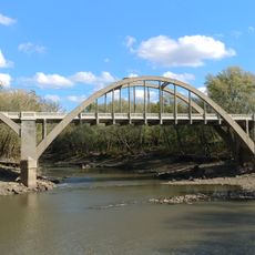
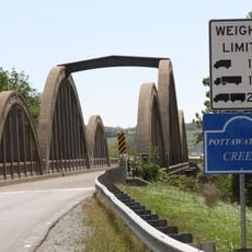
Hillsdale State Park, State park in Kansas, United States

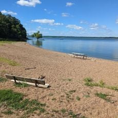
Hillsdale State Park is a large natural area in eastern Kansas built around a reservoir with wooded shores and open water. The landscape includes forests, clearings, and the lake itself, with trails and camping areas spread across the grounds.

The lake was completed in 1982 as part of regional water management, and the park was later established to manage the land and water for public use. This development brought recreation facilities to eastern Kansas.

The park offers spaces where visitors can observe native plants and wildlife in their natural settings. Walking through different areas, people encounter the local ecosystem and how it changes from woodland to water's edge.

The park has multiple camping areas with varying levels of facilities and services for different visitor needs. Be prepared for changing weather and water conditions, as the lake environment can shift significantly with seasons.

A large portion of the original forest was preserved when the lake was created and remains submerged underwater. These drowned trees create habitats for fish species and give the underwater environment its distinctive character.

The community of curious travelers

AroundUs brings together thousands of curated places, local tips, and hidden gems, enriched daily by 60,000 contributors worldwide.

Start exploring
Location
Inception
1994
GPS coordinates
38.66810,-94.91780
Latest update
December 14, 2025 11:05
Around this place
Blue Valley West High School
United States of America

Blue Valley West High School

27 km
Hillsdale Lake
United States of America

Hillsdale Lake

1.9 km
United States of America

Overland Park Arboretum and Botanical Gardens

24.5 km
United States of America

Kansas City Air Route Traffic Control Center

26.1 km
Mahaffie House
United States of America

Mahaffie House

26.9 km
United States of America

Powell Observatory

19.1 km
Cedar Cove Feline Conservatory & Sanctuary
United States of America

Cedar Cove Feline Conservatory & Sanctuary

25.7 km
Liston Stadium
United States of America

Liston Stadium

25.6 km
Jackson Hotel
United States of America

Jackson Hotel

11.1 km
William Thomas Turner Barn
United States of America

William Thomas Turner Barn

11.3 km
Tauy Jones House
United States of America

Tauy Jones House

26.3 km
I. O. Pickering House
United States of America

I. O. Pickering House

25.3 km
Old Castle Hall
United States of America

Old Castle Hall

26.1 km
Albert Ott House
United States of America

Albert Ott House

25 km
Franklin R. Lanter House
United States of America

Franklin R. Lanter House

25.1 km
Vinland Presbyterian Church
United States of America

Vinland Presbyterian Church

29.9 km
Vinland Grange Hall
United States of America

Vinland Grange Hall

29.8 km
Ottawa Library
United States of America

Ottawa Library

30.8 km
Martin Van Buren Parker House
United States of America

Martin Van Buren Parker House

25.1 km
Miami County Courthouse
United States of America

Miami County Courthouse

11.3 km
Mahaffie Stagecoach Stop-Farm
United States of America

Mahaffie Stagecoach Stop-Farm

27 km
Carey’s Ford Bridge
United States of America

Carey’s Ford Bridge

19.2 km
Midland Railway Baldwin City Depot
United States of America

Midland Railway Baldwin City Depot

27.3 km
John Brown Museum State Historic Site
United States of America

John Brown Museum State Historic Site

19.2 km
Black Jack Battlefield
United States of America

Black Jack Battlefield

21.2 km
Creamery Bridge
United States of America

Creamery Bridge

18.7 km
Windsurfer Beach
United States of America

Windsurfer Beach

1.5 km
Pottawatomie Creek Bridge
United States of America

Pottawatomie Creek Bridge

20.6 km
Show the full map
Reviews
Share your experience

No review yet

Discussions
Start a discussion...

No discussion yet

« Hillsdale State Park - State park in Kansas, United States » is provided by Around Us (aroundus.com). Images and texts are derived from Wikimedia project under a Creative Commons license. You are allowed to copy, distribute, and modify copies of this page, under the conditions set by the license, as long as this note is clearly visible.

Discover hidden gems everywhere you go!

From secret cafés to breathtaking viewpoints, skip the crowded tourist spots and find places that match your style. Our app makes it easy with voice search, smart filtering, route optimization, and insider tips from travelers worldwide. Download now for the complete mobile experience.

Around Us App Screenshot

A unique approach to discovering new places

Le Figaro

All the places worth exploring

France Info

A tailor-made excursion in just a few clicks

20 Minutes

Around Us
Travel Guide & Maps
Download

Send to your phone

QR Code
1

Open the camera app on your mobile.

2

Point at the QR code with your camera. A notification will appear.

3

Tap the notification to open the link.