Chest opened
+${chestReward.xp} XP
Explorer
NOUVEAU ×${chestReward.collectible.quantity}
tapez pour fermer
Chest locked

Open chests in the app

Around Us is built for your phone — chests unlock when you walk, explore and capture nearby places.

Enable Location

We need your location to show you interesting places around you

Discover nearby places

Find interesting locations and hidden gems around you

Precise directions

Get accurate directions and distances to places

Your location is never shared with other users. It's only used when you tap the location button.

Log in to your account

Start exploring — it's free

Trusted by 72,992 travelers worldwide

Continue with Google
Continue with Apple
or

We will send you a code to connect

By continuing, you accept our Terms and Conditions and our Privacy Policy

Check your inbox

We've sent a pincode in your inbox. Please enter the code below.

Indian River Hundred
Discussion Reviews Photo
1.7k Popularity

Indian River Hundred, Historical administrative division in Sussex County, Delaware

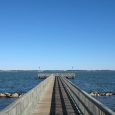
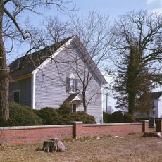
Indian River Hundred is a historical administrative division in Sussex County, Delaware, encompassing marshes and woodlands along the Indian River. The area spans agricultural land and natural landscapes, forming a recognizable geographic section of the county today.

Established in 1706, it was created from the division of Lewes and Rehoboth Hundred and became one of the original sections of Old Sussex. This division reflected the early administrative structure that English colonists built in the region.

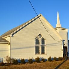
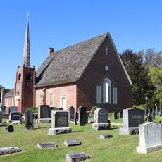
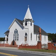
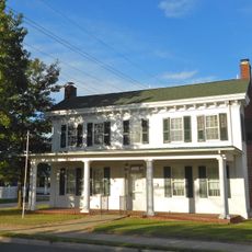
St. George's Chapel, built in 1794, served as a religious center and community gathering place for local residents. The building remains a focal point that shows how deeply faith and community life were connected in this region.

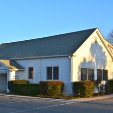
The area is accessible via Delaware Route 24, with Angola serving as the main community within its boundaries. Visitors will find a rural environment with open landscapes and historical sites that are best explored by car.

The hundred designation comes from the English administrative system and remained active for tax and voting purposes until the 1960s. This form of administration was rare in North America and makes this area a fascinating example of colonial governance structures.

The community of curious travelers

AroundUs brings together thousands of curated places, local tips, and hidden gems, enriched daily by 60,000 contributors worldwide.

Start exploring
Location
GPS coordinates
38.59500,-75.29100
Latest update
December 14, 2025 12:20
Around this place
Holts Landing State Park
United States of America

Holts Landing State Park

14.2 km
Georgetown Speedway
United States of America

Georgetown Speedway

8.9 km
Brick Hotel
United States of America

Brick Hotel

13.4 km
Harmony Church
United States of America

Harmony Church

6.4 km
Indian Mission School
United States of America

Indian Mission School

7 km
Blackwater Presbyterian Church
United States of America

Blackwater Presbyterian Church

12.5 km
Cool Spring Presbyterian Church
United States of America

Cool Spring Presbyterian Church

16.4 km
St. George's Chapel, Lewes
United States of America

St. George's Chapel, Lewes

11.9 km
Poplar Thicket
United States of America

Poplar Thicket

13.7 km
Old Sussex County Courthouse
United States of America

Old Sussex County Courthouse

13.4 km
Hopkins' Covered Bridge Farm
United States of America

Hopkins' Covered Bridge Farm

15.1 km
St. John's Methodist Church
United States of America

St. John's Methodist Church

9.8 km
Sussex County Courthouse and the Circle
United States of America

Sussex County Courthouse and the Circle

13.5 km
Peter S. Faucett House
United States of America

Peter S. Faucett House

13.5 km
Capt. Ebe Chandler House
United States of America

Capt. Ebe Chandler House

10 km
Richards Mansion
United States of America

Richards Mansion

13.5 km
Gardiner Wright Mansion
United States of America

Gardiner Wright Mansion

12.9 km
Ross Point School
United States of America

Ross Point School

14.8 km
Thomas Sipple House
United States of America

Thomas Sipple House

13.8 km
Judge's House and Law Office
United States of America

Judge's House and Law Office

13.5 km
Isaac Harmon Farmhouse
United States of America

Isaac Harmon Farmhouse

8.1 km
Dr. John W. Messick House and Office
United States of America

Dr. John W. Messick House and Office

13.4 km
Hearn Potato House
United States of America

Hearn Potato House

14.7 km
Ball Theatre
United States of America

Ball Theatre

3 km
United States of America

Spring Banke

14 km
Nanticoke Indian Museum
United States of America

Nanticoke Indian Museum

8 km
Joy Beach
United States of America

Joy Beach

16.4 km
Joseph T. Adams House
United States of America

Joseph T. Adams House

13.4 km
Show the full map
Reviews
Share your experience

No review yet

Discussions
Start a discussion...

No discussion yet

« Indian River Hundred - Historical administrative division in Sussex County, Delaware » is provided by Around Us (aroundus.com). Images and texts are derived from Wikimedia project under a Creative Commons license. You are allowed to copy, distribute, and modify copies of this page, under the conditions set by the license, as long as this note is clearly visible.

Discover hidden gems everywhere you go!

From secret cafés to breathtaking viewpoints, skip the crowded tourist spots and find places that match your style. Our app makes it easy with voice search, smart filtering, route optimization, and insider tips from travelers worldwide. Download now for the complete mobile experience.

Around Us App Screenshot

A unique approach to discovering new places

Le Figaro

All the places worth exploring

France Info

A tailor-made excursion in just a few clicks

20 Minutes

Around Us
Travel Guide & Maps
Download

Send to your phone

QR Code
1

Open the camera app on your mobile.

2

Point at the QR code with your camera. A notification will appear.

3

Tap the notification to open the link.