Enable Location

We need your location to show you interesting places around you

Discover nearby places

Find interesting locations and hidden gems around you

Precise directions

Get accurate directions and distances to places

Your location is never shared with other users. It's only used when you tap the location button.

James M. Robb – Colorado River State Park

Log in to your account

Start exploring — it's free

Trusted by 65,218 travelers worldwide

Continue with Google
Continue with Apple
or

We will send you a code to connect

By continuing, you accept our Terms and Conditions and our Privacy Policy

Check your inbox

We've sent a pincode in your inbox. Please enter the code below.

James M. Robb – Colorado River State Park
Discussion Reviews 1 Photos
3.4k Popularity

James M. Robb – Colorado River State Park, State park with five sections along Colorado River in Mesa County, United States.

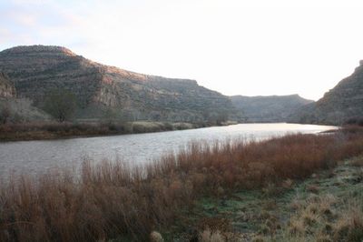
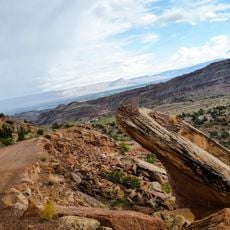
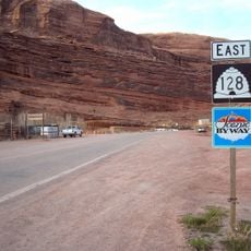
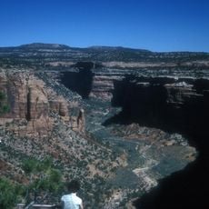
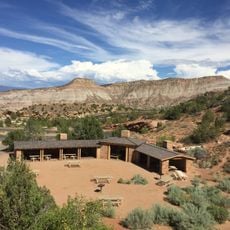
James M. Robb – Colorado River State Park is a state park in Mesa County, Colorado, made up of five separate sections along the Colorado River. The sections are named Island Acres, Fruita, Corn Lake, Connected Lakes, and the Wildlife Area, each offering direct access to the river.

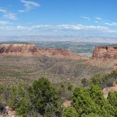
The park was established in 1994 by Colorado Parks to protect a series of riverside areas along the Colorado River in Mesa County. In 2005, it was renamed after James M. Robb to recognize his work in shaping and supporting the development of this river corridor.

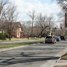
The park runs through several towns along the Colorado River, and locals use it regularly for fishing, picnicking, and walking along the water. The riverside setting draws people who want to spend time outdoors without traveling far from home.

Island Acres and Fruita are the two sections where overnight camping is possible, while the other three sections are open for day use only. Boat ramps and parking areas are available at several entry points, making river access straightforward for most visitors.

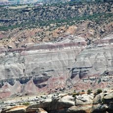
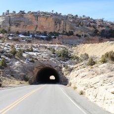
Floating the Colorado River between certain sections means passing through class II rapids, which is unusual for a park focused on family recreation. This makes the river route noticeably more dynamic than a typical riverside trail walk.

The community of curious travelers

AroundUs brings together thousands of curated places, local tips, and hidden gems, enriched daily by 60,000 contributors worldwide.

Start exploring
Location
Inception
1994
GPS coordinates
39.05750,-108.46100
Latest update
March 3, 2026 13:57
Around this place
Colorado National Monument
United States of America

Colorado National Monument

19.5 km
Independence Monument
United States of America

Independence Monument

23.1 km
Rim Rock Drive
United States of America

Rim Rock Drive

21.7 km
Ralph Stocker Stadium
United States of America

Ralph Stocker Stadium

8.1 km
Kissing Couple
United States of America

Kissing Couple

22.5 km
Land's End Observatory
United States of America

Land's End Observatory

20.8 km
CAF Rocky Mountain Wing Museum
United States of America

CAF Rocky Mountain Wing Museum

8.7 km
Serpents Trail
United States of America

Serpents Trail

15.4 km
Western Colorado Center for the Arts
United States of America

Western Colorado Center for the Arts

9.1 km
Mesa County Public Library District
United States of America

Mesa County Public Library District

9 km
Cross Orchards Historic Site
United States of America

Cross Orchards Historic Site

4.2 km
Saddlehorn Comfort Station
United States of America

Saddlehorn Comfort Station

24 km
Devils Kitchen Picnic Shelter
United States of America

Devils Kitchen Picnic Shelter

15.2 km
Clifton Community Center and Church
United States of America

Clifton Community Center and Church

3.9 km
Handy Chapel
United States of America

Handy Chapel

9.5 km
Dinosaur Diamond Prehistoric Highway
United States of America

Dinosaur Diamond Prehistoric Highway

9.6 km
North Seventh Street Historic Residential District
United States of America

North Seventh Street Historic Residential District

8.7 km
Monument Canyon
United States of America

Monument Canyon

22.2 km
No Thoroughfare Canyon
United States of America

No Thoroughfare Canyon

10.8 km
Ute Canyon
United States of America

Ute Canyon

17.7 km
Bookcliff Shelter
United States of America

Bookcliff Shelter

23.6 km
The Art Center
United States of America

The Art Center

9.2 km
Avalon Theatre
United States of America

Avalon Theatre

8.8 km
Mesa Theater
United States of America

Mesa Theater

8.9 km
Mesa County Public Library District - Central Library
United States of America

Mesa County Public Library District - Central Library

8.9 km
East Tunnel
United States of America

East Tunnel

16.2 km
Devils Kitchen Picnic Area
United States of America

Devils Kitchen Picnic Area

15.2 km
Saddlehorn Campground
United States of America

Saddlehorn Campground

24.1 km
Show the full map
Reviews
Share your experience

No review yet

Discussions
Start a discussion...

No discussion yet

« James M. Robb – Colorado River State Park - State park with five sections along Colorado River in Mesa County, United States » is provided by Around Us (aroundus.com). Images and texts are derived from Wikimedia project under a Creative Commons license. You are allowed to copy, distribute, and modify copies of this page, under the conditions set by the license, as long as this note is clearly visible.

Discover hidden gems everywhere you go!

From secret cafés to breathtaking viewpoints, skip the crowded tourist spots and find places that match your style. Our app makes it easy with voice search, smart filtering, route optimization, and insider tips from travelers worldwide. Download now for the complete mobile experience.

Around Us App Screenshot

A unique approach to discovering new places

Le Figaro

All the places worth exploring

France Info

A tailor-made excursion in just a few clicks

20 Minutes

Around Us
Travel Guide & Maps
Download

Send to your phone

QR Code
1

Open the camera app on your mobile.

2

Point at the QR code with your camera. A notification will appear.

3

Tap the notification to open the link.