Enable Location

We need your location to show you interesting places around you

Discover nearby places

Find interesting locations and hidden gems around you

Precise directions

Get accurate directions and distances to places

Your location is never shared with other users. It's only used when you tap the location button.

James E. Roberts Bridge

Log in to your account

Start exploring — it's free

Trusted by 61,363 travelers worldwide

Continue with Google
Continue with Apple
or

We will send you a code to connect

By continuing, you accept our Terms and Conditions and our Privacy Policy

Check your inbox

We've sent a pincode in your inbox. Please enter the code below.

James E. Roberts Bridge

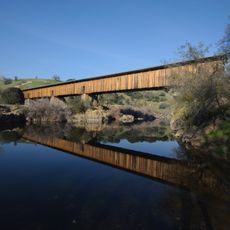
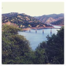
James E. Roberts Bridge, Road bridge in Tuolumne County, California.

Description

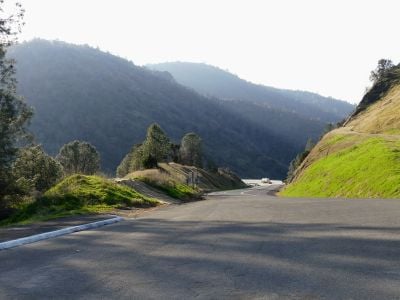
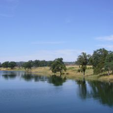
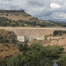
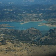
The James E. Roberts Bridge is a road bridge that crosses the Tuolumne River near Chinese Camp in Tuolumne County. It carries two state routes over Lake Don Pedro and handles regular traffic between important regional destinations.

History

The bridge was originally called the Tuolumne River Bridge when it opened in 1971. It received its current name in 2007 to honor a Caltrans project manager who played a key role in its development.

Culture

The bridge stands as a testament to California's engineering excellence, receiving recognition through the AISC Medium Span Steel Bridge award in 1972.

Practical

The crossing has two lanes for regular traffic flow and is easily accessible from both sides. The area can be visited year-round, though summer temperatures tend to be warm.

Did you know?

The structure won the AISC Medium Span Steel Bridge Award in 1972, a notable recognition for its steel construction. This award highlights the engineering quality that made the crossing stand out.

Location
Official opening
1971
Address
CA-120, Jamestown, CA 95327, USA
GPS coordinates
37.83940,-120.37900
Latest update
December 14, 2025 18:07

AroundUs brings together thousands of curated places, local tips, and hidden gems, enriched daily by 60,000 contributors worldwide. Discover all places nearby (Tuolumne County).

Around this place
New Melones Lake
United States of America

New Melones Lake

21.7 km
Moaning Cavern
United States of America

Moaning Cavern

26.7 km
Railtown 1897 State Historic Park
United States of America

Railtown 1897 State Historic Park

12.9 km
Lake Tulloch
United States of America

Lake Tulloch

19.3 km
Lake McClure
United States of America

Lake McClure

23.5 km
Turlock Lake State Recreation Area
United States of America

Turlock Lake State Recreation Area

29.6 km
Angels Hotel
United States of America

Angels Hotel

29.4 km
New Exchequer Dam
United States of America

New Exchequer Dam

29.8 km
Knight's Ferry Bridge
United States of America

Knight's Ferry Bridge

25.1 km
Gold Dredge
United States of America

Gold Dredge

24.5 km
Hotel Charlotte (Groveland, California)
United States of America

Hotel Charlotte (Groveland, California)

13.2 km
Track Bus No. 19
United States of America

Track Bus No. 19

12.8 km
Archie Stevenot Bridge
United States of America

Archie Stevenot Bridge

21.2 km
Odd Fellows Hall
United States of America

Odd Fellows Hall

20.9 km
Sam Choy Brick Store
United States of America

Sam Choy Brick Store

29.2 km
Copperopolis Congregational Church
United States of America

Copperopolis Congregational Church

27.6 km
Utica Mansion
United States of America

Utica Mansion

29.5 km
Abraham Schell House
United States of America

Abraham Schell House

26 km
Groveland Hotel
United States of America

Groveland Hotel

13.2 km
Old Adobe Barn
United States of America

Old Adobe Barn

20.8 km
Calaveras County Bank
United States of America

Calaveras County Bank

29.3 km
Gamble Building and Miner's Bean Kettle
United States of America

Gamble Building and Miner's Bean Kettle

10.9 km
Jacksonville Road Bridge
United States of America

Jacksonville Road Bridge

2.9 km
Lake Lodge Beach
United States of America

Lake Lodge Beach

16.7 km
La Grange Dam
United States of America

La Grange Dam

19.5 km
Old La Grange Schoolhouse
United States of America

Old La Grange Schoolhouse

21 km
Groveland Ranger Station
United States of America

Groveland Ranger Station

24.8 km
Coulterville Main Street Historic District
United States of America

Coulterville Main Street Historic District

21.4 km
Show the full map
« James E. Roberts Bridge - Road bridge in Tuolumne County, California » is provided by Around Us (aroundus.com). Images and texts are derived from Wikimedia project under a Creative Commons license. You are allowed to copy, distribute, and modify copies of this page, under the conditions set by the license, as long as this note is clearly visible.

Discover hidden gems everywhere you go!

From secret cafés to breathtaking viewpoints, skip the crowded tourist spots and find places that match your style. Our app makes it easy with voice search, smart filtering, route optimization, and insider tips from travelers worldwide. Download now for the complete mobile experience.

Around Us App Screenshot

A unique approach to discovering new places

Le Figaro

All the places worth exploring

France Info

A tailor-made excursion in just a few clicks

20 Minutes

Around Us
Travel Guide & Maps
Download

Send to your phone

QR Code
1

Open the camera app on your mobile.

2

Point at the QR code with your camera. A notification will appear.

3

Tap the notification to open the link.