John P. Saylor Trail

Log in to your account

AroundUs is a community-driven map of interesting places, built by curious explorers like you. It grows with every review, story, and photo you share.
Connect to save your favorite spots, contribute locations, and create personalized routes.
Continue with Google
Continue with Apple
Continue with X
Continue with Facebook
Continue with email
By continuing, you accept our Terms and Conditions and our Privacy Policy
Create an account

John P. Saylor Trail

Add to collection
Map
Suggest a change
Share

John P. Saylor Trail, Hiking trail in Gallitzin State Forest, Pennsylvania, United States

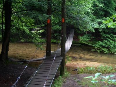
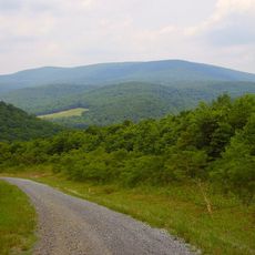
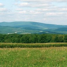
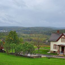
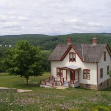
The John P. Saylor Trail is a hiking route through Gallitzin State Forest with varied terrain and several connecting pathways. The network passes through dense forests and natural landscapes with different difficulty levels.

The trail was named after a U.S. Congressman who devoted his career to protecting natural areas. His commitment to conservation shaped how such places are maintained and kept accessible to the public today.

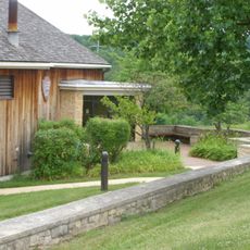
The trail connects visitors with the forest landscape that has long been part of the region's everyday life. People use this route to spend time outdoors and explore the local woodlands.

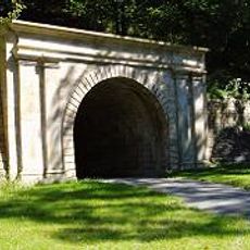
The trail has marked sections and multiple access points that allow hikers to choose based on their fitness level. Good footwear and attention to weather conditions are important for staying safe on the paths.

The route passes through different forest ecosystems that change significantly with the seasons, giving each visit a different appearance. Visitors can observe wildlife that becomes active and visible only at certain times of year.

Location: Pennsylvania

GPS coordinates: 40.21610,-78.75280

Latest update: December 14, 2025 13:07

Photos
Around this place
Johnstown Inclined Plane
United States of America

Johnstown Inclined Plane

19.3 km
Johnstown Flood National Memorial
United States of America

Johnstown Flood National Memorial

14.6 km
Blue Knob
United States of America

Blue Knob

18.1 km
Blue Knob State Park
United States of America

Blue Knob State Park

16.1 km
Staple Bend Tunnel
United States of America

Staple Bend Tunnel

18.1 km
Johnstown Flood Museum
United States of America

Johnstown Flood Museum

18.9 km
Cathedral of Saint John Gualbert
United States of America

Cathedral of Saint John Gualbert

18.4 km
Inclined Plane Bridge
United States of America

Inclined Plane Bridge

19.1 km
Moxham Historic District
United States of America

Moxham Historic District

16 km
Downtown Johnstown Historic District
United States of America

Downtown Johnstown Historic District

18.6 km
Windber Historic District
United States of America

Windber Historic District

7.1 km
Old Conemaugh Borough Historic District
United States of America

Old Conemaugh Borough Historic District

18.2 km
New Paris Covered Bridge
United States of America

New Paris Covered Bridge

13.7 km
Dr. Knisley Covered Bridge
United States of America

Dr. Knisley Covered Bridge

14.2 km
Ryot Covered Bridge
United States of America

Ryot Covered Bridge

13.6 km
Grand Army of the Republic Hall
United States of America

Grand Army of the Republic Hall

18.7 km
Alma Hall
United States of America

Alma Hall

18.6 km
Cairnbrook Historic District
United States of America

Cairnbrook Historic District

11.8 km
Snooks Covered Bridge
United States of America

Snooks Covered Bridge

15.6 km
Shade Furnace Archaeological District
United States of America

Shade Furnace Archaeological District

9.5 km
Osterburg Covered Bridge
United States of America

Osterburg Covered Bridge

18.5 km
Johnstown Flood National Memorial
United States of America

Johnstown Flood National Memorial

15 km
Tower of Voices
United States of America

Tower of Voices

19.1 km
Unger House
United States of America

Unger House

14.9 km
South Fork Fishing and Hunting Club Clubhouse
United States of America

South Fork Fishing and Hunting Club Clubhouse

13.6 km
Pasquerilla Performing Arts Center
United States of America

Pasquerilla Performing Arts Center

9 km
Lake View Visitor Center
United States of America

Lake View Visitor Center

15 km
Flight 93 National Memorial entrance sign
United States of America

Flight 93 National Memorial entrance sign

19.1 km
Show the full map
Reviews

Visited this place? Tap the stars to rate it and share your experience / photos with the community! Try now! You can cancel it anytime.

« John P. Saylor Trail - Hiking trail in Gallitzin State Forest, Pennsylvania, United States » is provided by Around Us (aroundus.com). Images and texts are derived from Wikimedia project under a Creative Commons license. You are allowed to copy, distribute, and modify copies of this page, under the conditions set by the license, as long as this note is clearly visible.

Discover hidden gems everywhere you go!

From secret cafés to breathtaking viewpoints, skip the crowded tourist spots and find places that match your style. Our app makes it easy with voice search, smart filtering, route optimization, and insider tips from travelers worldwide. Download now for the complete mobile experience.

Around Us App Screenshot

A unique approach to discovering new places

Le Figaro

All the places worth exploring

France Info

A tailor-made excursion in just a few clicks

20 Minutes