Moxham Historic District

Log in to your account

AroundUs is a community-driven map of interesting places, built by curious explorers like you. It grows with every review, story, and photo you share.
Connect to save your favorite spots, contribute locations, and create personalized routes.
Continue with Google
Continue with Apple
Continue with X
Continue with Facebook
Continue with email
By continuing, you accept our Terms and Conditions and our Privacy Policy
Create an account
Add to collection
Map
Suggest a change
Share

Moxham Historic District, Historic residential district in Johnstown, Pennsylvania.

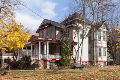
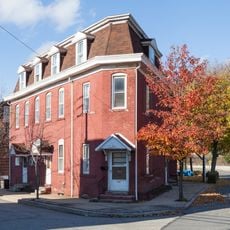
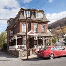
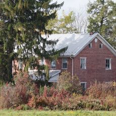
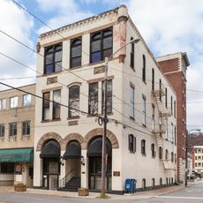
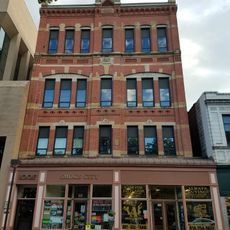
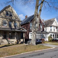
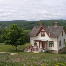
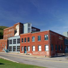
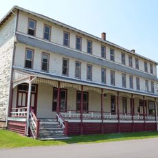
Moxham Historic District is a residential neighborhood in Johnstown containing around 330 buildings spread across about 70 acres, mostly built between 1890 and 1930. The collection includes Colonial Revival houses, churches, shops, and former carriage houses that together form a diverse urban streetscape from that era.

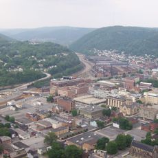
After the 1889 flood, the neighborhood grew rapidly around the Johnston Steel Street Rail Company, with only five buildings surviving from before the disaster. The area developed quickly between 1890 and 1930 as a major residential and commercial center for the rebuilding city.

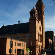
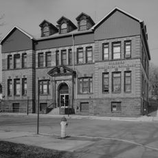
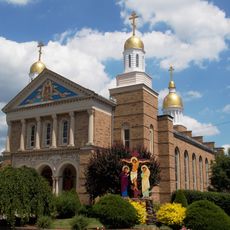
Ten churches representing different denominations shape the neighborhood today, with St. Patrick's, Second Presbyterian, and Grove Avenue Methodist among them. These buildings show how different faith communities built their own places of worship throughout the district.

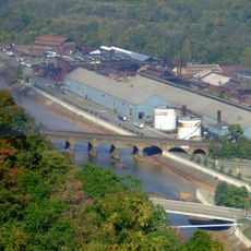
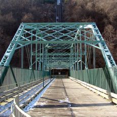
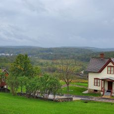
The district sits on elevated ground east of Stoney Creek, which makes it less prone to flooding than other parts of town. The higher elevation makes walking through the neighborhood easier and provides good views of the overall street layout.

Unlike surrounding areas that housed only factory workers, this neighborhood attracted residents from different social classes, as shown by its varied housing styles. This social diversity is still visible today in the different sizes and designs of homes throughout the district.

Location: Pennsylvania

GPS coordinates: 40.29780,-78.90830

Latest update: December 14, 2025 12:26

Photos
Around this place
Johnstown Inclined Plane
United States of America

Johnstown Inclined Plane

3.5 km
Johnstown Flood National Memorial
United States of America

Johnstown Flood National Memorial

12.2 km
Cambria Iron Company
United States of America

Cambria Iron Company

4.4 km
Stone Bridge
United States of America

Stone Bridge

4.1 km
Staple Bend Tunnel
United States of America

Staple Bend Tunnel

8.2 km
Johnstown Flood Museum
United States of America

Johnstown Flood Museum

3.5 km
Cathedral of Saint John Gualbert
United States of America

Cathedral of Saint John Gualbert

3.1 km
Inclined Plane Bridge
United States of America

Inclined Plane Bridge

3.5 km
John P. Saylor Trail
United States of America

John P. Saylor Trail

16 km
Cambria City Historic District
United States of America

Cambria City Historic District

5.1 km
Downtown Johnstown Historic District
United States of America

Downtown Johnstown Historic District

3.2 km
Windber Historic District
United States of America

Windber Historic District

9.4 km
Old Conemaugh Borough Historic District
United States of America

Old Conemaugh Borough Historic District

3.2 km
Minersville Historic District
United States of America

Minersville Historic District

5.2 km
Matthew Hair Farm
United States of America

Matthew Hair Farm

15 km
Laurel Hill Furnace
United States of America

Laurel Hill Furnace

14.9 km
Shaffer's Bridge
United States of America

Shaffer's Bridge

5.1 km
Grand Army of the Republic Hall
United States of America

Grand Army of the Republic Hall

3.3 km
Alma Hall
United States of America

Alma Hall

3.2 km
Westmont Historic District
United States of America

Westmont Historic District

3.7 km
Johnstown Flood National Memorial
United States of America

Johnstown Flood National Memorial

13 km
Bridge in Jenner Township
United States of America

Bridge in Jenner Township

16.6 km
Ross Furnace
United States of America

Ross Furnace

15.8 km
Unger House
United States of America

Unger House

13 km
Heritage Discovery Center
United States of America

Heritage Discovery Center

5.1 km
Christ the Saviour Orthodox Cathedral (Johnstown, Pennsylvania)
United States of America

Christ the Saviour Orthodox Cathedral (Johnstown, Pennsylvania)

6.6 km
South Fork Fishing and Hunting Club Clubhouse
United States of America

South Fork Fishing and Hunting Club Clubhouse

12.4 km
Pasquerilla Performing Arts Center
United States of America

Pasquerilla Performing Arts Center

7.1 km
Show the full map
Reviews

Visited this place? Tap the stars to rate it and share your experience / photos with the community! Try now! You can cancel it anytime.

« Moxham Historic District - Historic residential district in Johnstown, Pennsylvania » is provided by Around Us (aroundus.com). Images and texts are derived from Wikimedia project under a Creative Commons license. You are allowed to copy, distribute, and modify copies of this page, under the conditions set by the license, as long as this note is clearly visible.

Discover hidden gems everywhere you go!

From secret cafés to breathtaking viewpoints, skip the crowded tourist spots and find places that match your style. Our app makes it easy with voice search, smart filtering, route optimization, and insider tips from travelers worldwide. Download now for the complete mobile experience.

Around Us App Screenshot

A unique approach to discovering new places

Le Figaro

All the places worth exploring

France Info

A tailor-made excursion in just a few clicks

20 Minutes