Enable Location

We need your location to show you interesting places around you

Discover nearby places

Find interesting locations and hidden gems around you

Precise directions

Get accurate directions and distances to places

Your location is never shared with other users. It's only used when you tap the location button.

Kensington High School

Log in to your account

Start exploring — it's free

Trusted by 62,317 travelers worldwide

Continue with Google
Continue with Apple
or

We will send you a code to connect

By continuing, you accept our Terms and Conditions and our Privacy Policy

Check your inbox

We've sent a pincode in your inbox. Please enter the code below.

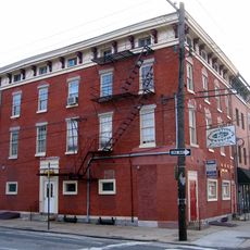
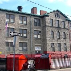
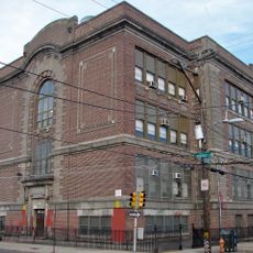
Kensington High School, Public high school in Philadelphia, Pennsylvania

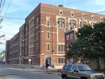
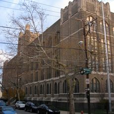
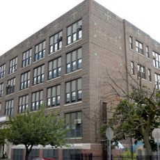
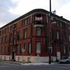
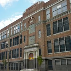
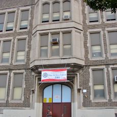
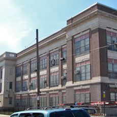
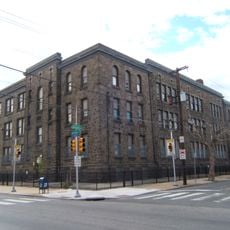
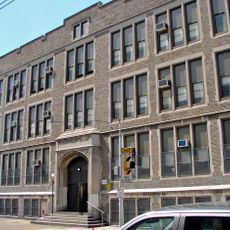
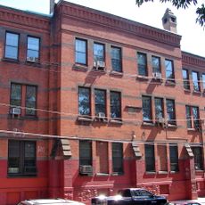
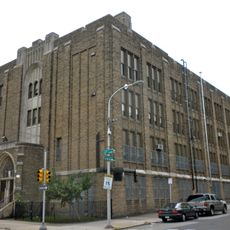
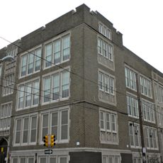
Kensington High School is a school building in Philadelphia listed on the National Register of Historic Places, constructed in the early 1900s as the city expanded. The structure features sturdy brick walls, large windows for natural light, and symmetrical design typical of educational buildings from that era, with some modern updates integrated into its original layout.

The school was constructed during Philadelphia's rapid expansion in the early 1900s to serve local families and workers. Its strong construction techniques from that era have preserved the main structure through repairs and interior updates, making it a symbol of the neighborhood's perseverance and growth.

The school reflects community identity through its presence as a gathering place where families, staff, and residents have created memories over generations. The building's role in neighborhood life extends beyond education, serving as a symbol of local pride and continuity.

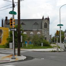
The school is accessible by public transportation or on foot, with parking available nearby. Visitors should respect school rules and the property, especially during school hours when the area is busy with students and staff moving about.

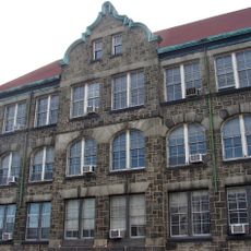
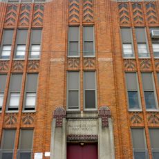
Although many people pass by the school daily, few notice the detailed brickwork patterns and original construction methods visible in the craftsmanship of the facade. These handcrafted details offer a rare glimpse into early 1900s building techniques seldom found in newer structures.

The community of curious travelers

AroundUs brings together thousands of curated places, local tips, and hidden gems, enriched daily by 60,000 contributors worldwide.

Start exploring
Location
GPS coordinates
39.98440,-75.12640
Latest update
February 7, 2026 11:40
Around this place
Penn Treaty Park
United States of America

Penn Treaty Park

2.1 km
Uptown Theatre
United States of America

Uptown Theatre

2.6 km
USS Olympia
United States of America

USS Olympia

2.4 km
Immaculate Conception Roman Catholic Church , Philadelphia
United States of America

Immaculate Conception Roman Catholic Church , Philadelphia

2.3 km
Penn Treaty Junior High School
United States of America

Penn Treaty Junior High School

1.3 km
Bodine High School for International Affairs
United States of America

Bodine High School for International Affairs

2.3 km
Fair Hill Burial Ground
United States of America

Fair Hill Burial Ground

2.2 km
Green Tree Tavern
United States of America

Green Tree Tavern

1.7 km
Philip H. Sheridan School
United States of America

Philip H. Sheridan School

2 km
Frances E. Willard School
United States of America

Frances E. Willard School

1.1 km
Beatty's Mills Factory Building
United States of America

Beatty's Mills Factory Building

189 m
26th District Police and Patrol Station
United States of America

26th District Police and Patrol Station

490 m
Joseph C. Ferguson School
United States of America

Joseph C. Ferguson School

1.8 km
Conwell Middle Magnet School
United States of America

Conwell Middle Magnet School

1.5 km
Memphis Street Academy
United States of America

Memphis Street Academy

1.2 km
Alternative Middle Years at James Martin School
United States of America

Alternative Middle Years at James Martin School

2.5 km
Thomas Powers School
United States of America

Thomas Powers School

720 m
Richmond School
United States of America

Richmond School

1.4 km
Northern National Bank
United States of America

Northern National Bank

1.7 km
David Farragut School
United States of America

David Farragut School

871 m
Northeast Manual Training School
United States of America

Northeast Manual Training School

1.8 km
Lithuanian Hall (Philadelphia, Pennsylvania)
United States of America

Lithuanian Hall (Philadelphia, Pennsylvania)

2.1 km
William Adamson School
United States of America

William Adamson School

1.2 km
Brooklyn Bowl
United States of America

Brooklyn Bowl

2.3 km
James Elverson, Jr. School
United States of America

James Elverson, Jr. School

2.4 km
The Clay Studio
United States of America

The Clay Studio

1.7 km
James R. Ludlow School
United States of America

James R. Ludlow School

2.2 km
Paul Lawrence Dunbar School
United States of America

Paul Lawrence Dunbar School

2.5 km
Show the full map
« Kensington High School - Public high school in Philadelphia, Pennsylvania » is provided by Around Us (aroundus.com). Images and texts are derived from Wikimedia project under a Creative Commons license. You are allowed to copy, distribute, and modify copies of this page, under the conditions set by the license, as long as this note is clearly visible.

Discover hidden gems everywhere you go!

From secret cafés to breathtaking viewpoints, skip the crowded tourist spots and find places that match your style. Our app makes it easy with voice search, smart filtering, route optimization, and insider tips from travelers worldwide. Download now for the complete mobile experience.

Around Us App Screenshot

A unique approach to discovering new places

Le Figaro

All the places worth exploring

France Info

A tailor-made excursion in just a few clicks

20 Minutes

Around Us
Travel Guide & Maps
Download

Send to your phone

QR Code
1

Open the camera app on your mobile.

2

Point at the QR code with your camera. A notification will appear.

3

Tap the notification to open the link.