Enable Location

We need your location to show you interesting places around you

Discover nearby places

Find interesting locations and hidden gems around you

Precise directions

Get accurate directions and distances to places

Your location is never shared with other users. It's only used when you tap the location button.

Log in to your account

Start exploring — it's free

Trusted by 62,857 travelers worldwide

Continue with Google
Continue with Apple
or

We will send you a code to connect

By continuing, you accept our Terms and Conditions and our Privacy Policy

Check your inbox

We've sent a pincode in your inbox. Please enter the code below.

Lake Andes National Wildlife Refuge

Lake Andes National Wildlife Refuge, National wildlife refuge in Charles Mix County, South Dakota.

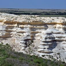
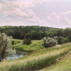
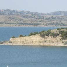
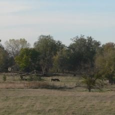
Lake Andes National Wildlife Refuge is a protected area with wetlands, grasslands, and forested sections that provide habitat for a range of wildlife. The center of the refuge is defined by Lake Andes itself, a large water body with numerous coves and shoreline features shaped by ancient glaciation.

The refuge was founded in 1936 to protect migratory waterfowl populations during their seasonal journeys. Its creation was part of a broader effort to safeguard natural habitats across America during that era.

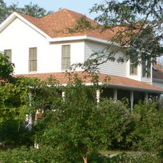
The refuge serves as a gathering place where visitors come to observe waterfowl, eagles, and migratory birds in their natural setting. People use the viewing areas throughout the year to witness the changing patterns of wildlife activity across seasons.

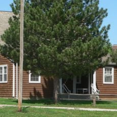
The refuge offers walking trails and viewing platforms where visitors can explore the landscape at their own pace. The office location provides information about the best times to visit and what wildlife appears during different seasons.

The lake was carved out by glacial movement thousands of years ago, creating a water landscape that stands out in this region. This geological history makes the place interesting as an example of how nature shapes terrain over vast timescales.

The community of curious travelers

AroundUs brings together thousands of curated places, local tips, and hidden gems, enriched daily by 60,000 contributors worldwide.

Start exploring
Inception
1936
GPS coordinates
43.18280,-98.44690
Latest update
December 14, 2025 12:26
Around this place
Niobrara Formation
United States of America

Niobrara Formation

58.8 km
Niobrara State Park
United States of America

Niobrara State Park

58.7 km
Chief Standing Bear Memorial Bridge
United States of America

Chief Standing Bear Memorial Bridge

59.2 km
Snake Creek Recreation Area
United States of America

Snake Creek Recreation Area

59.2 km
United States of America

White Horse Ranch

60.5 km
Niobrara River Bridge
United States of America

Niobrara River Bridge

56.6 km
Congregational Church and Manse
United States of America

Congregational Church and Manse

62.1 km
Aurora County Courthouse
United States of America

Aurora County Courthouse

59.6 km
Herrick Elevator
United States of America

Herrick Elevator

60.1 km
St. Andrew's Episcopal Church
United States of America

St. Andrew's Episcopal Church

59.5 km
Delmont Public School
United States of America

Delmont Public School

24.7 km
Rad Sladkovsky
United States of America

Rad Sladkovsky

54.3 km
Church of Christ in LaRoche Township
United States of America

Church of Christ in LaRoche Township

59.7 km
ZCBJ Hall
United States of America

ZCBJ Hall

51.6 km
Rouse Ranch
United States of America

Rouse Ranch

55.7 km
William P. Smith House
United States of America

William P. Smith House

45.7 km
Armour Historic District
United States of America

Armour Historic District

17.2 km
Methodist Episcopal Church
United States of America

Methodist Episcopal Church

60.7 km
Raesly House
United States of America

Raesly House

59.5 km
Charles Mix County Courthouse
United States of America

Charles Mix County Courthouse

8 km
Bon Homme County Courthouse
United States of America

Bon Homme County Courthouse

51.7 km
Ponca Tribal Self-Help Community Building Historic District
United States of America

Ponca Tribal Self-Help Community Building Historic District

59.9 km
Douglas County Courthouse
United States of America

Douglas County Courthouse

16.8 km
John Frydrych Farmstead
United States of America

John Frydrych Farmstead

59.1 km
Delmont State Bank
United States of America

Delmont State Bank

25 km
Wagner House
United States of America

Wagner House

24.7 km
Dimock (Dakota do Sul)
United States of America

Dimock (Dakota do Sul)

55.2 km
Lake Francis Case
United States of America

Lake Francis Case

16.6 km
Show the full map
« Lake Andes National Wildlife Refuge - National wildlife refuge in Charles Mix County, South Dakota » is provided by Around Us (aroundus.com). Images and texts are derived from Wikimedia project under a Creative Commons license. You are allowed to copy, distribute, and modify copies of this page, under the conditions set by the license, as long as this note is clearly visible.

Discover hidden gems everywhere you go!

From secret cafés to breathtaking viewpoints, skip the crowded tourist spots and find places that match your style. Our app makes it easy with voice search, smart filtering, route optimization, and insider tips from travelers worldwide. Download now for the complete mobile experience.

Around Us App Screenshot

A unique approach to discovering new places

Le Figaro

All the places worth exploring

France Info

A tailor-made excursion in just a few clicks

20 Minutes

Around Us
Travel Guide & Maps
Download

Send to your phone

QR Code
1

Open the camera app on your mobile.

2

Point at the QR code with your camera. A notification will appear.

3

Tap the notification to open the link.