Chest opened
+${chestReward.xp} XP
Explorer
NOUVEAU ×${chestReward.collectible.quantity}
tapez pour fermer
Chest locked

Open chests in the app

Around Us is built for your phone — chests unlock when you walk, explore and capture nearby places.

Enable Location

We need your location to show you interesting places around you

Discover nearby places

Find interesting locations and hidden gems around you

Precise directions

Get accurate directions and distances to places

Your location is never shared with other users. It's only used when you tap the location button.

Log in to your account

Start exploring — it's free

Trusted by 72,883 travelers worldwide

Continue with Google
Continue with Apple
or

We will send you a code to connect

By continuing, you accept our Terms and Conditions and our Privacy Policy

Check your inbox

We've sent a pincode in your inbox. Please enter the code below.

Owen–Putnam State Forest
Discussion Reviews Photo
1.5k Popularity

Owen–Putnam State Forest, Protected forest in Indiana, United States

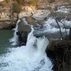
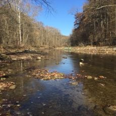
Owen-Putnam State Forest is a protected woodland area in south-central Indiana with scattered holdings of hardwood forest running in a north-south direction. The land contains diverse wildlife and several waterways that run through it.

The forest was established to advance Indiana's conservation efforts and protect this landscape for the future. Over time, camping areas and trail systems were created to allow public access and use.

Local people use the forest for hunting and nature programs that connect them to the land. These activities shape how the region values and spends time in these wooded areas.

The forest provides three primitive campgrounds at different locations, each with basic facilities like toilets and grills. Visitors should come prepared for simple accommodations and rough conditions.

Orange paint marks on trees show where the state forest boundaries are located. These color-coded signals help visitors tell public land apart from private properties.

The community of curious travelers

AroundUs brings together thousands of curated places, local tips, and hidden gems, enriched daily by 60,000 contributors worldwide.

Start exploring
Location
GPS coordinates
39.47500,-86.86940
Latest update
December 14, 2025 14:40
Around this place
Cataract Falls
United States of America

Cataract Falls

6.6 km
Cataract Falls Covered Bridge
United States of America

Cataract Falls Covered Bridge

6.7 km
Delta Kappa Epsilon Fraternity House
United States of America

Delta Kappa Epsilon Fraternity House

18.4 km
McKim Observatory
United States of America

McKim Observatory

19 km
Putnamville Presbyterian Church
United States of America

Putnamville Presbyterian Church

11 km
Courthouse Square Historic District
United States of America

Courthouse Square Historic District

18.8 km
David Enoch Beem House
United States of America

David Enoch Beem House

22.3 km
Indiana State Highway Bridge 46-11-1316
United States of America

Indiana State Highway Bridge 46-11-1316

16.5 km
Eastern Enlargement Historic District
United States of America

Eastern Enlargement Historic District

18.6 km
Northwood Historic District
United States of America

Northwood Historic District

19 km
Old Greencastle Historic District
United States of America

Old Greencastle Historic District

19 km
Clay County Courthouse
United States of America

Clay County Courthouse

22.2 km
Poland Presbyterian Church and Cemetery
United States of America

Poland Presbyterian Church and Cemetery

8 km
Heck-Hasler House
United States of America

Heck-Hasler House

19.2 km
F.P. Nelson House
United States of America

F.P. Nelson House

18.6 km
Richard M. Hazelett House
United States of America

Richard M. Hazelett House

19 km
William C. Van Arsdel House
United States of America

William C. Van Arsdel House

18.7 km
Alfred Hirt House
United States of America

Alfred Hirt House

18.9 km
The Boulders
United States of America

The Boulders

18.9 km
Putnam County Bridge No. 159
United States of America

Putnam County Bridge No. 159

12 km
Moffett-Ralston House
United States of America

Moffett-Ralston House

17.4 km
Indiana State Highway Bridge 42-11-3101
United States of America

Indiana State Highway Bridge 42-11-3101

11.2 km
Lycurgus Stoner House
United States of America

Lycurgus Stoner House

12.7 km
Eaglefield Place
United States of America

Eaglefield Place

14.9 km
Houck Covered Bridge
United States of America

Houck Covered Bridge

13.4 km
Big Walnut Creek
United States of America

Big Walnut Creek

7.4 km
Dunbar Covered Bridge
United States of America

Dunbar Covered Bridge

20.5 km
Cagles Mill Lake
United States of America

Cagles Mill Lake

1.7 km
Show the full map
Reviews
Share your experience

No review yet

Discussions
Start a discussion...

No discussion yet

« Owen–Putnam State Forest - Protected forest in Indiana, United States » is provided by Around Us (aroundus.com). Images and texts are derived from Wikimedia project under a Creative Commons license. You are allowed to copy, distribute, and modify copies of this page, under the conditions set by the license, as long as this note is clearly visible.

Discover hidden gems everywhere you go!

From secret cafés to breathtaking viewpoints, skip the crowded tourist spots and find places that match your style. Our app makes it easy with voice search, smart filtering, route optimization, and insider tips from travelers worldwide. Download now for the complete mobile experience.

Around Us App Screenshot

A unique approach to discovering new places

Le Figaro

All the places worth exploring

France Info

A tailor-made excursion in just a few clicks

20 Minutes

Around Us
Travel Guide & Maps
Download

Send to your phone

QR Code
1

Open the camera app on your mobile.

2

Point at the QR code with your camera. A notification will appear.

3

Tap the notification to open the link.