Enable Location

We need your location to show you interesting places around you

Discover nearby places

Find interesting locations and hidden gems around you

Precise directions

Get accurate directions and distances to places

Your location is never shared with other users. It's only used when you tap the location button.

Orchard Beach State Park

Log in to your account

Start exploring — it's free

Trusted by 61,917 travelers worldwide

Continue with Google
Continue with Apple
or

We will send you a code to connect

By continuing, you accept our Terms and Conditions and our Privacy Policy

Check your inbox

We've sent a pincode in your inbox. Please enter the code below.

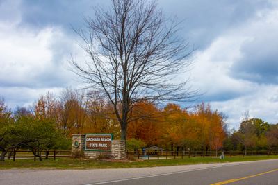
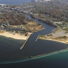
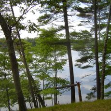
Orchard Beach State Park, Historic state park on Lake Michigan bluff, Manistee County, US

Orchard Beach State Park is a state park on a Lake Michigan bluff with 166 campsites spread across an elevation of about 100 feet. Paved paths connect different sections of the park and make it easy to move around the grounds.

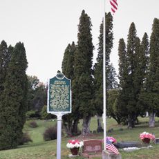
The park was established in 1921 and named after an old apple orchard that once occupied land north of Manistee. This agricultural past shaped the area before it became a public recreation space.

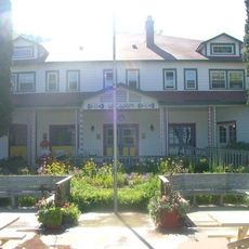
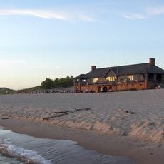
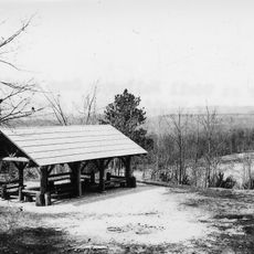
The stone pavilion and shelter building serve as gathering places for weddings and regional events that shape community life. These structures stand as meeting points where people come together to mark important occasions.

The park offers about 3.5 miles of trails through forest areas that are accessible year-round. Visitors can enjoy hiking, cross-country skiing, or nature watching depending on the season and weather.

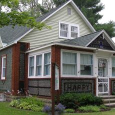
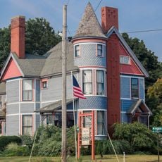
A historic structure weighing about 850 tons was relocated and restored on the park grounds. This project demonstrates impressive engineering work and commitment to preserving structures from earlier times.

The community of curious travelers

AroundUs brings together thousands of curated places, local tips, and hidden gems, enriched daily by 60,000 contributors worldwide.

Start exploring
Location
Inception
1921
GPS coordinates
44.27860,-86.31410
Latest update
December 11, 2025 11:01
Around this place
Big Sable Point Light
United States of America

Big Sable Point Light

29.3 km
SS City of Milwaukee
United States of America

SS City of Milwaukee

2.1 km
Watervale
United States of America

Watervale

31.6 km
Ramsdell Theatre
United States of America

Ramsdell Theatre

3.7 km
John J. Makinen Bottle House
United States of America

John J. Makinen Bottle House

26.4 km
Manistee Pierhead lights
United States of America

Manistee Pierhead lights

4 km
Udell Lookout Tower
United States of America

Udell Lookout Tower

18.8 km
Camp Arcadia
United States of America

Camp Arcadia

24.9 km
Our Saviour's Evangelical Lutheran Church
United States of America

Our Saviour's Evangelical Lutheran Church

3.9 km
Guardian Angels Church
United States of America

Guardian Angels Church

4.1 km
Chapel of St. John-by-the-Lake
United States of America

Chapel of St. John-by-the-Lake

12.7 km
Warren A. and Catherine Cartier House
United States of America

Warren A. and Catherine Cartier House

37.4 km
Ludington State Park Beach House
United States of America

Ludington State Park Beach House

31.5 km
Scottville School
United States of America

Scottville School

35.9 km
Camp Tosebo
United States of America

Camp Tosebo

9.7 km
First Congregational Church
United States of America

First Congregational Church

3.8 km
Manistee Iron Works
United States of America

Manistee Iron Works

3.2 km
Manistee Harbor, South Breakwater
United States of America

Manistee Harbor, South Breakwater

4.2 km
East Ludington Avenue Historic District
United States of America

East Ludington Avenue Historic District

37.3 km
Simeon Babcock House
United States of America

Simeon Babcock House

3.9 km
Sandenburgh-Rogers Summer Resort Complex
United States of America

Sandenburgh-Rogers Summer Resort Complex

9.8 km
Manistee Golf & Country Club
United States of America

Manistee Golf & Country Club

5 km
Ludington State Park
United States of America

Ludington State Park

30.5 km
Bottle House Museum
United States of America

Bottle House Museum

26.5 km
Vogue Theatre
United States of America

Vogue Theatre

3.5 km
Onekama Branch Library
United States of America

Onekama Branch Library

13.1 km
Udell Rollways Day Use Area
United States of America

Udell Rollways Day Use Area

18.8 km
Joyfield Cemetery Historical Marker
United States of America

Joyfield Cemetery Historical Marker

34.6 km
Show the full map
« Orchard Beach State Park - Historic state park on Lake Michigan bluff, Manistee County, US » is provided by Around Us (aroundus.com). Images and texts are derived from Wikimedia project under a Creative Commons license. You are allowed to copy, distribute, and modify copies of this page, under the conditions set by the license, as long as this note is clearly visible.

Discover hidden gems everywhere you go!

From secret cafés to breathtaking viewpoints, skip the crowded tourist spots and find places that match your style. Our app makes it easy with voice search, smart filtering, route optimization, and insider tips from travelers worldwide. Download now for the complete mobile experience.

Around Us App Screenshot

A unique approach to discovering new places

Le Figaro

All the places worth exploring

France Info

A tailor-made excursion in just a few clicks

20 Minutes

Around Us
Travel Guide & Maps
Download

Send to your phone

QR Code
1

Open the camera app on your mobile.

2

Point at the QR code with your camera. A notification will appear.

3

Tap the notification to open the link.