Enable Location

We need your location to show you interesting places around you

Discover nearby places

Find interesting locations and hidden gems around you

Precise directions

Get accurate directions and distances to places

Your location is never shared with other users. It's only used when you tap the location button.

Penwood State Park

Log in to your account

Start exploring — it's free

Trusted by 61,869 travelers worldwide

Continue with Google
Continue with Apple
or

We will send you a code to connect

By continuing, you accept our Terms and Conditions and our Privacy Policy

Check your inbox

We've sent a pincode in your inbox. Please enter the code below.

Penwood State Park

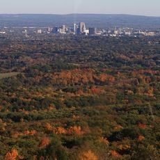
Penwood State Park, State park on Talcott Mountain in Bloomfield, US.

Description

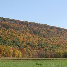
Penwood State Park is a forested area on Talcott Mountain in Bloomfield covering 787 acres of woods and natural paths. The trails are marked with different colors to help visitors navigate through the terrain to Lake Louise and the ridge above.

History

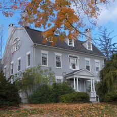
Curtis H. Veeder, a Connecticut industrialist, donated this land to the state in 1944 to establish a protected recreational space. Since then it has become a regional destination for outdoor activity.

Culture

The Metacomet Trail within the park forms part of Connecticut's Blue Blazed Trail system, connecting visitors to regional hiking traditions.

Practical

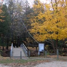
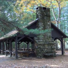
The main picnic area near the entrance is the best starting point and provides access to all marked trails. Visitors should wear sturdy shoes and bring water, especially for longer hikes through the woods.

Did you know?

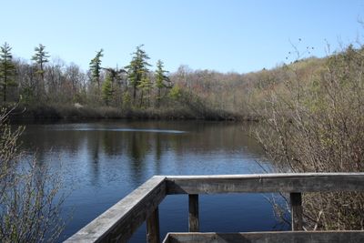
Lake Louise is a kettle bog formed from glacial activity, home to uncommon plant species adapted to these wet conditions. The bog at the mountain ridge shows signs of the region's ice age past.

Location
Inception
1944
Elevation above the sea
204 m
GPS coordinates
41.86000,-72.78000
Latest update
December 13, 2025 11:45

AroundUs brings together thousands of curated places, local tips, and hidden gems, enriched daily by 60,000 contributors worldwide. Discover all places nearby (Bloomfield).

Around this place
Heublein Tower
United States of America

Heublein Tower

4.1 km
Talcott Mountain
United States of America

Talcott Mountain

5.6 km
Connecticut General Life Insurance Company Headquarters
United States of America

Connecticut General Life Insurance Company Headquarters

5.9 km
S1C reactor
United States of America

S1C reactor

5.6 km
Talcott Mountain State Park
United States of America

Talcott Mountain State Park

4 km
McLean Game Refuge
United States of America

McLean Game Refuge

6.8 km
Amos Eno House
United States of America

Amos Eno House

2.4 km
Stratton Brook State Park
United States of America

Stratton Brook State Park

4.6 km
Drake Hill Road Bridge
United States of America

Drake Hill Road Bridge

1.9 km
Eno Memorial Hall
United States of America

Eno Memorial Hall

2.4 km
Simsbury Center Historic District
United States of America

Simsbury Center Historic District

2.6 km
Capt. Elisha Phelps House
United States of America

Capt. Elisha Phelps House

2.5 km
Avon Congregational Church
United States of America

Avon Congregational Church

7 km
Oliver Filley House
United States of America

Oliver Filley House

3.2 km
Terry's Plain Historic District
United States of America

Terry's Plain Historic District

2.7 km
Francis Gillette House
United States of America

Francis Gillette House

5.9 km
Simsbury Bank and Trust Company Building
United States of America

Simsbury Bank and Trust Company Building

2.5 km
Robert and Julia Darling House
United States of America

Robert and Julia Darling House

2.3 km
East Weatogue Historic District
United States of America

East Weatogue Historic District

2.1 km
Simsbury Townhouse
United States of America

Simsbury Townhouse

2.4 km
Tariffville Historic District
United States of America

Tariffville Historic District

5.7 km
John Humphrey House
United States of America

John Humphrey House

1.3 km
Horace Belden School and Central Grammar School
United States of America

Horace Belden School and Central Grammar School

3 km
Massaco Forest Pavilion
United States of America

Massaco Forest Pavilion

4.7 km
Whitfield Cowles House
United States of America

Whitfield Cowles House

6.7 km
Beardsley-Mix House
United States of America

Beardsley-Mix House

5 km
Southwest District School
United States of America

Southwest District School

4.8 km
Simsbury Free Library
United States of America

Simsbury Free Library

2.5 km
Show the full map
« Penwood State Park - State park on Talcott Mountain in Bloomfield, US » is provided by Around Us (aroundus.com). Images and texts are derived from Wikimedia project under a Creative Commons license. You are allowed to copy, distribute, and modify copies of this page, under the conditions set by the license, as long as this note is clearly visible.

Discover hidden gems everywhere you go!

From secret cafés to breathtaking viewpoints, skip the crowded tourist spots and find places that match your style. Our app makes it easy with voice search, smart filtering, route optimization, and insider tips from travelers worldwide. Download now for the complete mobile experience.

Around Us App Screenshot

A unique approach to discovering new places

Le Figaro

All the places worth exploring

France Info

A tailor-made excursion in just a few clicks

20 Minutes

Around Us
Travel Guide & Maps
Download

Send to your phone

QR Code
1

Open the camera app on your mobile.

2

Point at the QR code with your camera. A notification will appear.

3

Tap the notification to open the link.