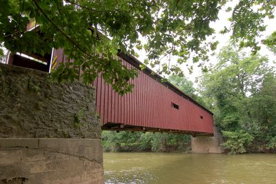
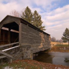
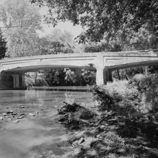
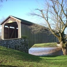
Pinetown Bushong's Mill Covered Bridge, Covered bridge in Lancaster County, Pennsylvania.
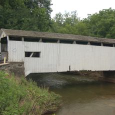
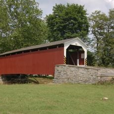
Pinetown Bushong's Mill Covered Bridge is a red wooden structure that crosses the Conestoga River between Upper Leacock and Manheim Township with a single-span design. It measures 12 feet 10 inches (3.9 meters) wide and sits about 17 feet 6 inches (5.3 meters) above the average waterline, with interior double Burr arch trusses providing its structural support.
The structure was built in 1867 by Elias McMellen as part of the local transportation network, employing the proven double Burr arch truss design. After destruction from Hurricane Agnes in 1973, it was faithfully reconstructed and later listed on the National Register of Historic Places in 1980.
The name comes from a historic mill that once stood nearby and served as a gathering place for the local community. The structure is viewed by many as a symbol of the rural craftsmanship traditions that run deep in this region.
Access is easiest from the state roads connecting the two townships, and the site is normally accessible during daylight hours. The structure can be viewed from outside, but facilities nearby are limited, so it helps to explore the surrounding area beforehand.
The bridge is officially known as Big Conestoga #6 Bridge and marks the point where Lititz Run merges into the Conestoga River. This convergence of two waterways gives the location a special hydrological character that many visitors overlook.
The community of curious travelers
AroundUs brings together thousands of curated places, local tips, and hidden gems, enriched daily by 60,000 contributors worldwide.