Enable Location

We need your location to show you interesting places around you

Discover nearby places

Find interesting locations and hidden gems around you

Precise directions

Get accurate directions and distances to places

Your location is never shared with other users. It's only used when you tap the location button.

Log in to your account

Start exploring — it's free

Trusted by 62,187 travelers worldwide

Continue with Google
Continue with Apple
or

We will send you a code to connect

By continuing, you accept our Terms and Conditions and our Privacy Policy

Check your inbox

We've sent a pincode in your inbox. Please enter the code below.

Quemahoning Reservoir

Quemahoning Reservoir, body of water

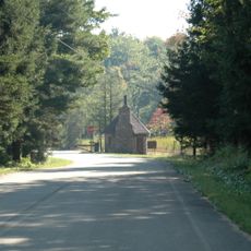
Quemahoning Reservoir is a large body of water in Somerset County covering about 900 acres and serves as both a recreation area and water source for the region. The site features tree-lined shores with easy access, a boat launch open day and night, camping areas for tents and RVs, simple wood cabins, and covered pavilions for gatherings.

The reservoir was built decades ago through the construction of a dam that transformed open land into the water body visible today. This major project became important for local water management and flood prevention while also creating a recreation destination for Somerset County residents.

The reservoir is an important gathering place for the local community, where residents and visitors come together on weekends for picnics and family time. Fishing is a deeply rooted activity here, with anglers sitting quietly on the shores waiting for bass and other fish, reflecting how the water has become central to outdoor recreation in Somerset County.

Visitors can easily reach the site by car on smooth roads leading to parking areas, from which the water is accessible on foot. The weather can change quickly throughout the year, so it is wise to prepare for shifting conditions and bring appropriate clothing and gear.

A memorable detail among anglers is that early morning hours offer the best chances for catching large bass, especially when using simple lures like poppers from a kayak. Water can become murky after heavy rains, changing conditions and forcing fishermen to adjust their techniques and choice of bait.

The community of curious travelers

AroundUs brings together thousands of curated places, local tips, and hidden gems, enriched daily by 60,000 contributors worldwide.

Start exploring
Location
GPS coordinates
40.16600,-78.96200
Latest update
February 7, 2026 11:40
Around this place
Flight 93 National Memorial
United States of America

Flight 93 National Memorial

13.1 km
Johnstown Inclined Plane
United States of America

Johnstown Inclined Plane

18 km
Inclined Plane Bridge
United States of America

Inclined Plane Bridge

18.1 km
Moxham Historic District
United States of America

Moxham Historic District

15.4 km
Downtown Johnstown Historic District
United States of America

Downtown Johnstown Historic District

18.1 km
Glessner Bridge
United States of America

Glessner Bridge

16 km
Somerset Historical Center
United States of America

Somerset Historical Center

14.7 km
Windber Historic District
United States of America

Windber Historic District

13.5 km
Trostletown Bridge
United States of America

Trostletown Bridge

7.9 km
Nathan's Department Store
United States of America

Nathan's Department Store

18.1 km
Matthew Hair Farm
United States of America

Matthew Hair Farm

3.9 km
Shaffer's Bridge
United States of America

Shaffer's Bridge

12.8 km
Alma Hall
United States of America

Alma Hall

18.1 km
Cairnbrook Historic District
United States of America

Cairnbrook Historic District

13.3 km
Boswell Historic District
United States of America

Boswell Historic District

5.6 km
Stoystown Historic District
United States of America

Stoystown Historic District

7.1 km
Shade Furnace Archaeological District
United States of America

Shade Furnace Archaeological District

11.5 km
Walter's Mill Bridge
United States of America

Walter's Mill Bridge

14.9 km
Westmont Historic District
United States of America

Westmont Historic District

17.5 km
Bridge in Jenner Township
United States of America

Bridge in Jenner Township

4.4 km
Tower of Voices
United States of America

Tower of Voices

11.9 km
Laurel Mountain State Park
United States of America

Laurel Mountain State Park

17.3 km
Wall of Names
United States of America

Wall of Names

13.5 km
Western Overlook Trail
United States of America

Western Overlook Trail

13.3 km
Pasquerilla Performing Arts Center
United States of America

Pasquerilla Performing Arts Center

15.8 km
Flight 93 National Memorial entrance sign
United States of America

Flight 93 National Memorial entrance sign

11.6 km
Flight 93 National Memorial Visitor Center
United States of America

Flight 93 National Memorial Visitor Center

13.1 km
Flight 93 National Memorial Visitor Shelter
United States of America

Flight 93 National Memorial Visitor Shelter

13.8 km
Show the full map
« Quemahoning Reservoir - body of water » is provided by Around Us (aroundus.com). Images and texts are derived from Wikimedia project under a Creative Commons license. You are allowed to copy, distribute, and modify copies of this page, under the conditions set by the license, as long as this note is clearly visible.

Discover hidden gems everywhere you go!

From secret cafés to breathtaking viewpoints, skip the crowded tourist spots and find places that match your style. Our app makes it easy with voice search, smart filtering, route optimization, and insider tips from travelers worldwide. Download now for the complete mobile experience.

Around Us App Screenshot

A unique approach to discovering new places

Le Figaro

All the places worth exploring

France Info

A tailor-made excursion in just a few clicks

20 Minutes

Around Us
Travel Guide & Maps
Download

Send to your phone

QR Code
1

Open the camera app on your mobile.

2

Point at the QR code with your camera. A notification will appear.

3

Tap the notification to open the link.