Quinebaug Woods

Log in to your account

AroundUs is a community-driven map of interesting places, built by curious explorers like you. It grows with every review, story, and photo you share.
Connect to save your favorite spots, contribute locations, and create personalized routes.
Continue with Google
Continue with Apple
Continue with X
Continue with Facebook
Continue with email
By continuing, you accept our Terms and Conditions and our Privacy Policy
Create an account
Add to collection
Map
Suggest a change
Share

Quinebaug Woods, Protected area in Massachusetts, United States.

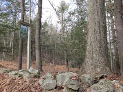
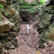
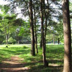
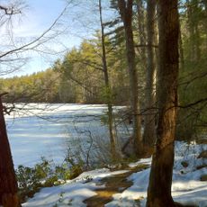
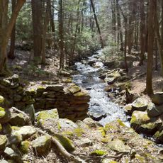
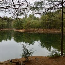
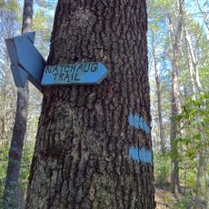
Quinebaug Woods is a protected forest area in Massachusetts with a network of trails crossing through varied landscape types. The paths wind through wooded sections and more open terrain, allowing visitors to experience different parts of the natural environment.

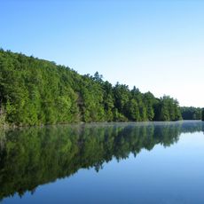
The area sits within the Quinebaug River watershed, which was inhabited by Native American communities before European arrival in the 1600s. Protection of these woodlands reflects efforts to preserve the region's ecological character and biodiversity.

The area serves as an educational resource for local schools and organizations, facilitating nature studies and environmental conservation programs.

Parking areas are located near trail entrances, with paths accessible for different fitness levels year-round. Weather and seasonal conditions affect path conditions, so checking before your visit helps with planning.

The protected area contains multiple indigenous plant species and provides habitat for local wildlife, including deer, rabbits, and numerous bird varieties.

GPS coordinates: 42.06960,-72.15600

Latest update: December 13, 2025 11:45

Photos
Around this place
Old Sturbridge Village
United States of America

Old Sturbridge Village

6.4 km
Tantiusques
United States of America

Tantiusques

2.5 km
Bigelow Hollow State Park
United States of America

Bigelow Hollow State Park

7.6 km
Brimfield State Forest
United States of America

Brimfield State Forest

7 km
Nipmuck State Forest
United States of America

Nipmuck State Forest

8.1 km
Natchaug State Forest
United States of America

Natchaug State Forest

8.1 km
Oliver Wight House
United States of America

Oliver Wight House

7.2 km
George B. and Ruth D. Wells House
United States of America

George B. and Ruth D. Wells House

8.8 km
Sturbridge Common Historic District
United States of America

Sturbridge Common Historic District

7.6 km
Union Green Historic District
United States of America

Union Green Historic District

8.9 km
Leadmine Wildlife Management Area
United States of America

Leadmine Wildlife Management Area

1.7 km
James Gleason Cottage
United States of America

James Gleason Cottage

9.3 km
Hamilton Mill-West Street Factory Housing
United States of America

Hamilton Mill-West Street Factory Housing

9.1 km
Judson–Litchfield House
United States of America

Judson–Litchfield House

8.8 km
Albert H. Wheeler House
United States of America

Albert H. Wheeler House

9.1 km
H. Morse House
United States of America

H. Morse House

9 km
Hamilton Mill Brick House
United States of America

Hamilton Mill Brick House

9.2 km
William Hodgson Two-Family House
United States of America

William Hodgson Two-Family House

9.3 km
Glover Street Historic District
United States of America

Glover Street Historic District

9 km
Dennison School House
United States of America

Dennison School House

7.9 km
Lorenzo R. Stone House
United States of America

Lorenzo R. Stone House

9.1 km
Simon Plimpton Farmhouse
United States of America

Simon Plimpton Farmhouse

8.4 km
Hamilton Millwright–Agent's House
United States of America

Hamilton Millwright–Agent's House

9.3 km
High-School Streets Historic District
United States of America

High-School Streets Historic District

9.1 km
Clarke-Glover Farmhouse
United States of America

Clarke-Glover Farmhouse

9.1 km
Natchaug Trail
United States of America

Natchaug Trail

8.1 km
Napoleon LaRochelle Two-Family House
United States of America

Napoleon LaRochelle Two-Family House

8.8 km
John M. Wells House
United States of America

John M. Wells House

9 km
Show the full map
Reviews

Visited this place? Tap the stars to rate it and share your experience / photos with the community! Try now! You can cancel it anytime.

« Quinebaug Woods - Protected area in Massachusetts, United States » is provided by Around Us (aroundus.com). Images and texts are derived from Wikimedia project under a Creative Commons license. You are allowed to copy, distribute, and modify copies of this page, under the conditions set by the license, as long as this note is clearly visible.

Discover hidden gems everywhere you go!

From secret cafés to breathtaking viewpoints, skip the crowded tourist spots and find places that match your style. Our app makes it easy with voice search, smart filtering, route optimization, and insider tips from travelers worldwide. Download now for the complete mobile experience.

Around Us App Screenshot

A unique approach to discovering new places

Le Figaro

All the places worth exploring

France Info

A tailor-made excursion in just a few clicks

20 Minutes