Enable Location

We need your location to show you interesting places around you

Discover nearby places

Find interesting locations and hidden gems around you

Precise directions

Get accurate directions and distances to places

Your location is never shared with other users. It's only used when you tap the location button.

Tantiusques

Log in to your account

Start exploring — it's free

Trusted by 64,614 travelers worldwide

Continue with Google
Continue with Apple
or

We will send you a code to connect

By continuing, you accept our Terms and Conditions and our Privacy Policy

Check your inbox

We've sent a pincode in your inbox. Please enter the code below.

Discussion Reviews 1 Photos
5.7k Popularity

Tantiusques, Archaeological site in Sturbridge, Massachusetts, US.

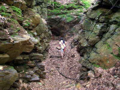
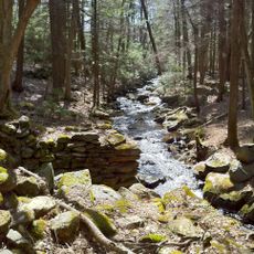
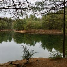
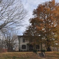
Tantiusques is a forested property in Sturbridge, Massachusetts, listed on the National Register of Historic Places as an archaeological site. It contains visible remains of mining operations, including mine cuts, ditches, and stone foundations left from colonial times onward.

In 1644, John Winthrop the Younger acquired the land from the Nipmuc and began developing it for lead, iron, and graphite extraction. Graphite mining continued well into the 19th century under Frederic Tudor and finally stopped around 1910.

The name Tantiusques comes from the Nipmuc language and describes a location between two low hills. Long before European settlers arrived, the Nipmuc gathered graphite here for use in ceremonial paints.

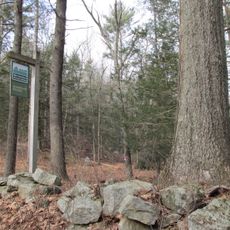
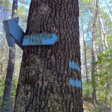
The site is managed by The Trustees of Reservations and can be reached on foot via marked trails through the woods. The ground is uneven in places due to old mine features, so sturdy footwear is a good idea.

Captain Joseph Dixon, who worked here under Tudor as a graphite processor, went on to help shape industrial graphite use across the country. The graphite extracted at this site was used for making crucibles and early pencils, linking this forested spot to everyday objects of the 19th century.

The community of curious travelers

AroundUs brings together thousands of curated places, local tips, and hidden gems, enriched daily by 60,000 contributors worldwide.

Start exploring
Location
GPS coordinates
42.05720,-72.13110
Latest update
March 3, 2026 10:08
Around this place
Old Sturbridge Village
United States of America

Old Sturbridge Village

6.3 km
Bigelow Hollow State Park
United States of America

Bigelow Hollow State Park

5.9 km
Quinebaug Woods
United States of America

Quinebaug Woods

2.5 km
Nipmuck State Forest
United States of America

Nipmuck State Forest

6.5 km
Natchaug State Forest
United States of America

Natchaug State Forest

6.5 km
Oliver Wight House
United States of America

Oliver Wight House

6.9 km
George B. and Ruth D. Wells House
United States of America

George B. and Ruth D. Wells House

6.7 km
Sturbridge Common Historic District
United States of America

Sturbridge Common Historic District

7 km
James Gleason Cottage
United States of America

James Gleason Cottage

7.6 km
Leadmine Wildlife Management Area
United States of America

Leadmine Wildlife Management Area

1.3 km
Hamilton Mill-West Street Factory Housing
United States of America

Hamilton Mill-West Street Factory Housing

7.4 km
Judson–Litchfield House
United States of America

Judson–Litchfield House

7 km
Albert H. Wheeler House
United States of America

Albert H. Wheeler House

7.3 km
Chamberlain-Bordeau House
United States of America

Chamberlain-Bordeau House

7.7 km
H. Morse House
United States of America

H. Morse House

7.2 km
Hamilton Mill Brick House
United States of America

Hamilton Mill Brick House

7.5 km
William Hodgson Two-Family House
United States of America

William Hodgson Two-Family House

7.5 km
Glover Street Historic District
United States of America

Glover Street Historic District

7.2 km
Dennison School House
United States of America

Dennison School House

5.8 km
Henry E. Durfee Farmhouse
United States of America

Henry E. Durfee Farmhouse

7.4 km
Lorenzo R. Stone House
United States of America

Lorenzo R. Stone House

7.3 km
Simon Plimpton Farmhouse
United States of America

Simon Plimpton Farmhouse

6.6 km
Hamilton Millwright–Agent's House
United States of America

Hamilton Millwright–Agent's House

7.6 km
High-School Streets Historic District
United States of America

High-School Streets Historic District

7.4 km
Clarke-Glover Farmhouse
United States of America

Clarke-Glover Farmhouse

7.4 km
Natchaug Trail
United States of America

Natchaug Trail

6.5 km
Napoleon LaRochelle Two-Family House
United States of America

Napoleon LaRochelle Two-Family House

7.2 km
John M. Wells House
United States of America

John M. Wells House

6.8 km
Show the full map
Reviews
Share your experience

No review yet

Discussions
Start a discussion...

No discussion yet

« Tantiusques - Archaeological site in Sturbridge, Massachusetts, US » is provided by Around Us (aroundus.com). Images and texts are derived from Wikimedia project under a Creative Commons license. You are allowed to copy, distribute, and modify copies of this page, under the conditions set by the license, as long as this note is clearly visible.

Discover hidden gems everywhere you go!

From secret cafés to breathtaking viewpoints, skip the crowded tourist spots and find places that match your style. Our app makes it easy with voice search, smart filtering, route optimization, and insider tips from travelers worldwide. Download now for the complete mobile experience.

Around Us App Screenshot

A unique approach to discovering new places

Le Figaro

All the places worth exploring

France Info

A tailor-made excursion in just a few clicks

20 Minutes

Around Us
Travel Guide & Maps
Download

Send to your phone

QR Code
1

Open the camera app on your mobile.

2

Point at the QR code with your camera. A notification will appear.

3

Tap the notification to open the link.