Chest opened
+${chestReward.xp} XP
Explorer
NOUVEAU ×${chestReward.collectible.quantity}
tapez pour fermer
Chest locked

Open chests in the app

Around Us is built for your phone — chests unlock when you walk, explore and capture nearby places.

Enable Location

We need your location to show you interesting places around you

Discover nearby places

Find interesting locations and hidden gems around you

Precise directions

Get accurate directions and distances to places

Your location is never shared with other users. It's only used when you tap the location button.

Log in to your account

Start exploring — it's free

Trusted by 72,878 travelers worldwide

Continue with Google
Continue with Apple
or

We will send you a code to connect

By continuing, you accept our Terms and Conditions and our Privacy Policy

Check your inbox

We've sent a pincode in your inbox. Please enter the code below.

Discussion Reviews Photo
1.3k Popularity

Ramey Mound, Archaeological mound in Bath County, Kentucky, United States.

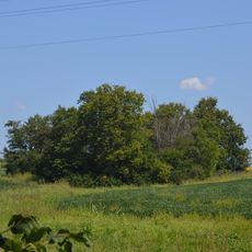
Ramey Mound is an archaeological site in Bath County featuring an earthen enclosure with four smaller mounds positioned around its perimeter. The entire area covers less than one acre and displays the typical construction methods of prehistoric cultures in this region.

The site originates from the prehistoric Adena culture that flourished many centuries before modern times. Its first recorded documentation came in 1807, when observers noted an earthwork standing about 3 feet (1 meter) tall.

The site reveals how Native American peoples arranged earthen structures and incorporated a natural stream into the ceremonial landscape. This careful placement shows the importance they placed on ritual spaces and respect for nature.

The site sits approximately half a mile north of Sharpsburg and is accessible by road. Since you are visiting an exposed archaeological area, wear sturdy shoes and allow time to examine the earthen structures carefully.

The site took its name from Emma Ramey, who owned the land in the 1930s. It stands as Bath County's only property listed on the National Register of Historic Places.

The community of curious travelers

AroundUs brings together thousands of curated places, local tips, and hidden gems, enriched daily by 60,000 contributors worldwide.

Start exploring
Location
GPS coordinates
38.14889,-83.90361
Latest update
December 14, 2025 18:11
Around this place
Cane Ridge
United States of America

Cane Ridge

22.3 km
United States of America

Pilot Knob State Nature Preserve

26.6 km
Goshen Primitive Baptist Church
United States of America

Goshen Primitive Baptist Church

20.6 km
The Grange
United States of America

The Grange

28.2 km
Bluegrass Heritage Museum
United States of America

Bluegrass Heritage Museum

29.9 km
Confederate Monument of Mt. Sterling
United States of America

Confederate Monument of Mt. Sterling

10.6 km
Mound Hill Archaeological Site
United States of America

Mound Hill Archaeological Site

21 km
Forest Retreat
United States of America

Forest Retreat

24.8 km
Clark Mansion
United States of America

Clark Mansion

30.6 km
Clark County Court House
United States of America

Clark County Court House

29.7 km
Ringos Mill Covered Bridge
United States of America

Ringos Mill Covered Bridge

28.9 km
KEAS Tabernacle Christian Methodist Episcopal Church
United States of America

KEAS Tabernacle Christian Methodist Episcopal Church

10.8 km
Hillsboro Covered Bridge
United States of America

Hillsboro Covered Bridge

24.9 km
Enoch Smith House
United States of America

Enoch Smith House

11.8 km
William Hickman House
United States of America

William Hickman House

29.9 km
Confederate Monument in Owingsville
United States of America

Confederate Monument in Owingsville

12.6 km
Methodist Episcopal Church South
United States of America

Methodist Episcopal Church South

10.5 km
Church of the Ascension
United States of America

Church of the Ascension

10.8 km
Walker Buckner House
United States of America

Walker Buckner House

20.8 km
Corinth Christian Methodist Episcopal Church
United States of America

Corinth Christian Methodist Episcopal Church

21.6 km
Raccoon John Smith House
United States of America

Raccoon John Smith House

11.8 km
Thomas Deye Owings House
United States of America

Thomas Deye Owings House

12.1 km
Snow Hill
United States of America

Snow Hill

14.7 km
Stone Barn on Brushy Creek
United States of America

Stone Barn on Brushy Creek

24.8 km
J.J. Nesbitt House
United States of America

J.J. Nesbitt House

11.9 km
Owingsville Commercial District and Courthouse Square
United States of America

Owingsville Commercial District and Courthouse Square

12.3 km
William Mathers House
United States of America

William Mathers House

21.9 km
Erasmus Riggs House
United States of America

Erasmus Riggs House

18.5 km
Show the full map
Reviews
Share your experience

No review yet

Discussions
Start a discussion...

No discussion yet

« Ramey Mound - Archaeological mound in Bath County, Kentucky, United States » is provided by Around Us (aroundus.com). Images and texts are derived from Wikimedia project under a Creative Commons license. You are allowed to copy, distribute, and modify copies of this page, under the conditions set by the license, as long as this note is clearly visible.

Discover hidden gems everywhere you go!

From secret cafés to breathtaking viewpoints, skip the crowded tourist spots and find places that match your style. Our app makes it easy with voice search, smart filtering, route optimization, and insider tips from travelers worldwide. Download now for the complete mobile experience.

Around Us App Screenshot

A unique approach to discovering new places

Le Figaro

All the places worth exploring

France Info

A tailor-made excursion in just a few clicks

20 Minutes

Around Us
Travel Guide & Maps
Download

Send to your phone

QR Code
1

Open the camera app on your mobile.

2

Point at the QR code with your camera. A notification will appear.

3

Tap the notification to open the link.