Enable Location

We need your location to show you interesting places around you

Discover nearby places

Find interesting locations and hidden gems around you

Precise directions

Get accurate directions and distances to places

Your location is never shared with other users. It's only used when you tap the location button.

Log in to your account

Start exploring — it's free

Trusted by 65,436 travelers worldwide

Continue with Google
Continue with Apple
or

We will send you a code to connect

By continuing, you accept our Terms and Conditions and our Privacy Policy

Check your inbox

We've sent a pincode in your inbox. Please enter the code below.

Waconda Lake
Discussion Reviews Photo
6.3k Popularity

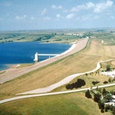
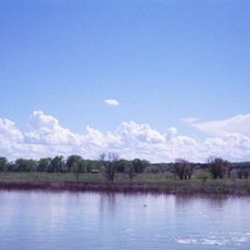
Waconda Lake, reservoir in Kansas, named for the inundated spring

Waconda Lake is a reservoir in north-central Kansas that forms the centerpiece of Glen Elder State Park. It sits on the Solomon River and is surrounded by campgrounds, a marina, rental cabins, and trails that run through the adjacent wildlife area.

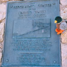
The lake was formed in the 1960s when a dam was built across the Solomon River to reduce flooding downstream. The rising water covered Waconda Springs, a mineral spring that had drawn Native American peoples for centuries and later became a destination for people seeking health treatments.

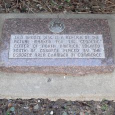
The name Waconda comes from Native American peoples who treated the spring here as a sacred place. A replica of that spring stands in the park today, giving visitors a sense of what the site once looked like.

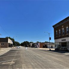
The park sits east of Cawker City and is easy to reach by car. Summer is the best time for water activities, but winter draws visitors who come to watch bald eagles near the water.

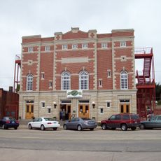
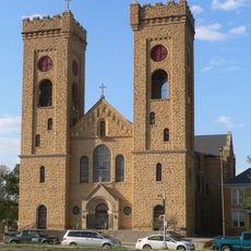
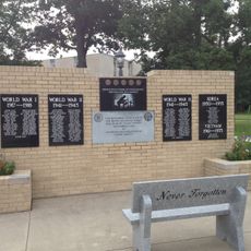
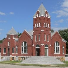
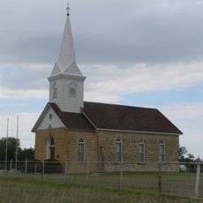
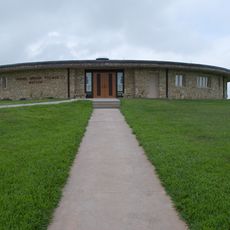
The park is home to a small heritage village where an old church built by settlers in 1878 was moved and reassembled after the area flooded. Walking through this village gives a rare sense of what frontier life along the Solomon River once looked like.

The community of curious travelers

AroundUs brings together thousands of curated places, local tips, and hidden gems, enriched daily by 60,000 contributors worldwide.

Start exploring
Location
GPS coordinates
39.49080,-98.37280
Latest update
March 3, 2026 10:09
Around this place
Geographic center of the contiguous United States
United States of America

Geographic center of the contiguous United States

41.5 km
Wilson Lake
United States of America

Wilson Lake

63.3 km
Meades Ranch Triangulation Station
United States of America

Meades Ranch Triangulation Station

33.1 km
Nazareth Convent and Academy
United States of America

Nazareth Convent and Academy

61.7 km
Brown Grand Theatre
United States of America

Brown Grand Theatre

61.5 km
St. John the Baptist Catholic Church
United States of America

St. John the Baptist Catholic Church

23.5 km
Pott's Ford Bridge
United States of America

Pott's Ford Bridge

47.3 km
Jamestown (Kansas) Wildlife Area
United States of America

Jamestown (Kansas) Wildlife Area

44.6 km
Bankers Loan and Trust Company Building
United States of America

Bankers Loan and Trust Company Building

62 km
Jewell County Courthouse
United States of America

Jewell County Courthouse

35.9 km
Cloud County Courthouse
United States of America

Cloud County Courthouse

61.8 km
Paradise Water Tower
United States of America

Paradise Water Tower

62.5 km
Cloud County Veterans Memorial
United States of America

Cloud County Veterans Memorial

61.8 km
Burr Oak United Methodist Church
United States of America

Burr Oak United Methodist Church

42.5 km
Mitchell County Courthouse
United States of America

Mitchell County Courthouse

23 km
Glasco Downtown Historic District
United States of America

Glasco Downtown Historic District

48.1 km
Danske Evangelist Lutheran Kirke
United States of America

Danske Evangelist Lutheran Kirke

45.4 km
First National Bank Building
United States of America

First National Bank Building

47.7 km
Downs Carnegie Library
United States of America

Downs Carnegie Library

14.8 km
Old Cawker City Library
United States of America

Old Cawker City Library

5.6 km
Lincoln County Courthouse
United States of America

Lincoln County Courthouse

53.8 km
Osborne Public Carnegie Library
United States of America

Osborne Public Carnegie Library

28.6 km
Cummins Block Building
United States of America

Cummins Block Building

53.8 km
Samuel P. Dinsmoor's Garden of Eden
United States of America

Samuel P. Dinsmoor's Garden of Eden

50.2 km
Pawnee Indian Museum State Historic Site
United States of America

Pawnee Indian Museum State Historic Site

63.9 km
Salt Creek Bridge
United States of America

Salt Creek Bridge

42.3 km
O.W. Francis House
United States of America

O.W. Francis House

43.8 km
Bullfoot Creek Bridge
United States of America

Bullfoot Creek Bridge

58.4 km
Show the full map
Reviews
Share your experience

No review yet

Discussions
Start a discussion...

No discussion yet

« Waconda Lake - reservoir in Kansas, named for the inundated spring » is provided by Around Us (aroundus.com). Images and texts are derived from Wikimedia project under a Creative Commons license. You are allowed to copy, distribute, and modify copies of this page, under the conditions set by the license, as long as this note is clearly visible.

Discover hidden gems everywhere you go!

From secret cafés to breathtaking viewpoints, skip the crowded tourist spots and find places that match your style. Our app makes it easy with voice search, smart filtering, route optimization, and insider tips from travelers worldwide. Download now for the complete mobile experience.

Around Us App Screenshot

A unique approach to discovering new places

Le Figaro

All the places worth exploring

France Info

A tailor-made excursion in just a few clicks

20 Minutes

Around Us
Travel Guide & Maps
Download

Send to your phone

QR Code
1

Open the camera app on your mobile.

2

Point at the QR code with your camera. A notification will appear.

3

Tap the notification to open the link.