Salt Pond Mountain

Log in to your account

AroundUs is a community-driven map of interesting places, built by curious explorers like you. It grows with every review, story, and photo you share.
Connect to save your favorite spots, contribute locations, and create personalized routes.
Continue with Google
Continue with Apple
Continue with X
Continue with Facebook
Continue with email
By continuing, you accept our Terms and Conditions and our Privacy Policy
Create an account
Add to collection
Map
Suggest a change
Share

Salt Pond Mountain, Mountain summit in Giles County, Virginia, United States.

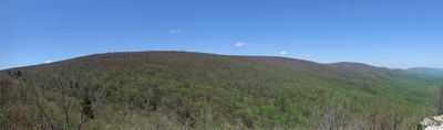
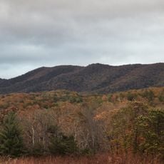
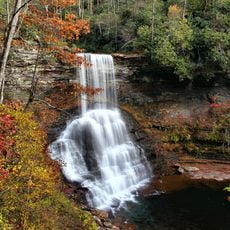
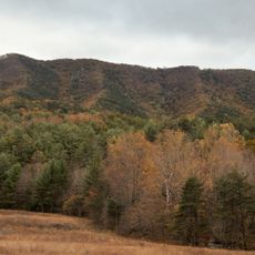
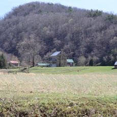
Salt Pond Mountain is a summit in the Appalachian range located in southwestern Virginia, rising approximately 1,330 meters (4,360 feet) above sea level. The peak stretches roughly 7 miles from southwest to northeast with forested slopes and open ridge areas along its spine.

The mountain formed millions of years ago during the Appalachian orogeny when tectonic forces shaped the entire range. Erosion and weathering over vast time spans created the ridges and valleys that define the landscape today.

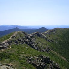
The Appalachian Trail crossing through the northeast section of Salt Pond Mountain connects hikers to generations of outdoor traditions.

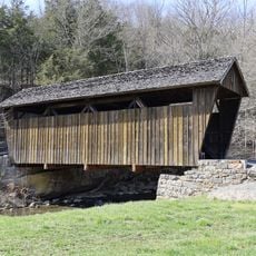
Several trails climb the mountain with the most popular ones starting near Mountain Lake and nearby trailheads. Bring sturdy hiking boots and check weather conditions before heading out since mountain conditions can change quickly at higher elevations.

The mountain sits on the Eastern Continental Divide which determines whether water drains toward the Atlantic Ocean or the Gulf of Mexico. This geological boundary means rain falling here splits between two different ocean destinations.

Location: Virginia

Part of: Ridge-and-Valley Appalachians

GPS coordinates: 37.40846,-80.49450

Latest update: December 14, 2025 11:41

Photos
Around this place
Appalachian Trail
United States of America

Appalachian Trail

11.9 km
Rehoboth Church
United States of America

Rehoboth Church

20.2 km
Brush Mountain Wilderness
United States of America

Brush Mountain Wilderness

18.9 km
Solitude
United States of America

Solitude

21.2 km
Cascades
United States of America

Cascades

10 km
Indian Creek Covered Bridge
United States of America

Indian Creek Covered Bridge

17 km
Brush Mountain East Wilderness
United States of America

Brush Mountain East Wilderness

17.8 km
United States of America

Sinking Creek Valley Cluster

15.2 km
Salt Sulphur Springs Historic District
United States of America

Salt Sulphur Springs Historic District

19.2 km
Laurel Creek Covered Bridge
United States of America

Laurel Creek Covered Bridge

20.6 km
Union Historic District
United States of America

Union Historic District

20.8 km
Odd Fellows Hall
United States of America

Odd Fellows Hall

20.3 km
Doe Creek Farm
United States of America

Doe Creek Farm

11.6 km
Blacksburg Historic District
United States of America

Blacksburg Historic District

21 km
Wallace Estill, Sr., House
United States of America

Wallace Estill, Sr., House

17.7 km
William Gaston Caperton, Jr., House
United States of America

William Gaston Caperton, Jr., House

20.6 km
Huffman House
United States of America

Huffman House

10.7 km
McNeer House
United States of America

McNeer House

19.5 km
Brig. Gen. John Echols House
United States of America

Brig. Gen. John Echols House

20.9 km
Joseph McDonald Farm
United States of America

Joseph McDonald Farm

20.3 km
Newport Historic District (Newport, Virginia)
United States of America

Newport Historic District (Newport, Virginia)

12.8 km
Keister House
United States of America

Keister House

19.9 km
Greater Newport Rural Historic District
United States of America

Greater Newport Rural Historic District

11.6 km
Michael Kinzer House
United States of America

Michael Kinzer House

19.7 km
Walnut Spring
United States of America

Walnut Spring

20.1 km
Lyric Theatre
United States of America

Lyric Theatre

21 km
Hanging Rock Raptor Observatory
United States of America

Hanging Rock Raptor Observatory

11.3 km
Link Farm Covered Bridge
United States of America

Link Farm Covered Bridge

11 km
Show the full map
Reviews

Visited this place? Tap the stars to rate it and share your experience / photos with the community! Try now! You can cancel it anytime.

« Salt Pond Mountain - Mountain summit in Giles County, Virginia, United States » is provided by Around Us (aroundus.com). Images and texts are derived from Wikimedia project under a Creative Commons license. You are allowed to copy, distribute, and modify copies of this page, under the conditions set by the license, as long as this note is clearly visible.

Discover hidden gems everywhere you go!

From secret cafés to breathtaking viewpoints, skip the crowded tourist spots and find places that match your style. Our app makes it easy with voice search, smart filtering, route optimization, and insider tips from travelers worldwide. Download now for the complete mobile experience.

Around Us App Screenshot

A unique approach to discovering new places

Le Figaro

All the places worth exploring

France Info

A tailor-made excursion in just a few clicks

20 Minutes