Enable Location

We need your location to show you interesting places around you

Discover nearby places

Find interesting locations and hidden gems around you

Precise directions

Get accurate directions and distances to places

Your location is never shared with other users. It's only used when you tap the location button.

Cascades

Log in to your account

Start exploring — it's free

Trusted by 62,003 travelers worldwide

Continue with Google
Continue with Apple
or

We will send you a code to connect

By continuing, you accept our Terms and Conditions and our Privacy Policy

Check your inbox

We've sent a pincode in your inbox. Please enter the code below.

Cascades

Cascades, Protected mountain area in Washington, US

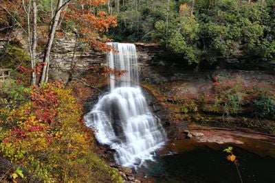
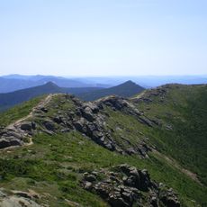
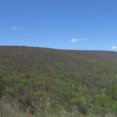
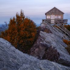
The Cascades is a protected mountain range with over 700 glaciers that wind through steep peaks and valleys, serving as natural water reservoirs for the region. The landscape shifts dramatically between sheer rock faces, icy summits, and forested valleys.

The range was explored and named by British navigator George Vancouver in 1792, who documented numerous peaks throughout the mountains. These early explorations laid the groundwork for scientific understanding of the landscape.

The mountain range carries names given by Native American tribes who hunted and gathered here for centuries, and you can still see their legacy in place names across the territory.

The western slopes receive far more rain than the eastern side, which stays considerably drier due to the mountain's rain shadow effect. Plan for changeable weather conditions and check trail accessibility before visiting, as conditions vary widely by location.

Large predators like wolves, grizzly bears, and mountain lions have returned to live naturally in this region. Visitors who explore carefully may spot signs of these animals moving through the mountains.

The community of curious travelers

AroundUs brings together thousands of curated places, local tips, and hidden gems, enriched daily by 60,000 contributors worldwide.

Start exploring
GPS coordinates
37.36806,-80.59528
Latest update
December 14, 2025 12:25
Around this place
Appalachian Trail
United States of America

Appalachian Trail

19 km
Solitude
United States of America

Solitude

21.7 km
Salt Pond Mountain
United States of America

Salt Pond Mountain

10 km
Indian Creek Covered Bridge
United States of America

Indian Creek Covered Bridge

20 km
Kentland Farm Historic and Archeological District
United States of America

Kentland Farm Historic and Archeological District

19.9 km
Laurel Creek Covered Bridge
United States of America

Laurel Creek Covered Bridge

21.7 km
Cook's Mill
United States of America

Cook's Mill

21.3 km
Andrew Johnston House
United States of America

Andrew Johnston House

13.2 km
Odd Fellows Hall
United States of America

Odd Fellows Hall

21.3 km
Doe Creek Farm
United States of America

Doe Creek Farm

4.8 km
Giles County Courthouse
United States of America

Giles County Courthouse

13.2 km
Wallace Estill, Sr., House
United States of America

Wallace Estill, Sr., House

17.8 km
Evans House No. 2
United States of America

Evans House No. 2

20.1 km
Narrows Commercial Historic District
United States of America

Narrows Commercial Historic District

19.6 km
Huffman House
United States of America

Huffman House

17.3 km
Belle-Hampton
United States of America

Belle-Hampton

21.8 km
Prices Fork Historic District
United States of America

Prices Fork Historic District

19.9 km
John Hoge House
United States of America

John Hoge House

21.3 km
Joseph McDonald Farm
United States of America

Joseph McDonald Farm

19.1 km
Newport Historic District (Newport, Virginia)
United States of America

Newport Historic District (Newport, Virginia)

12.1 km
Keister House
United States of America

Keister House

21.2 km
Greater Newport Rural Historic District
United States of America

Greater Newport Rural Historic District

9 km
Linkous-Kipps House
United States of America

Linkous-Kipps House

21.6 km
Michael Kinzer House
United States of America

Michael Kinzer House

19.2 km
Walnut Spring
United States of America

Walnut Spring

18.2 km
Adam Wall House
United States of America

Adam Wall House

21.1 km
Hanging Rock Raptor Observatory
United States of America

Hanging Rock Raptor Observatory

19.7 km
Link Farm Covered Bridge
United States of America

Link Farm Covered Bridge

9.4 km
Show the full map
« Cascades - Protected mountain area in Washington, US » is provided by Around Us (aroundus.com). Images and texts are derived from Wikimedia project under a Creative Commons license. You are allowed to copy, distribute, and modify copies of this page, under the conditions set by the license, as long as this note is clearly visible.

Discover hidden gems everywhere you go!

From secret cafés to breathtaking viewpoints, skip the crowded tourist spots and find places that match your style. Our app makes it easy with voice search, smart filtering, route optimization, and insider tips from travelers worldwide. Download now for the complete mobile experience.

Around Us App Screenshot

A unique approach to discovering new places

Le Figaro

All the places worth exploring

France Info

A tailor-made excursion in just a few clicks

20 Minutes

Around Us
Travel Guide & Maps
Download

Send to your phone

QR Code
1

Open the camera app on your mobile.

2

Point at the QR code with your camera. A notification will appear.

3

Tap the notification to open the link.