Chest opened
+${chestReward.xp} XP
Explorer
NOUVEAU ×${chestReward.collectible.quantity}
tapez pour fermer
Chest locked

Open chests in the app

Around Us is built for your phone — chests unlock when you walk, explore and capture nearby places.

Enable Location

We need your location to show you interesting places around you

Discover nearby places

Find interesting locations and hidden gems around you

Precise directions

Get accurate directions and distances to places

Your location is never shared with other users. It's only used when you tap the location button.

Log in to your account

Start exploring — it's free

Trusted by 72,878 travelers worldwide

Continue with Google
Continue with Apple
or

We will send you a code to connect

By continuing, you accept our Terms and Conditions and our Privacy Policy

Check your inbox

We've sent a pincode in your inbox. Please enter the code below.

Discussion Reviews Photo
1.5k Popularity

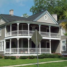
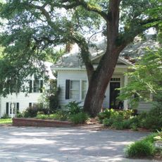
Socastee Historic District, Historic district in Socastee, South Carolina, US.

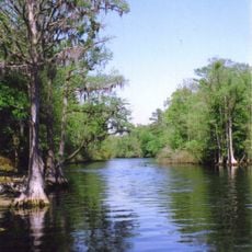
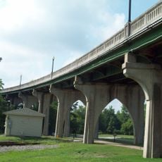
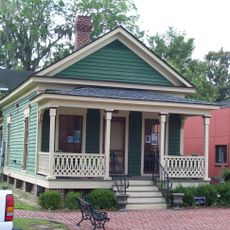
The Socastee Historic District is a protected preservation area along the Intracoastal Waterway containing three historic buildings, a pecan grove, and a metal swing bridge. The site spans about 4 acres and combines these varied elements into a single coherent historic ensemble.

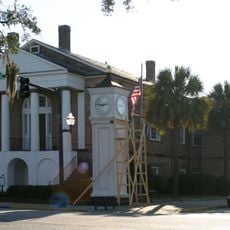
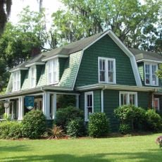
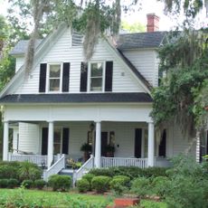
The place traces its roots to Samuel S. Sarvis, who built his residence in 1881 and served as postmaster in 1896. The area developed into a small settlement that gained an important infrastructure improvement with the bridge construction in 1936.

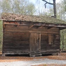
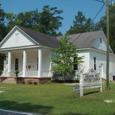
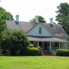
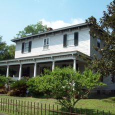
The Thomas B. Cooper Store served as the community's gathering hub starting in 1905 and shaped local social life before closing in 1932. Stores like this functioned as natural meeting places where neighbors exchanged news and built connections.

The area is easily accessible via the metal bridge, which continues to serve as the main crossing over the waterway and allows daily passage. Visitors should allow time to explore the buildings and landscape, as the site invites a leisurely pace of discovery.

The metal bridge was operated by a gatekeeper who lived in a house built directly atop the bridge structure. This unusual living arrangement shows how closely infrastructure was woven into the daily lives of early residents.

The community of curious travelers

AroundUs brings together thousands of curated places, local tips, and hidden gems, enriched daily by 60,000 contributors worldwide.

Start exploring
Location
GPS coordinates
33.98639,-78.99917
Latest update
December 14, 2025 14:44
Around this place
Brooks Stadium
United States of America

Brooks Stadium

21.6 km
Myrtle Beach Speedway
United States of America

Myrtle Beach Speedway

27.1 km
Pirates Voyage Dinner & Show

Pirates Voyage Dinner & Show

30.3 km
Lumber River
United States of America

Lumber River

70.6 km
HTC Center
United States of America

HTC Center

20.9 km
Carolina Opry
United States of America

Carolina Opry

30.5 km
Old Horry County Courthouse
United States of America

Old Horry County Courthouse

17.4 km
Slave Houses, Gregg Plantation
United States of America

Slave Houses, Gregg Plantation

26.8 km
Rankin-Harwell House
United States of America

Rankin-Harwell House

30.5 km
Waccamaw River Memorial Bridge
United States of America

Waccamaw River Memorial Bridge

17.6 km
Galivants Ferry Historic District
United States of America

Galivants Ferry Historic District

23.8 km
Conway Downtown Historic District
United States of America

Conway Downtown Historic District

17.3 km
United States Post Office
United States of America

United States Post Office

17.2 km
Wheels of Yesteryear
United States of America

Wheels of Yesteryear

27.1 km
Kingston Presbyterian Church
United States of America

Kingston Presbyterian Church

17.3 km
Burroughs School
United States of America

Burroughs School

16.8 km
Paul Quattlebaum House
United States of America

Paul Quattlebaum House

17.4 km
John P. Derham House
United States of America

John P. Derham House

15.5 km
H.W. Ambrose House
United States of America

H.W. Ambrose House

16.5 km
Dillard Barn
United States of America

Dillard Barn

29.7 km
C.P. Quattlebaum Office
United States of America

C.P. Quattlebaum Office

17.4 km
Beaty-Little House
United States of America

Beaty-Little House

17.1 km
Arthur M. Burroughs House
United States of America

Arthur M. Burroughs House

16.8 km
Buck's Upper Mill Farm
United States of America

Buck's Upper Mill Farm

28.2 km
C.P. Quattlebaum House
United States of America

C.P. Quattlebaum House

17.4 km
Conway Residential Historic District
United States of America

Conway Residential Historic District

17.1 km
Beaty-Spivey House
United States of America

Beaty-Spivey House

17.1 km
J.W. Holliday Jr. House
United States of America

J.W. Holliday Jr. House

17.1 km
Show the full map
Reviews
Share your experience

No review yet

Discussions
Start a discussion...

No discussion yet

« Socastee Historic District - Historic district in Socastee, South Carolina, US » is provided by Around Us (aroundus.com). Images and texts are derived from Wikimedia project under a Creative Commons license. You are allowed to copy, distribute, and modify copies of this page, under the conditions set by the license, as long as this note is clearly visible.

Discover hidden gems everywhere you go!

From secret cafés to breathtaking viewpoints, skip the crowded tourist spots and find places that match your style. Our app makes it easy with voice search, smart filtering, route optimization, and insider tips from travelers worldwide. Download now for the complete mobile experience.

Around Us App Screenshot

A unique approach to discovering new places

Le Figaro

All the places worth exploring

France Info

A tailor-made excursion in just a few clicks

20 Minutes

Around Us
Travel Guide & Maps
Download

Send to your phone

QR Code
1

Open the camera app on your mobile.

2

Point at the QR code with your camera. A notification will appear.

3

Tap the notification to open the link.