Enable Location

We need your location to show you interesting places around you

Discover nearby places

Find interesting locations and hidden gems around you

Precise directions

Get accurate directions and distances to places

Your location is never shared with other users. It's only used when you tap the location button.

South Hadley Canal

Log in to your account

Start exploring — it's free

Trusted by 61,904 travelers worldwide

Continue with Google
Continue with Apple
or

We will send you a code to connect

By continuing, you accept our Terms and Conditions and our Privacy Policy

Check your inbox

We've sent a pincode in your inbox. Please enter the code below.

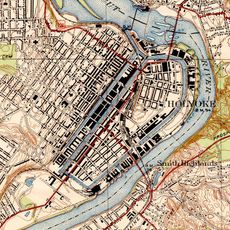
South Hadley Canal, Industrial waterway in South Hadley, Massachusetts.

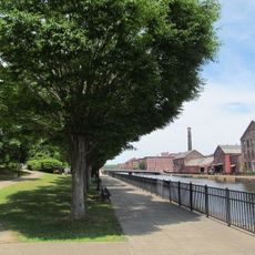
South Hadley Canal is a historic waterway running along the Connecticut River in Massachusetts, built with stone walls and water control structures. The system includes an inclined stone ramp where boats were lifted using waterwheels and a cart mechanism.

The canal was built in 1795 to bypass a 53-foot drop at Great Falls, making it the first navigable waterway system in the United States. This construction marked an early turning point in American engineering for overcoming natural river obstacles.

The waterway became central to how people in the region moved goods and connected communities separated by the river's natural barriers. It shows how residents reshaped their landscape to work with the river rather than against it.

The area is accessible through Hadley Falls Canal Park, which has walking paths and outdoor spaces for exploration. Wear sturdy shoes since the paths along the river can be uneven, and keep a safe distance from the water and stone structures.

The system used two large waterwheels to pull boats up a solid stone ramp, a solution that was earlier and simpler than the lock gates used on other American canals. This approach solved the problem of moving vessels across a steep drop without the complexity of traditional locks.

The community of curious travelers

AroundUs brings together thousands of curated places, local tips, and hidden gems, enriched daily by 60,000 contributors worldwide.

Start exploring
Location
GPS coordinates
42.22080,-72.60920
Latest update
December 12, 2025 12:00
Around this place
Mount Tom
United States of America

Mount Tom

4 km
Dinosaur Footprints Reservation
United States of America

Dinosaur Footprints Reservation

2.6 km
Holyoke Canal System
United States of America

Holyoke Canal System

1.5 km
Mackenzie Stadium
United States of America

Mackenzie Stadium

2.5 km
Holyoke Heritage State Park
United States of America

Holyoke Heritage State Park

1.7 km
Wistariahurst
United States of America

Wistariahurst

1.9 km
Victory Theatre
United States of America

Victory Theatre

1.5 km
Holyoke City Hall
United States of America

Holyoke City Hall

1.6 km
United States of America

Holyoke Merry-Go-Round

1.6 km
Mount Holyoke College Art Museum
United States of America

Mount Holyoke College Art Museum

5 km
Willimansett Bridge
United States of America

Willimansett Bridge

2.9 km
Vietnam Memorial Bridge
United States of America

Vietnam Memorial Bridge

1.5 km
Mount Holyoke College Botanic Garden
United States of America

Mount Holyoke College Botanic Garden

5.1 km
United States of America

Churchill, Holyoke, Massachusetts

2.3 km
Joseph Allen Skinner Museum
United States of America

Joseph Allen Skinner Museum

1.9 km
Clovis Robert Block
United States of America

Clovis Robert Block

2.3 km
Woodbridge Street Historic District
United States of America

Woodbridge Street Historic District

5.7 km
Caledonia Building
United States of America

Caledonia Building

1.5 km
Veterans Park (Holyoke, Massachusetts)
United States of America

Veterans Park (Holyoke, Massachusetts)

1.4 km
Carreau Block
United States of America

Carreau Block

4 km
Hadley Falls Company Housing District
United States of America

Hadley Falls Company Housing District

2.5 km
Friedrich Block
United States of America

Friedrich Block

2.6 km
Chapin School
United States of America

Chapin School

4 km
United States Post Office–South Hadley Main
United States of America

United States Post Office–South Hadley Main

5.2 km
United States Post Office–Holyoke Main
United States of America

United States Post Office–Holyoke Main

1.4 km
Mount Tom State Reservation
United States of America

Mount Tom State Reservation

5.5 km
North High Street Historic District
United States of America

North High Street Historic District

1.4 km
Joseph E. Muller Bridge
United States of America

Joseph E. Muller Bridge

536 m
Show the full map
« South Hadley Canal - Industrial waterway in South Hadley, Massachusetts » is provided by Around Us (aroundus.com). Images and texts are derived from Wikimedia project under a Creative Commons license. You are allowed to copy, distribute, and modify copies of this page, under the conditions set by the license, as long as this note is clearly visible.

Discover hidden gems everywhere you go!

From secret cafés to breathtaking viewpoints, skip the crowded tourist spots and find places that match your style. Our app makes it easy with voice search, smart filtering, route optimization, and insider tips from travelers worldwide. Download now for the complete mobile experience.

Around Us App Screenshot

A unique approach to discovering new places

Le Figaro

All the places worth exploring

France Info

A tailor-made excursion in just a few clicks

20 Minutes

Around Us
Travel Guide & Maps
Download

Send to your phone

QR Code
1

Open the camera app on your mobile.

2

Point at the QR code with your camera. A notification will appear.

3

Tap the notification to open the link.