Mount Tom, Mountain summit in Massachusetts, United States
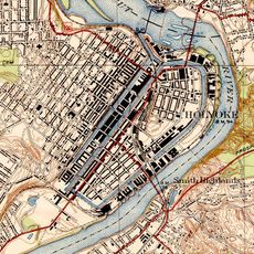
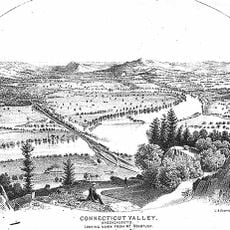
Mount Tom is a mountain summit near Holyoke and Easthampton that rises about 1,200 feet above the Connecticut River Valley. The peak features steep cliffs and rocky slopes that are visible from many points in the surrounding area.
The peak takes its name from Rowland Thomas, a surveyor who mapped the Springfield area in the 1660s. The geological structure dates back to the Triassic Period and reflects a long history of the region.
The mountain appears on the official seals of both Easthampton and Holyoke, showing how important this landmark is to local communities. You can see these representations around town and understand how the peak shapes people's sense of place here.
The Metacomet-Monadnock Trail crosses the summit and gives hikers, runners, and photographers access points throughout the year. The route is well-established and easy to navigate, making it simple to find where to start and when to visit.
The basalt formations here date to the Triassic Period and create different microclimates across the slopes. These varying conditions support rare plant species that grow nowhere else in the surrounding area.
The community of curious travelers
AroundUs brings together thousands of curated places, local tips, and hidden gems, enriched daily by 60,000 contributors worldwide.