·

Enable Location

We need your location to show you interesting places around you

Discover nearby places

Find interesting locations and hidden gems around you

Precise directions

Get accurate directions and distances to places

Your location is never shared with other users. It's only used when you tap the location button.

Log in to your account

Start exploring — it's free

Trusted by 62,638 travelers worldwide

Continue with Google
Continue with Apple
or

We will send you a code to connect

By continuing, you accept our Terms and Conditions and our Privacy Policy

Check your inbox

We've sent a pincode in your inbox. Please enter the code below.

Starve Hollow State Recreation Area

Starve Hollow State Recreation Area, Protected recreation area in southern Indiana, United States.

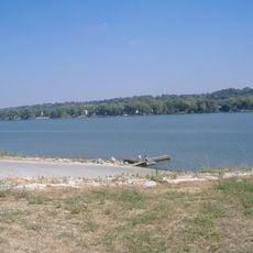
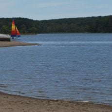
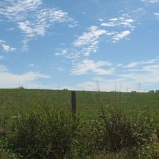
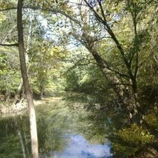
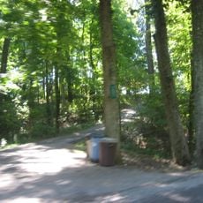
Starve Hollow is a recreation area in southern Indiana covering 280 acres with a 145-acre lake at its center. The site provides campgrounds, boat rentals, fishing docks, and several hiking trails that wind through forested and open terrain.

The site grew out of the larger Jackson-Washington State Forest and became a dedicated space for outdoor recreation and nature education in Indiana. This shift transformed the land into a place designed specifically for public recreation and environmental learning.

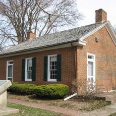
The Education Center runs forestry classes and nature programs from May through October, where visitors learn about woodland management and how people work to protect the land.

The area is accessible year-round, though summer offers the best conditions for water activities and boating. Visitors should check local water conditions before swimming or engaging in water sports, as safety measures are in place.

The lake contains blue-green algae throughout the year, which visitors need to consider when planning water activities. This naturally occurring algae shapes how people approach swimming and other water sports at this location.

The community of curious travelers

AroundUs brings together thousands of curated places, local tips, and hidden gems, enriched daily by 60,000 contributors worldwide.

Start exploring
Location
GPS coordinates
38.56670,-85.79580
Latest update
December 12, 2025 07:55
Around this place
Rose Island
United States of America

Rose Island

21.8 km
United States of America

Indiana Army Ammunition Plant

22.6 km
Pigeon Roost State Historic Site
United States of America

Pigeon Roost State Historic Site

5.9 km
Charlestown State Park
United States of America

Charlestown State Park

21 km
Deam Lake State Recreation Area
United States of America

Deam Lake State Recreation Area

12.2 km
United States of America

New Albany Shale

17 km
John Work House and Mill Site
United States of America

John Work House and Mill Site

17.4 km
Prather Site
United States of America

Prather Site

22.8 km
New Albany National Cemetery
United States of America

New Albany National Cemetery

29.7 km
John Hay Center
United States of America

John Hay Center

26.6 km
Lapping Park
United States of America

Lapping Park

25.4 km
Washington County Courthouse
United States of America

Washington County Courthouse

26.9 km
First Baptist Church
United States of America

First Baptist Church

26.8 km
Woodbine
United States of America

Woodbine

30.9 km
Simpson Memorial United Methodist Church
United States of America

Simpson Memorial United Methodist Church

27.5 km
Cedar Bough Place Historic District
United States of America

Cedar Bough Place Historic District

30.4 km
Salem Downtown Historic District
United States of America

Salem Downtown Historic District

26.8 km
Old Pike Inn
United States of America

Old Pike Inn

30.6 km
Shelby Place Historic District
United States of America

Shelby Place Historic District

30.1 km
Scott County Home
United States of America

Scott County Home

12.1 km
Thomas Downs House
United States of America

Thomas Downs House

18.1 km
DePauw Avenue Historic District
United States of America

DePauw Avenue Historic District

29.5 km
Scottsburg Courthouse Square Historic District
United States of America

Scottsburg Courthouse Square Historic District

13.4 km
Benjamin Ferguson House
United States of America

Benjamin Ferguson House

18.2 km
Watson House
United States of America

Watson House

17.9 km
Jersey Park Farm
United States of America

Jersey Park Farm

25.5 km
Hedden's Grove Historic District
United States of America

Hedden's Grove Historic District

28.7 km
Wooded Glen Covered Bridge
United States of America

Wooded Glen Covered Bridge

5.9 km
Show the full map
« Starve Hollow State Recreation Area - Protected recreation area in southern Indiana, United States » is provided by Around Us (aroundus.com). Images and texts are derived from Wikimedia project under a Creative Commons license. You are allowed to copy, distribute, and modify copies of this page, under the conditions set by the license, as long as this note is clearly visible.

Discover hidden gems everywhere you go!

From secret cafés to breathtaking viewpoints, skip the crowded tourist spots and find places that match your style. Our app makes it easy with voice search, smart filtering, route optimization, and insider tips from travelers worldwide. Download now for the complete mobile experience.

Around Us App Screenshot

A unique approach to discovering new places

Le Figaro

All the places worth exploring

France Info

A tailor-made excursion in just a few clicks

20 Minutes

Around Us
Travel Guide & Maps
Download

Send to your phone

QR Code
1

Open the camera app on your mobile.

2

Point at the QR code with your camera. A notification will appear.

3

Tap the notification to open the link.