Chest opened
+${chestReward.xp} XP
Explorer
NOUVEAU ×${chestReward.collectible.quantity}
tapez pour fermer
Chest locked

Open chests in the app

Around Us is built for your phone — chests unlock when you walk, explore and capture nearby places.

Enable Location

We need your location to show you interesting places around you

Discover nearby places

Find interesting locations and hidden gems around you

Precise directions

Get accurate directions and distances to places

Your location is never shared with other users. It's only used when you tap the location button.

Strip District

Log in to your account

Start exploring — it's free

Trusted by 72,888 travelers worldwide

Continue with Google
Continue with Apple
or

We will send you a code to connect

By continuing, you accept our Terms and Conditions and our Privacy Policy

Check your inbox

We've sent a pincode in your inbox. Please enter the code below.

Discussion Reviews 1 Photos
28.9k Popularity

Strip District, Historic market district in Pittsburgh, United States.

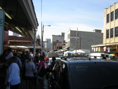
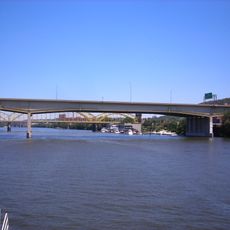
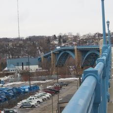
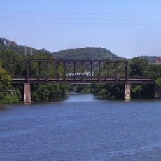
The Strip District is a neighborhood along the Allegheny River in Pittsburgh, running from 11th to 33rd Streets across four main corridors: Railroad Street, Smallman Street, Penn Avenue, and Liberty Avenue. The area is filled with food vendors, ethnic markets, and specialty stores that define its character.

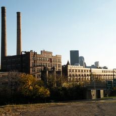
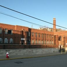
During the 19th century, the neighborhood housed the Fort Pitt Foundry, an industrial facility that manufactured large cannons for the Civil War. This site was central to Pittsburgh's role as a major manufacturing and weapons production center.

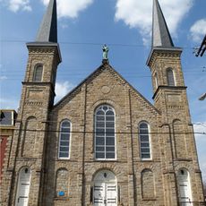
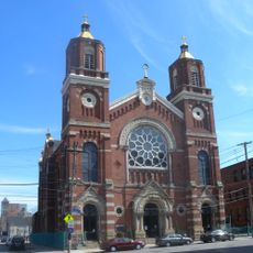
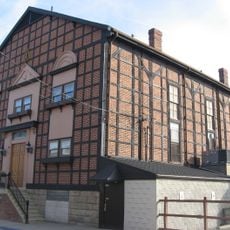
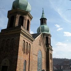
The St. Stanislaus Kostka Church anchors the neighborhood's cultural identity and reflects the immigrant communities who settled here over many decades. Today, the church and surrounding shops showcase the diverse traditions that shaped daily life in this part of the city.

The neighborhood is best explored on foot, with the four main streets providing clear landmarks to navigate shops and market stalls. Visiting early in the day offers the best selection of fresh goods and fewer crowds.

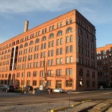
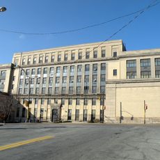
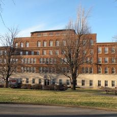
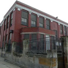
Former warehouse buildings in the district have been converted into offices and research facilities where companies develop autonomous vehicles and robotics technology. This transformation shows how the neighborhood shifted from traditional commerce to become a hub for technology development.

The community of curious travelers

AroundUs brings together thousands of curated places, local tips, and hidden gems, enriched daily by 60,000 contributors worldwide.

Start exploring
Location
GPS coordinates
40.45000,-79.98500
Latest update
December 24, 2025 21:28
Around this place
Heinz History Center
United States of America

Heinz History Center

718 m
Saint Anthony's Chapel
United States of America

Saint Anthony's Chapel

1.7 km
H. J. Heinz Company complex
United States of America

H. J. Heinz Company complex

699 m
David McCullough Bridge
United States of America

David McCullough Bridge

528 m
Veterans Bridge
United States of America

Veterans Bridge

712 m
31st Street Bridge
United States of America

31st Street Bridge

1.6 km
St. Stanislaus Kostka Church
United States of America

St. Stanislaus Kostka Church

284 m
Armstrong Cork Company building
United States of America

Armstrong Cork Company building

521 m
United States of America

Frank Curto Park

699 m
Teutonia Maennerchor Hall
United States of America

Teutonia Maennerchor Hall

1.1 km
30th Street Bridge
United States of America

30th Street Bridge

1.6 km
Federated Tower
United States of America

Federated Tower

993 m
Clifford B. Connelly Trade School
United States of America

Clifford B. Connelly Trade School

718 m
Senator John Heinz History Center
United States of America

Senator John Heinz History Center

694 m
Saint Nicholas Croatian Catholic Church
United States of America

Saint Nicholas Croatian Catholic Church

959 m
August Wilson House
United States of America

August Wilson House

527 m
Penn Incline
United States of America

Penn Incline

178 m
Tuberculosis Hospital of Pittsburgh
United States of America

Tuberculosis Hospital of Pittsburgh

1.4 km
United States of America

Troy Hill Incline

1.6 km
Herr's Island Railroad Bridge
United States of America

Herr's Island Railroad Bridge

1.2 km
Schiller Elementary School
United States of America

Schiller Elementary School

1 km
Byrnes & Kiefer Building
United States of America

Byrnes & Kiefer Building

857 m
Letsche Elementary School
United States of America

Letsche Elementary School

670 m
Eberhardt & Ober Brewery
United States of America

Eberhardt & Ober Brewery

954 m
Springfield Public School
United States of America

Springfield Public School

1.6 km
Heinz Auditorium
United States of America

Heinz Auditorium

732 m
United States of America

ArtGardens of Pittsburgh

699 m
Mechanic Street Bridge
United States of America

Mechanic Street Bridge

519 m
Show the full map
Reviews
Share your experience

No review yet

Discussions
Start a discussion...

No discussion yet

« Strip District - Historic market district in Pittsburgh, United States » is provided by Around Us (aroundus.com). Images and texts are derived from Wikimedia project under a Creative Commons license. You are allowed to copy, distribute, and modify copies of this page, under the conditions set by the license, as long as this note is clearly visible.

Discover hidden gems everywhere you go!

From secret cafés to breathtaking viewpoints, skip the crowded tourist spots and find places that match your style. Our app makes it easy with voice search, smart filtering, route optimization, and insider tips from travelers worldwide. Download now for the complete mobile experience.

Around Us App Screenshot

A unique approach to discovering new places

Le Figaro

All the places worth exploring

France Info

A tailor-made excursion in just a few clicks

20 Minutes

Around Us
Travel Guide & Maps
Download

Send to your phone

QR Code
1

Open the camera app on your mobile.

2

Point at the QR code with your camera. A notification will appear.

3

Tap the notification to open the link.