Chest opened
+${chestReward.xp} XP
Explorer
NOUVEAU ×${chestReward.collectible.quantity}
tapez pour fermer
Chest locked

Open chests in the app

Around Us is built for your phone — chests unlock when you walk, explore and capture nearby places.

Enable Location

We need your location to show you interesting places around you

Discover nearby places

Find interesting locations and hidden gems around you

Precise directions

Get accurate directions and distances to places

Your location is never shared with other users. It's only used when you tap the location button.

Log in to your account

Start exploring — it's free

Trusted by 72,925 travelers worldwide

Continue with Google
Continue with Apple
or

We will send you a code to connect

By continuing, you accept our Terms and Conditions and our Privacy Policy

Check your inbox

We've sent a pincode in your inbox. Please enter the code below.

Discussion Reviews Photo
1.2k Popularity

Susquehannah Turnpike, Straße in den Vereinigten Staaten

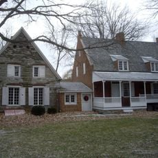
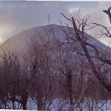
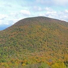
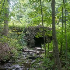
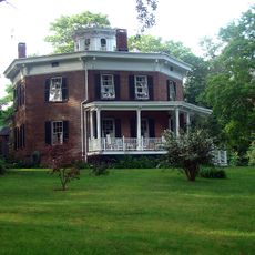
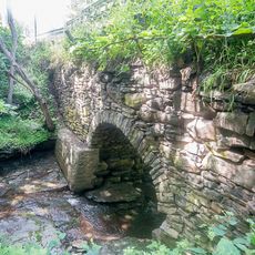
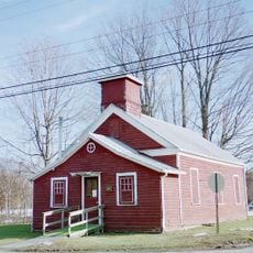
The Susquehannah Turnpike is a historic road in New York built over 200 years ago to enable travel and trade between communities. It runs from Catskill near the Hudson River through Greene County and features nine original milestones and several preserved stone arch bridges from its construction period.

The road was built around 1800 and became passable by 1806, though floods disrupted construction. It partly followed the Mohican Trail and was later extended by the Susquehannah and Bath Turnpike Company before canals and railroads shifted traffic in the 1800s.

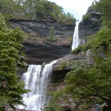
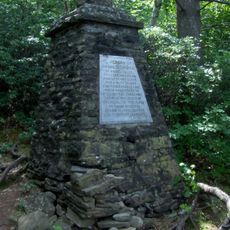
The name reflects the Susquehanna River, a major waterway that shaped the route and the region's development. Along the road today, old stone bridges and markers show how early traders and settlers moved goods and families through this landscape.

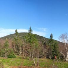
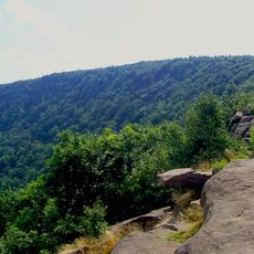
The road remains passable today and can be explored on foot or by bicycle for a quiet outdoor experience. Wear comfortable shoes as some sections are uneven, and plan time to stop and read the information boards scattered along the route.

Early travelers tried to avoid tolls by using side roads called shunpikes, such as Miller Hill Road in Meredith. Toll collectors responded by moving the toll booth closer to town and raising fees, revealing the resourcefulness of those trying to bypass the charge.

The community of curious travelers

AroundUs brings together thousands of curated places, local tips, and hidden gems, enriched daily by 60,000 contributors worldwide.

Start exploring
Location
GPS coordinates
42.30972,-74.01611
Latest update
February 9, 2026 07:45
Around this place
Kaaterskill Falls
United States of America

Kaaterskill Falls

13.5 km
Catskill Game Farm
United States of America

Catskill Game Farm

8 km
Bronck House
United States of America

Bronck House

14.2 km
Thomas Cole Mountain
United States of America

Thomas Cole Mountain

10.8 km
Black Dome
United States of America

Black Dome

9.8 km
Blackhead
United States of America

Blackhead

8.7 km
North Mountain
United States of America

North Mountain

10.6 km
All Souls Church
United States of America

All Souls Church

13.6 km
Hathaway
United States of America

Hathaway

13.2 km
Rowena Memorial School
United States of America

Rowena Memorial School

15 km
Thomas Cole House
United States of America

Thomas Cole House

15.8 km
Bronck Farm 13-Sided Barn
United States of America

Bronck Farm 13-Sided Barn

14.7 km
Woodward Road Stone Arch Bridge
United States of America

Woodward Road Stone Arch Bridge

9.5 km
Commercial Building at 32 West Bridge Street
United States of America

Commercial Building at 32 West Bridge Street

15.9 km
Salisbury Manor
United States of America

Salisbury Manor

9.5 km
Greenville Presbyterian Church
United States of America

Greenville Presbyterian Church

11.9 km
David Van Gelder Octagon House
United States of America

David Van Gelder Octagon House

15.6 km
St. Paul's Lutheran Church
United States of America

St. Paul's Lutheran Church

15.6 km
Henry T. Botsford House
United States of America

Henry T. Botsford House

10.8 km
Leeds Dutch Reformed Church
United States of America

Leeds Dutch Reformed Church

11.3 km
Hervey Street Road Stone Arch Bridge
United States of America

Hervey Street Road Stone Arch Bridge

9.9 km
DuBois Stone House
United States of America

DuBois Stone House

15.7 km
Tannersville Main Street Historic District
United States of America

Tannersville Main Street Historic District

15.7 km
Prevost Manor House
United States of America

Prevost Manor House

11.9 km
District School No. 11
United States of America

District School No. 11

14.2 km
Frank D. Layman Memorial
United States of America

Frank D. Layman Memorial

13.9 km
Newkirk Homestead
United States of America

Newkirk Homestead

10.2 km
Benjamin DuBois Stone House
United States of America

Benjamin DuBois Stone House

15.6 km
Show the full map
Reviews
Share your experience

No review yet

Discussions
Start a discussion...

No discussion yet

« Susquehannah Turnpike - Straße in den Vereinigten Staaten » is provided by Around Us (aroundus.com). Images and texts are derived from Wikimedia project under a Creative Commons license. You are allowed to copy, distribute, and modify copies of this page, under the conditions set by the license, as long as this note is clearly visible.

Discover hidden gems everywhere you go!

From secret cafés to breathtaking viewpoints, skip the crowded tourist spots and find places that match your style. Our app makes it easy with voice search, smart filtering, route optimization, and insider tips from travelers worldwide. Download now for the complete mobile experience.

Around Us App Screenshot

A unique approach to discovering new places

Le Figaro

All the places worth exploring

France Info

A tailor-made excursion in just a few clicks

20 Minutes

Around Us
Travel Guide & Maps
Download

Send to your phone

QR Code
1

Open the camera app on your mobile.

2

Point at the QR code with your camera. A notification will appear.

3

Tap the notification to open the link.