Chest opened
+${chestReward.xp} XP
Explorer
NOUVEAU ×${chestReward.collectible.quantity}
tapez pour fermer
Chest locked

Open chests in the app

Around Us is built for your phone — chests unlock when you walk, explore and capture nearby places.

Enable Location

We need your location to show you interesting places around you

Discover nearby places

Find interesting locations and hidden gems around you

Precise directions

Get accurate directions and distances to places

Your location is never shared with other users. It's only used when you tap the location button.

Log in to your account

Start exploring — it's free

Trusted by 73,084 travelers worldwide

Continue with Google
Continue with Apple
or

We will send you a code to connect

By continuing, you accept our Terms and Conditions and our Privacy Policy

Check your inbox

We've sent a pincode in your inbox. Please enter the code below.

Territorial era of Minnesota
Discussion Reviews Photo
21.1k Popularity

Territorial era of Minnesota, Historical territory in Minnesota, United States

The Minnesota Territory was a historical administrative region encompassing present-day Minnesota and portions of the Dakotas east of the Missouri River. It covered a vast landscape of river valleys and waterways central to early American western expansion.

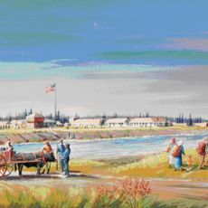
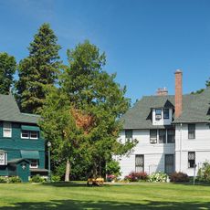
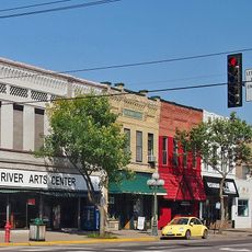
From 1849 to 1858, the region transformed from a sparsely populated area into an organized territory with established settlements. This rapid development was driven by settler arrival and the availability of river transportation routes.

European settlers arrived in large numbers during this period, establishing communities and transforming the region's population makeup. Their arrival shaped the social fabric and development of early settlements throughout the territory.

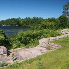
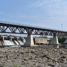
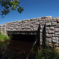
The Mississippi River served as the main transportation route since road connections to neighboring regions did not exist and water routes were the most reliable way to travel. Understanding early settlement patterns requires recognizing how completely river transport shaped movement and trade.

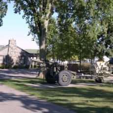
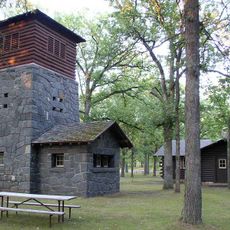
Military installations such as Fort Snelling and Fort Ripley were strategically positioned to ensure security and support settlement of the region. These forts played a key role in controlling the territory during its early development phase.

The community of curious travelers

AroundUs brings together thousands of curated places, local tips, and hidden gems, enriched daily by 60,000 contributors worldwide.

Start exploring
Location
GPS coordinates
46.00000,-94.00000
Latest update
December 7, 2025 20:43
Around this place
Paul Bunyan Land
United States of America

Paul Bunyan Land

39.3 km
Charles A. Lindbergh State Park
United States of America

Charles A. Lindbergh State Park

30.9 km
Fort Ripley
United States of America

Fort Ripley

34.8 km
Mille Lacs Kathio State Park
United States of America

Mille Lacs Kathio State Park

24.6 km
Mille Lacs National Wildlife Refuge
United States of America

Mille Lacs National Wildlife Refuge

37.6 km
Minnesota Military Museum
United States of America

Minnesota Military Museum

28.3 km
Mille Lacs Indian Museum
United States of America

Mille Lacs Indian Museum

27.9 km
Church of St. Stephen-Catholic
United States of America

Church of St. Stephen-Catholic

39.5 km
Milaca Municipal Hall
United States of America

Milaca Municipal Hall

38.5 km
Church of Our Savior-Episcopal
United States of America

Church of Our Savior-Episcopal

27.8 km
Camp Ripley Bridge
United States of America

Camp Ripley Bridge

27.2 km
Church of Sts. Peter and Paul-Catholic
United States of America

Church of Sts. Peter and Paul-Catholic

29.6 km
Charles A. Weyerhaeuser and Musser Houses
United States of America

Charles A. Weyerhaeuser and Musser Houses

28.5 km
Nature Road Bridge
United States of America

Nature Road Bridge

33.8 km
St. Joseph's Church-Catholic
United States of America

St. Joseph's Church-Catholic

8.3 km
Burton-Rosenmeier House
United States of America

Burton-Rosenmeier House

28.4 km
Kenney Lake Overlook
United States of America

Kenney Lake Overlook

38.4 km
Mille Lacs County Courthouse
United States of America

Mille Lacs County Courthouse

38.9 km
Soo Line Rail Bridge at Blanchard Dam
United States of America

Soo Line Rail Bridge at Blanchard Dam

31.9 km
Morrison County Courthouse
United States of America

Morrison County Courthouse

28 km
Pine Tree Lumber Company Office Building
United States of America

Pine Tree Lumber Company Office Building

27.9 km
Little Falls Carnegie Library
United States of America

Little Falls Carnegie Library

27.9 km
Little Falls Commercial Historic District
United States of America

Little Falls Commercial Historic District

28.2 km
St. Alban's Bay Culvert
United States of America

St. Alban's Bay Culvert

33.5 km
Bridge No. 3355-Kathio Township
United States of America

Bridge No. 3355-Kathio Township

28.8 km
Mille Lacs Indian Museum
United States of America

Mille Lacs Indian Museum

27.2 km
Charles A. Lindbergh State Park WPA/Rustic Style Historic Resources
United States of America

Charles A. Lindbergh State Park WPA/Rustic Style Historic Resources

30.6 km
Charles Lindbergh House and Museum
United States of America

Charles Lindbergh House and Museum

30.3 km
Show the full map
Reviews
Share your experience

No review yet

Discussions
Start a discussion...

No discussion yet

« Territorial era of Minnesota - Historical territory in Minnesota, United States » is provided by Around Us (aroundus.com). Images and texts are derived from Wikimedia project under a Creative Commons license. You are allowed to copy, distribute, and modify copies of this page, under the conditions set by the license, as long as this note is clearly visible.

Discover hidden gems everywhere you go!

From secret cafés to breathtaking viewpoints, skip the crowded tourist spots and find places that match your style. Our app makes it easy with voice search, smart filtering, route optimization, and insider tips from travelers worldwide. Download now for the complete mobile experience.

Around Us App Screenshot

A unique approach to discovering new places

Le Figaro

All the places worth exploring

France Info

A tailor-made excursion in just a few clicks

20 Minutes

Around Us
Travel Guide & Maps
Download

Send to your phone

QR Code
1

Open the camera app on your mobile.

2

Point at the QR code with your camera. A notification will appear.

3

Tap the notification to open the link.