Chest opened
+${chestReward.xp} XP
Explorer
NOUVEAU ×${chestReward.collectible.quantity}
tapez pour fermer
Chest locked

Open chests in the app

Around Us is built for your phone — chests unlock when you walk, explore and capture nearby places.

Enable Location

We need your location to show you interesting places around you

Discover nearby places

Find interesting locations and hidden gems around you

Precise directions

Get accurate directions and distances to places

Your location is never shared with other users. It's only used when you tap the location button.

Topsail Island

Log in to your account

Start exploring — it's free

Trusted by 72,925 travelers worldwide

Continue with Google
Continue with Apple
or

We will send you a code to connect

By continuing, you accept our Terms and Conditions and our Privacy Policy

Check your inbox

We've sent a pincode in your inbox. Please enter the code below.

Topsail Island
Discussion Reviews 1 Photos
40.5k Popularity

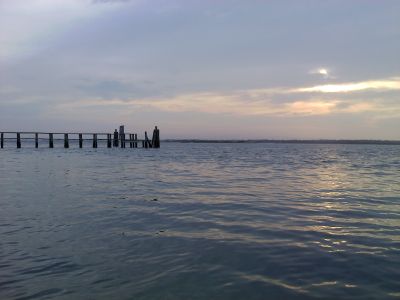
Topsail Island, Barrier island in North Carolina, United States.

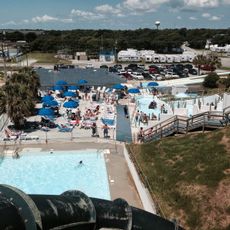
Topsail Island is a barrier island off North Carolina's coast featuring sandy beaches, salt marshes, and pine forests along its length. Three separate communities are spread across the island, each with its own character and waterfront access.

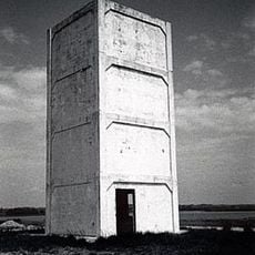
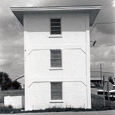
The island served as a testing ground for experimental military rockets during World War II, when the U.S. Navy launched hundreds of missiles from facilities here. This wartime period left lasting marks on the island's development and local memory.

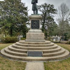
The island carries stories of pirates, military heritage, and Native American traditions that shaped its identity over centuries. Walking through the communities, you sense how these historical narratives remain woven into local life and memory.

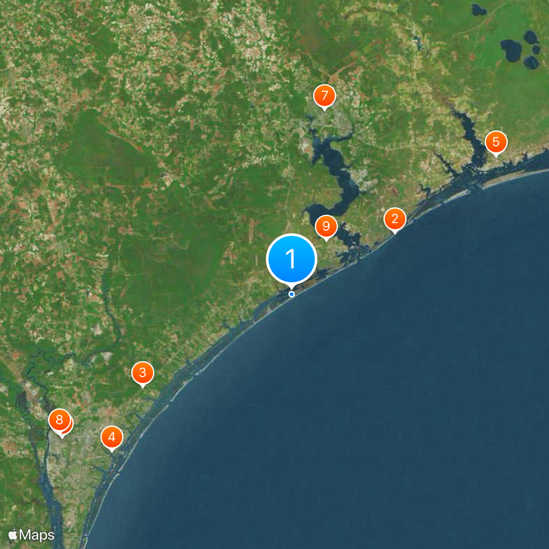
Two high-rise bridges connect the island to the mainland, with one bridge in the northern area and another serving the central communities. Spring and fall offer the most comfortable weather and fewer crowds than summer months.

Sea turtles nest on the island's beaches, and visitors may encounter rescue programs caring for injured animals before releasing them back to the ocean. This conservation work represents an ongoing commitment to protecting marine life.

The community of curious travelers

AroundUs brings together thousands of curated places, local tips, and hidden gems, enriched daily by 60,000 contributors worldwide.

Start exploring
Location
Location
GPS coordinates
34.46970,-77.47190
Latest update
December 17, 2025 08:38
Around this place
United States of America

Onslow Beach

21.8 km
Poplar Grove
United States of America

Poplar Grove

31.7 km
Airlie Gardens
United States of America

Airlie Gardens

43.2 km
Mac Daddy's
United States of America

Mac Daddy's

44.6 km
Wilmington National Cemetery
United States of America

Wilmington National Cemetery

49.1 km
United States of America

Museum of the Marine

34 km
Oakdale Cemetery
United States of America

Oakdale Cemetery

49.1 km
Yopps Meeting House
United States of America

Yopps Meeting House

11.6 km
Sloop Point
United States of America

Sloop Point

13.1 km
Pelletier House
United States of America

Pelletier House

31.6 km
Palo Alto Plantation
United States of America

Palo Alto Plantation

43.8 km
Dan Cameron Bridge
United States of America

Dan Cameron Bridge

48.4 km
Carolina Heights Historic District
United States of America

Carolina Heights Historic District

49.6 km
Market Street Mansion District
United States of America

Market Street Mansion District

49.2 km
Mount Lebanon Chapel and Cemetery
United States of America

Mount Lebanon Chapel and Cemetery

43.3 km
Carolina Place Historic District
United States of America

Carolina Place Historic District

49 km
Bradley-Latimer Summer House
United States of America

Bradley-Latimer Summer House

43.5 km
Bank of Onslow and Jacksonville Masonic Temple
United States of America

Bank of Onslow and Jacksonville Masonic Temple

31.5 km
Gabriel's Landing
United States of America

Gabriel's Landing

43.1 km
Tinga Nursery
United States of America

Tinga Nursery

45.2 km
Brookwood Historic District
United States of America

Brookwood Historic District

48.4 km
Delgrado School
United States of America

Delgrado School

49.3 km
US Naval Ordnance Testing Facility Observation Tower No. 2
United States of America

US Naval Ordnance Testing Facility Observation Tower No. 2

16.3 km
James D. and Frances Sprunt Cottage
United States of America

James D. and Frances Sprunt Cottage

41.3 km
The Salty Pirate Water Park
United States of America

The Salty Pirate Water Park

43.6 km
Westbrook–Ardmore Historic District
United States of America

Westbrook–Ardmore Historic District

49.6 km
US Naval Ordnance Testing Facility Control Tower
United States of America

US Naval Ordnance Testing Facility Control Tower

18.5 km
Old McFaye's Farm
United States of America

Old McFaye's Farm

43 km
Show the full map
Reviews
Share your experience

No review yet

Discussions
Start a discussion...

No discussion yet

« Topsail Island - Barrier island in North Carolina, United States » is provided by Around Us (aroundus.com). Images and texts are derived from Wikimedia project under a Creative Commons license. You are allowed to copy, distribute, and modify copies of this page, under the conditions set by the license, as long as this note is clearly visible.

Discover hidden gems everywhere you go!

From secret cafés to breathtaking viewpoints, skip the crowded tourist spots and find places that match your style. Our app makes it easy with voice search, smart filtering, route optimization, and insider tips from travelers worldwide. Download now for the complete mobile experience.

Around Us App Screenshot

A unique approach to discovering new places

Le Figaro

All the places worth exploring

France Info

A tailor-made excursion in just a few clicks

20 Minutes

Around Us
Travel Guide & Maps
Download

Send to your phone

QR Code
1

Open the camera app on your mobile.

2

Point at the QR code with your camera. A notification will appear.

3

Tap the notification to open the link.