Carolina Heights Historic District

Log in to your account

AroundUs is a community-driven map of interesting places, built by curious explorers like you. It grows with every review, story, and photo you share.
Connect to save your favorite spots, contribute locations, and create personalized routes.
Continue with Google
Continue with Apple
Continue with X
Continue with Facebook
Continue with email
By continuing, you accept our Terms and Conditions and our Privacy Policy
Create an account
Add to collection
Map
Suggest a change
Share

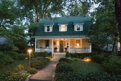
Carolina Heights Historic District, Residential historic district in Wilmington, United States

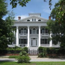
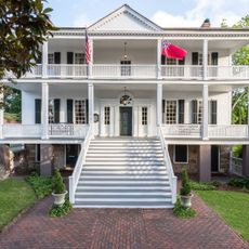
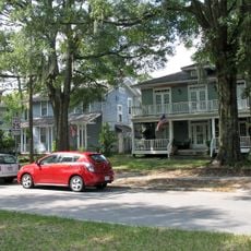
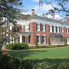
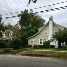
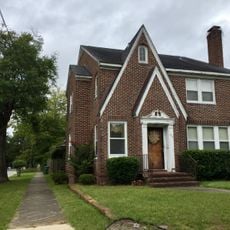
Carolina Heights Historic District is a residential area with roughly 420 buildings representing Queen Anne, Colonial Revival, and Classical Revival architectural styles. The homes are distributed across the neighborhood bounded by Market Street, Thirteenth Street, Rankin Street, and Nineteenth Street.

Development began in 1907 when Mary Bridgers purchased land to create a new residential neighborhood served by streetcars through 1939. This project transformed rural land into a prosperous residential area with consistent architectural standards.

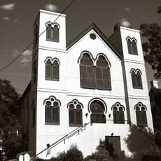
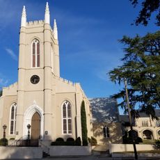
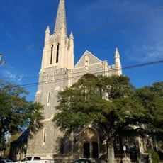
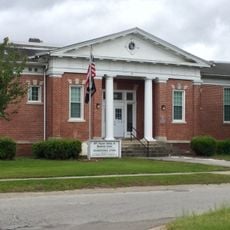
The Trinity Methodist Episcopal Church and St. Paul's Episcopal Church serve as gathering places that shaped the spiritual and social life of residents. These buildings became anchors of community identity and continue to reflect the values of the people who settled here.

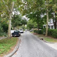
Visitors can explore the neighborhood on foot since walking paths connect the residential sections throughout the area. The best approach is to start from the boundaries at Market Street, Thirteenth Street, Rankin Street, or Nineteenth Street.

Architect Burett H. Stephens imposed strict design standards that controlled both the minimum cost and final appearance of homes. These rules ensured the neighborhood maintained a unified visual character that set it apart from surrounding areas.

Location: Wilmington

GPS coordinates: 34.23860,-77.93310

Latest update: December 14, 2025 14:40

Photos
Around this place
USS North Carolina
United States of America

USS North Carolina

2 km
Cape Fear Memorial Bridge
United States of America

Cape Fear Memorial Bridge

2.1 km
Confederate Memorial
United States of America

Confederate Memorial

1.3 km
St. Mary Catholic Church
United States of America

St. Mary Catholic Church

1.2 km
Cotton Exchange of Wilmington
United States of America

Cotton Exchange of Wilmington

1.5 km
Temple of Israel
United States of America

Temple of Israel

1.1 km
Murchison Building
United States of America

Murchison Building

1.5 km
Wilmington Historic District
United States of America

Wilmington Historic District

1.7 km
Thalian Hall
United States of America

Thalian Hall

1.3 km
The George Davis Monument
United States of America

The George Davis Monument

1.2 km
Cape Fear Museum
United States of America

Cape Fear Museum

573 m
St. James Episcopal Church
United States of America

St. James Episcopal Church

1.2 km
Cameron Art Museum
United States of America

Cameron Art Museum

6.3 km
Alton Lennon Federal Building and Courthouse
United States of America

Alton Lennon Federal Building and Courthouse

1.6 km
Wilmington National Cemetery
United States of America

Wilmington National Cemetery

675 m
Wilmington Riverwalk
United States of America

Wilmington Riverwalk

1.7 km
First Presbyterian Church
United States of America

First Presbyterian Church

1.3 km
Burgwin-Wright House and Gardens
United States of America

Burgwin-Wright House and Gardens

1.3 km
Sunset Park Historic District
United States of America

Sunset Park Historic District

4 km
Oakdale Cemetery
United States of America

Oakdale Cemetery

579 m
Dan Cameron Bridge
United States of America

Dan Cameron Bridge

7.3 km
Market Street Mansion District
United States of America

Market Street Mansion District

583 m
Joe and Barbara Schwartz Center
United States of America

Joe and Barbara Schwartz Center

1.6 km
Carolina Place Historic District
United States of America

Carolina Place Historic District

987 m
Tinga Nursery
United States of America

Tinga Nursery

6.8 km
Brookwood Historic District
United States of America

Brookwood Historic District

1.5 km
Delgrado School
United States of America

Delgrado School

1.4 km
Westbrook–Ardmore Historic District
United States of America

Westbrook–Ardmore Historic District

888 m
Show the full map
Reviews

Visited this place? Tap the stars to rate it and share your experience / photos with the community! Try now! You can cancel it anytime.

« Carolina Heights Historic District - Residential historic district in Wilmington, United States » is provided by Around Us (aroundus.com). Images and texts are derived from Wikimedia project under a Creative Commons license. You are allowed to copy, distribute, and modify copies of this page, under the conditions set by the license, as long as this note is clearly visible.

Discover hidden gems everywhere you go!

From secret cafés to breathtaking viewpoints, skip the crowded tourist spots and find places that match your style. Our app makes it easy with voice search, smart filtering, route optimization, and insider tips from travelers worldwide. Download now for the complete mobile experience.

Around Us App Screenshot

A unique approach to discovering new places

Le Figaro

All the places worth exploring

France Info

A tailor-made excursion in just a few clicks

20 Minutes