Enable Location

We need your location to show you interesting places around you

Discover nearby places

Find interesting locations and hidden gems around you

Precise directions

Get accurate directions and distances to places

Your location is never shared with other users. It's only used when you tap the location button.

Log in to your account

Start exploring — it's free

Trusted by 63,165 travelers worldwide

Continue with Google
Continue with Apple
or

We will send you a code to connect

By continuing, you accept our Terms and Conditions and our Privacy Policy

Check your inbox

We've sent a pincode in your inbox. Please enter the code below.

Upper Piney Lake Trail
Discussion Reviews Photo
1.3k Popularity

Upper Piney Lake Trail, Weg in den Vereinigten Staaten

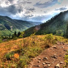
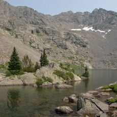
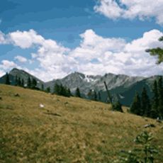
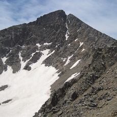
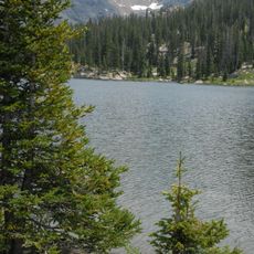
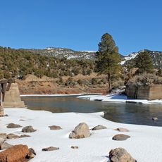
Upper Piney Lake Trail is a hiking path near Vail that stretches about 6 miles round trip from a parking area outside Piney River Ranch. The route passes Piney Lake, climbs through wildflower meadows and aspen forests, crosses several streams, and reaches a waterfall over rocks within roughly an hour and a half of walking.

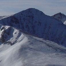
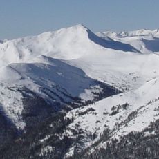
The trail developed over time as hikers and hunters explored the Piney Lake area and the surrounding Gore Range foothills. It became a popular destination for visitors to Vail seeking mountain walks and connections to the natural landscape.

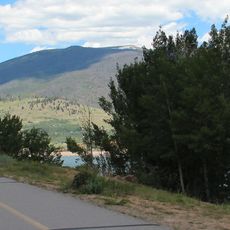
The trail and surrounding area draw visitors seeking a peaceful connection to the Colorado mountains and their flowing waters. People come to experience the quiet of the forest and to watch the changing seasons marked by the aspen trees and wildflowers.

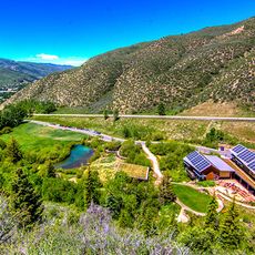
Access the trail via Red Sandstone Road from Interstate 70 near Vail; the final section is unpaved with limited parking, so arriving early is helpful. Wear sturdy hiking boots, bring plenty of water, and be prepared for changing weather and insects during warmer months.

The waterfall roughly an hour and a half into the walk is often overlooked as many visitors focus on reaching the lake instead, missing the powerful flow of water over stone. Beyond the falls, the trail becomes less defined and less crowded, offering a rougher experience for hikers who want to venture past the popular stopping point.

The community of curious travelers

AroundUs brings together thousands of curated places, local tips, and hidden gems, enriched daily by 60,000 contributors worldwide.

Start exploring
Location
GPS coordinates
39.72050,-106.40500
Latest update
February 9, 2026 07:46
Reviews
Share your experience

No review yet

Discussions
Start a discussion...

No discussion yet

« Upper Piney Lake Trail - Weg in den Vereinigten Staaten » is provided by Around Us (aroundus.com). Images and texts are derived from Wikimedia project under a Creative Commons license. You are allowed to copy, distribute, and modify copies of this page, under the conditions set by the license, as long as this note is clearly visible.

Discover hidden gems everywhere you go!

From secret cafés to breathtaking viewpoints, skip the crowded tourist spots and find places that match your style. Our app makes it easy with voice search, smart filtering, route optimization, and insider tips from travelers worldwide. Download now for the complete mobile experience.

Around Us App Screenshot

A unique approach to discovering new places

Le Figaro

All the places worth exploring

France Info

A tailor-made excursion in just a few clicks

20 Minutes

Around Us
Travel Guide & Maps
Download

Send to your phone

QR Code
1

Open the camera app on your mobile.

2

Point at the QR code with your camera. A notification will appear.

3

Tap the notification to open the link.