Enable Location

We need your location to show you interesting places around you

Discover nearby places

Find interesting locations and hidden gems around you

Precise directions

Get accurate directions and distances to places

Your location is never shared with other users. It's only used when you tap the location button.

Van Buren State Park

Log in to your account

Start exploring — it's free

Trusted by 62,168 travelers worldwide

Continue with Google
Continue with Apple
or

We will send you a code to connect

By continuing, you accept our Terms and Conditions and our Privacy Policy

Check your inbox

We've sent a pincode in your inbox. Please enter the code below.

Van Buren State Park

Van Buren State Park, State park at Lake Michigan shoreline, United States.

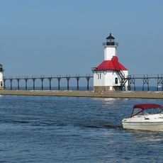
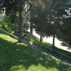
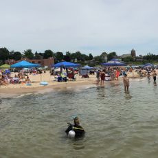
Van Buren State Park is a state-managed property on Lake Michigan's shore featuring expansive sandy beaches, tall sand dunes, and wooded hiking paths. The grounds span several hundred acres and contain camping areas, picnic facilities, and beach access for visitors.

The park was established in 1966 after Michigan acquired land from private owners. This purchase opened the Lake Michigan shoreline and dune landscape to the public as a recreational destination.

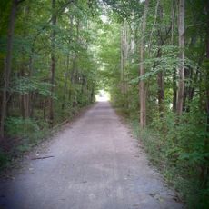
The park connects to Van Buren Trail State Park and Kal-Haven Trail State Park, forming a network of recreational paths for Michigan residents.

The park provides more than 200 camping sites with modern facilities including showers, restrooms, and cooking grills for visitors. Beach access is straightforward, and walking trails run through the wooded sections of the property.

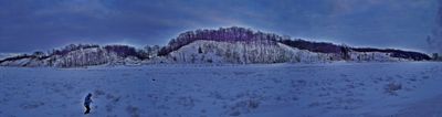
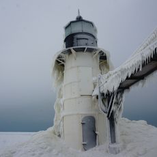
The sand dunes rise to heights of roughly 200 meters and offer wide views across the lake with changing landscapes throughout the seasons. In winter, the grounds transform into a snow-covered terrain with frozen shorelines.

The community of curious travelers

AroundUs brings together thousands of curated places, local tips, and hidden gems, enriched daily by 60,000 contributors worldwide.

Start exploring
Location
Inception
1965
GPS coordinates
42.34780,-86.30080
Latest update
December 10, 2025 20:04
Around this place
Kal-Haven Trail
United States of America

Kal-Haven Trail

28.5 km
St. Joseph North Pier Inner and Outer Lights
United States of America

St. Joseph North Pier Inner and Outer Lights

30.3 km
South Haven Light
United States of America

South Haven Light

6.1 km
Fort Miami
United States of America

Fort Miami

30.3 km
Shiloh House
United States of America

Shiloh House

29.6 km
Blossomland Bridge
United States of America

Blossomland Bridge

30 km
Michigan Maritime Museum
United States of America

Michigan Maritime Museum

6.9 km
North Point Park
United States of America

North Point Park

528 m
Ninth District Lighthouse Depot
United States of America

Ninth District Lighthouse Depot

30.1 km
Bangor Elevator
United States of America

Bangor Elevator

16 km
Liberty Hyde Bailey Birthplace
United States of America

Liberty Hyde Bailey Birthplace

5.8 km
St. Joseph North Pier Outer Light
United States of America

St. Joseph North Pier Outer Light

30.3 km
North Watervliet Road – Paw Paw Lake Outlet Bridge
United States of America

North Watervliet Road – Paw Paw Lake Outlet Bridge

16.1 km
St. Joseph North Pier Inner Light
United States of America

St. Joseph North Pier Inner Light

30.3 km
Fidelity Building
United States of America

Fidelity Building

28.9 km
Wendell P. and Harriet Rounds Robbins House
United States of America

Wendell P. and Harriet Rounds Robbins House

29.5 km
Bailey Museum
United States of America

Bailey Museum

5.8 km
Dyckman Park
United States of America

Dyckman Park

6.5 km
North Beach
United States of America

North Beach

6.5 km
Dyckman Bridge
United States of America

Dyckman Bridge

6.9 km
South Beach
United States of America

South Beach

6.1 km
Michigan Theatre
United States of America

Michigan Theatre

6.7 km
South Haven Memorial Library
United States of America

South Haven Memorial Library

6.5 km
Scott Club Historical Marker
United States of America

Scott Club Historical Marker

6.7 km
Old Saint Joseph Neighborhood Historical Marker
United States of America

Old Saint Joseph Neighborhood Historical Marker

31.6 km
CSX St Joseph River Bridge
United States of America

CSX St Joseph River Bridge

30.2 km
Burnett's Post Historical Marker
United States of America

Burnett's Post Historical Marker

31.4 km
Scott Club
United States of America

Scott Club

6.7 km
Show the full map
« Van Buren State Park - State park at Lake Michigan shoreline, United States » is provided by Around Us (aroundus.com). Images and texts are derived from Wikimedia project under a Creative Commons license. You are allowed to copy, distribute, and modify copies of this page, under the conditions set by the license, as long as this note is clearly visible.

Discover hidden gems everywhere you go!

From secret cafés to breathtaking viewpoints, skip the crowded tourist spots and find places that match your style. Our app makes it easy with voice search, smart filtering, route optimization, and insider tips from travelers worldwide. Download now for the complete mobile experience.

Around Us App Screenshot

A unique approach to discovering new places

Le Figaro

All the places worth exploring

France Info

A tailor-made excursion in just a few clicks

20 Minutes

Around Us
Travel Guide & Maps
Download

Send to your phone

QR Code
1

Open the camera app on your mobile.

2

Point at the QR code with your camera. A notification will appear.

3

Tap the notification to open the link.