Chest opened
+${chestReward.xp} XP
Explorer
NOUVEAU ×${chestReward.collectible.quantity}
tapez pour fermer

See the monuments around you in AR Open chests in the app

Around Us is built for your phone — point your camera at the streets and discover the monuments and places around you in augmented reality. Around Us is built for your phone — chests unlock when you walk, explore and capture nearby places.

Enable Location

We need your location to show you interesting places around you

Discover nearby places

Find interesting locations and hidden gems around you

Precise directions

Get accurate directions and distances to places

Your location is never shared with other users. It's only used when you tap the location button.

Kal-Haven Trail

Log in to your account

Start exploring — it's free

Trusted by 85,427 travelers worldwide

Continue with Google
Continue with Apple
or

We will send you a code to connect

By continuing, you accept our Terms and Conditions and our Privacy Policy

Check your inbox

We've sent a pincode in your inbox. Please enter the code below.

Discussion Reviews 1 Photos
10.8k Popularity

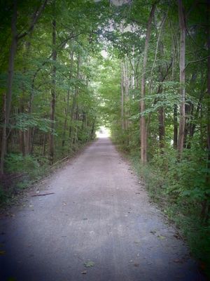
Kal-Haven Trail, Rail trail between Kalamazoo and South Haven, Michigan, US.

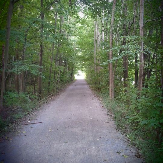
Kal-Haven Trail is a paved pathway stretching roughly 35 miles through woodlands, wetlands, and small towns that connect the two communities. The crushed limestone surface works well for walking, biking, and other outdoor recreation.

The land was originally a railroad line built in the 1870s that served the Kalamazoo & South Haven Railroad and later Michigan Central Railroad. In the 1990s, the abandoned rail corridor was converted into a public recreation trail.

Small towns along the path have preserved old railway stations and a red caboose that show how trains once shaped the region. These reminders help visitors understand the connection between transportation and community life.

The path has several entry points with parking and restroom facilities, making it easy to start your visit from different locations. Spring through fall offers the best conditions, as milder weather and full trail access make travel easier for most visitors.

The route crosses the Black River over a covered wooden bridge that visitors pass through while traveling. Another highlight is a 1920s bridge with a distinctive arch in the middle, designed to strengthen the structure against the weight and stresses it faces.

The community of curious travelers

AroundUs brings together thousands of curated places, local tips, and hidden gems, enriched daily by 60,000 contributors worldwide.
Start exploring
Location
GPS coordinates
42.38250,-85.95750
Latest update
August 29, 2026 21:54
Around this place
Saugatuck Dunes State Park
United States of America

Saugatuck Dunes State Park

25.4 mi
Dorr E. Felt Mansion
United States of America

Dorr E. Felt Mansion

24.9 mi
Van Buren State Park
United States of America

Van Buren State Park

17.7 mi
Lake Allegan
United States of America

Lake Allegan

11.7 mi
South Haven Light
United States of America

South Haven Light

16.9 mi
Second Street Bridge
United States of America

Second Street Bridge

11.4 mi
Michigan Maritime Museum
United States of America

Michigan Maritime Museum

16.3 mi
New Richmond Swing Bridge
United States of America

New Richmond Swing Bridge

20.1 mi
Oakwood Cemetery Chapel
United States of America

Oakwood Cemetery Chapel

11.1 mi
United States of America

North Point Park

17.7 mi
Griswold Civic Center Historic District
United States of America

Griswold Civic Center Historic District

11.3 mi
Lake Shore Chapel
United States of America

Lake Shore Chapel

22.9 mi
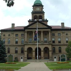
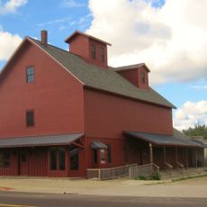
Bangor Elevator
United States of America

Bangor Elevator

9.2 mi
Francis Metallic Surfboat
United States of America

Francis Metallic Surfboat

22 mi
Pritchard's Outlook Historic District
United States of America

Pritchard's Outlook Historic District

11.4 mi
Augustus Lilly House
United States of America

Augustus Lilly House

12.2 mi
Edward D. Born House
United States of America

Edward D. Born House

12 mi
Saugatuck Pump House
United States of America

Saugatuck Pump House

23.1 mi
Henry Franks House
United States of America

Henry Franks House

11 mi
Marshall Street Historic District
United States of America

Marshall Street Historic District

11.2 mi
Downtown Allegan Historic District
United States of America

Downtown Allegan Historic District

11.4 mi
Hacklander Site
United States of America

Hacklander Site

20.4 mi
William C. Messenger House
United States of America

William C. Messenger House

11.9 mi
Engelbert B. Born House
United States of America

Engelbert B. Born House

11.9 mi
William H. Brown House
United States of America

William H. Brown House

10.6 mi
Dyckman Beach
United States of America

Dyckman Beach

16.5 mi
North Beach
United States of America

North Beach

16.7 mi
South Beach
United States of America

South Beach

16.7 mi
Show the full map
Reviews
Share your experience

No review yet

Discussions
Start a discussion...

No discussion yet

« Kal-Haven Trail - Rail trail between Kalamazoo and South Haven, Michigan, US » is provided by Around Us (aroundus.com). Images and texts are derived from Wikimedia project under a Creative Commons license. You are allowed to copy, distribute, and modify copies of this page, under the conditions set by the license, as long as this note is clearly visible.

Discover hidden gems everywhere you go!

From secret cafés to breathtaking viewpoints, skip the crowded tourist spots and find places that match your style. Our app makes it easy with voice search, smart filtering, route optimization, and insider tips from travelers worldwide. Download now for the complete mobile experience.
Around Us App Screenshot

A unique approach to discovering new places

Le Figaro

All the places worth exploring

France Info

A tailor-made excursion in just a few clicks

20 Minutes

Around Us
Travel Guide & Maps
Download

Send to your phone

QR Code
1

Open the camera app on your mobile.

2

Point at the QR code with your camera. A notification will appear.

3

Tap the notification to open the link.