Enable Location

We need your location to show you interesting places around you

Discover nearby places

Find interesting locations and hidden gems around you

Precise directions

Get accurate directions and distances to places

Your location is never shared with other users. It's only used when you tap the location button.

Ware–Hardwick Covered Bridge

Log in to your account

Start exploring — it's free

Trusted by 62,478 travelers worldwide

Continue with Google
Continue with Apple
or

We will send you a code to connect

By continuing, you accept our Terms and Conditions and our Privacy Policy

Check your inbox

We've sent a pincode in your inbox. Please enter the code below.

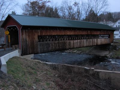
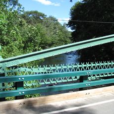
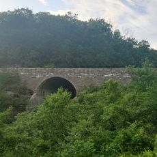
Ware–Hardwick Covered Bridge, Historic covered bridge in Gilbertville, Massachusetts, United States.

The Ware-Hardwick Covered Bridge is a timber structure spanning the Ware River with vertical board walls and a peaked metal roof. Inside, the bridge displays a lattice framework that is a defining characteristic of this construction style.

The bridge was built in 1886, marking the region's investment in infrastructure during that era. A major restoration was completed in 2010, returning it to full use for all vehicles.

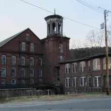
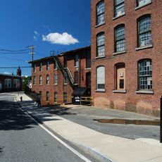
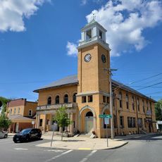
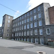
The bridge sits within a landscape shaped by regional textile production, as it connects areas where mills once operated. Its presence reminds visitors of how such structures supported the economic life of local communities.

The bridge sits on Old Gilbertville Road between the two towns and functions as a single-lane passage for vehicle traffic. Parking areas are available on both sides for visitors who want to stop and look around.

This bridge has intentional openings in its side walls that allow daylight to filter through the wooden lattice inside. Walking through it creates a distinctive pattern of light and shadow that changes throughout the day.

The community of curious travelers

AroundUs brings together thousands of curated places, local tips, and hidden gems, enriched daily by 60,000 contributors worldwide.

Start exploring
Location
GPS coordinates
42.31028,-72.21250
Latest update
December 14, 2025 15:02
Around this place
Quabbin Reservoir
United States of America

Quabbin Reservoir

9 km
Rock House Reservation
United States of America

Rock House Reservation

4.7 km
Chicopee Valley Aqueduct
United States of America

Chicopee Valley Aqueduct

11.2 km
Lucy Stone Home Site
United States of America

Lucy Stone Home Site

6.2 km
John Payson Williston Observatory
United States of America

John Payson Williston Observatory

7 km
Ware Town Hall
United States of America

Ware Town Hall

6.1 km
Warren Public Library
United States of America

Warren Public Library

10.9 km
Gilbertville Historic District
United States of America

Gilbertville Historic District

500 m
Ware Millyard Historic District
United States of America

Ware Millyard Historic District

6.1 km
Brookfield Cemetery
United States of America

Brookfield Cemetery

13.2 km
Warren First Congregational Church – Federated Church
United States of America

Warren First Congregational Church – Federated Church

10.9 km
Crossman Bridge
United States of America

Crossman Bridge

11.5 km
Warren Town Hall
United States of America

Warren Town Hall

10.9 km
Ware Center Historic District
United States of America

Ware Center Historic District

7.7 km
Fobes-O'Donnell House
United States of America

Fobes-O'Donnell House

13.4 km
Otis Company Mill No. 1
United States of America

Otis Company Mill No. 1

6.1 km
Kensington Park Historic District
United States of America

Kensington Park Historic District

9.2 km
North Brookfield Town House
United States of America

North Brookfield Town House

11.5 km
Jedediah Foster Homesite
United States of America

Jedediah Foster Homesite

11.1 km
Elm Hill Farm Historic District
United States of America

Elm Hill Farm Historic District

14.4 km
Barre Common District
United States of America

Barre Common District

15.3 km
Brookfield Common Historic District
United States of America

Brookfield Common Historic District

14 km
Wickaboag Valley Historic District
United States of America

Wickaboag Valley Historic District

6.4 km
West Brick School
United States of America

West Brick School

12.2 km
West Brookfield Center Historic District
United States of America

West Brookfield Center Historic District

10.3 km
Hardwick Village Historic District
United States of America

Hardwick Village Historic District

4.4 km
Oakham Center Historic District
United States of America

Oakham Center Historic District

14.8 km
Winsor Dam Bridge
United States of America

Winsor Dam Bridge

10.7 km
Show the full map
« Ware–Hardwick Covered Bridge - Historic covered bridge in Gilbertville, Massachusetts, United States » is provided by Around Us (aroundus.com). Images and texts are derived from Wikimedia project under a Creative Commons license. You are allowed to copy, distribute, and modify copies of this page, under the conditions set by the license, as long as this note is clearly visible.

Discover hidden gems everywhere you go!

From secret cafés to breathtaking viewpoints, skip the crowded tourist spots and find places that match your style. Our app makes it easy with voice search, smart filtering, route optimization, and insider tips from travelers worldwide. Download now for the complete mobile experience.

Around Us App Screenshot

A unique approach to discovering new places

Le Figaro

All the places worth exploring

France Info

A tailor-made excursion in just a few clicks

20 Minutes

Around Us
Travel Guide & Maps
Download

Send to your phone

QR Code
1

Open the camera app on your mobile.

2

Point at the QR code with your camera. A notification will appear.

3

Tap the notification to open the link.