Enable Location

We need your location to show you interesting places around you

Discover nearby places

Find interesting locations and hidden gems around you

Precise directions

Get accurate directions and distances to places

Your location is never shared with other users. It's only used when you tap the location button.

Chicopee Valley Aqueduct

Log in to your account

Start exploring — it's free

Trusted by 61,428 travelers worldwide

Continue with Google
Continue with Apple
or

We will send you a code to connect

By continuing, you accept our Terms and Conditions and our Privacy Policy

Check your inbox

We've sent a pincode in your inbox. Please enter the code below.

Chicopee Valley Aqueduct

Chicopee Valley Aqueduct, Water infrastructure system in Western Massachusetts, United States.

Description

The Chicopee Valley Aqueduct is a pipeline system that carries water from a reservoir into communities across Western Massachusetts. The network consists of different pipe sections and includes a treatment facility that processes the water before it reaches homes and businesses.

History

The pipeline system was authorized in the mid-20th century and completed three years later. Decades after it opened, the infrastructure was upgraded to improve its reliability.

Culture

The system serves several communities and plays an important role in daily life across the region. Local residents depend on this hidden infrastructure for their household water supply without thinking about where it comes from.

Practical

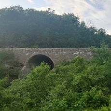
The pipeline runs underground and is not visible from above, so you would visit the connected treatment facility instead. Plan a visit on a weekday when the facilities are more accessible to the public.

Did you know?

In the 2000s, the system was expanded with an additional pipeline to ensure continuous water supply even during maintenance work. This backup line shows how critical reliable water delivery is for the entire region.

Location
GPS coordinates
42.28310,-72.34330
Latest update
December 14, 2025 16:44

AroundUs brings together thousands of curated places, local tips, and hidden gems, enriched daily by 60,000 contributors worldwide. Discover all places nearby (Massachusetts).

Around this place
Quabbin Reservoir
United States of America

Quabbin Reservoir

9.2 km
Mount Norwottuck
United States of America

Mount Norwottuck

14 km
Rock House Reservation
United States of America

Rock House Reservation

12.1 km
Mount Holyoke Range State Park
United States of America

Mount Holyoke Range State Park

14.2 km
Mount Lincoln
United States of America

Mount Lincoln

11.1 km
Steaming Tender Restuarant
United States of America

Steaming Tender Restuarant

14.2 km
Long Mountain
United States of America

Long Mountain

11.5 km
Ware–Hardwick Covered Bridge
United States of America

Ware–Hardwick Covered Bridge

11.2 km
Lucy Stone Home Site
United States of America

Lucy Stone Home Site

12.8 km
John Payson Williston Observatory
United States of America

John Payson Williston Observatory

7.8 km
Ware Town Hall
United States of America

Ware Town Hall

8.6 km
Clapp Memorial Library
United States of America

Clapp Memorial Library

4.7 km
Warren Public Library
United States of America

Warren Public Library

14.6 km
Gilbertville Historic District
United States of America

Gilbertville Historic District

11.4 km
Ware Millyard Historic District
United States of America

Ware Millyard Historic District

9.1 km
Palmer Memorial Hall
United States of America

Palmer Memorial Hall

14.2 km
Ludlow Center Historic District
United States of America

Ludlow Center Historic District

14 km
Pelham Town Hall Historic District
United States of America

Pelham Town Hall Historic District

13.1 km
Belchertown Center Historic District
United States of America

Belchertown Center Historic District

4.9 km
Crossman Bridge
United States of America

Crossman Bridge

11.4 km
Warren Town Hall
United States of America

Warren Town Hall

14.5 km
Ware Center Historic District
United States of America

Ware Center Historic District

5.9 km
Otis Company Mill No. 1
United States of America

Otis Company Mill No. 1

9 km
Kensington Park Historic District
United States of America

Kensington Park Historic District

12.7 km
United States Post Office–Palmer Main
United States of America

United States Post Office–Palmer Main

14.1 km
Walker-Collis House
United States of America

Walker-Collis House

5.7 km
Hardwick Village Historic District
United States of America

Hardwick Village Historic District

14.1 km
Winsor Dam Bridge
United States of America

Winsor Dam Bridge

533 m
Show the full map
« Chicopee Valley Aqueduct - Water infrastructure system in Western Massachusetts, United States » is provided by Around Us (aroundus.com). Images and texts are derived from Wikimedia project under a Creative Commons license. You are allowed to copy, distribute, and modify copies of this page, under the conditions set by the license, as long as this note is clearly visible.

Discover hidden gems everywhere you go!

From secret cafés to breathtaking viewpoints, skip the crowded tourist spots and find places that match your style. Our app makes it easy with voice search, smart filtering, route optimization, and insider tips from travelers worldwide. Download now for the complete mobile experience.

Around Us App Screenshot

A unique approach to discovering new places

Le Figaro

All the places worth exploring

France Info

A tailor-made excursion in just a few clicks

20 Minutes

Around Us
Travel Guide & Maps
Download

Send to your phone

QR Code
1

Open the camera app on your mobile.

2

Point at the QR code with your camera. A notification will appear.

3

Tap the notification to open the link.