Enable Location

We need your location to show you interesting places around you

Discover nearby places

Find interesting locations and hidden gems around you

Precise directions

Get accurate directions and distances to places

Your location is never shared with other users. It's only used when you tap the location button.

Waterloo-Pinckney Trail

Log in to your account

Start exploring — it's free

Trusted by 62,455 travelers worldwide

Continue with Google
Continue with Apple
or

We will send you a code to connect

By continuing, you accept our Terms and Conditions and our Privacy Policy

Check your inbox

We've sent a pincode in your inbox. Please enter the code below.

Waterloo-Pinckney Trail

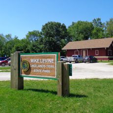
Waterloo-Pinckney Trail, recreational trail in Michigan, United States

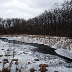
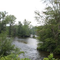
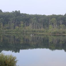
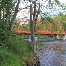
The Waterloo-Pinckney Trail is a 38-mile hiking path in southeast Michigan connecting two large recreation areas through forests, wetlands, and open fields. Blue blazes mark the route as it winds past lakes, ridges, and varying terrain that changes throughout the journey.

The trail was conceived in the 1960s and developed over more than two decades before its official opening in 1986. The original route stretched over 46 miles before being shortened to its current length to better serve visitors.

The trail serves as a gathering place for outdoor enthusiasts who seek solitude and reflection in nature. Visitors use this route to disconnect from daily routines and experience the rural character of Michigan's landscape.

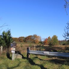
The trail is well-marked with blue blazes and offers multiple starting points at parking areas for walks of varying length. Bring sturdy hiking boots, water, and snacks since the terrain varies and includes steep sections that require careful footing.

A wooden observation tower on Sackrider Hill rewards the steep climb with panoramic views over the forests and lakes below. This overlooked vantage point offers unexpected perspective on the glacially shaped landscape that few visitors discover.

The community of curious travelers

AroundUs brings together thousands of curated places, local tips, and hidden gems, enriched daily by 60,000 contributors worldwide.

Start exploring
Location
GPS coordinates
42.40070,-84.04220
Latest update
February 9, 2026 08:23
Around this place
Purple Rose Theatre Company
United States of America

Purple Rose Theatre Company

9.5 km
Waterloo State Recreation Area
United States of America

Waterloo State Recreation Area

13 km
Pinckney State Recreation Area
United States of America

Pinckney State Recreation Area

6.5 km
Delhi Bridge
United States of America

Delhi Bridge

20.6 km
Woodland Center Correctional Facility
United States of America

Woodland Center Correctional Facility

23.3 km
Brighton Recreation Area
United States of America

Brighton Recreation Area

20.3 km
Hudson Mills Metropark
United States of America

Hudson Mills Metropark

11.1 km
Mike Levine Lakelands Trail State Park
United States of America

Mike Levine Lakelands Trail State Park

8 km
Peach Mountain Observatory
United States of America

Peach Mountain Observatory

8.8 km
Huron Meadows Metropark
United States of America

Huron Meadows Metropark

23.9 km
Delhi Metropark
United States of America

Delhi Metropark

20.8 km
Chelsea Commercial Historic District
United States of America

Chelsea Commercial Historic District

9.4 km
Bell Road Bridge
United States of America

Bell Road Bridge

11 km
Dexter–Huron Metropark
United States of America

Dexter–Huron Metropark

16.9 km
Saint Mary's School
United States of America

Saint Mary's School

9.7 km
George W. Palmer House
United States of America

George W. Palmer House

9.4 km
Stockbridge Town Hall
United States of America

Stockbridge Town Hall

12.6 km
James Litchfield House
United States of America

James Litchfield House

14.9 km
Waterloo Farm Museum
United States of America

Waterloo Farm Museum

11.6 km
William K. and Nellie Sexton House
United States of America

William K. and Nellie Sexton House

23.8 km
Sidney T. Smith House
United States of America

Sidney T. Smith House

19.5 km
August Westphal Farmstead
United States of America

August Westphal Farmstead

22.8 km
Whitmore Lake Bowl
United States of America

Whitmore Lake Bowl

23.2 km
Gerald E. Eddy Discovery Center
United States of America

Gerald E. Eddy Discovery Center

9.4 km
Chilson Impoundment
United States of America

Chilson Impoundment

19.5 km
Zion Lutheran Church Historical Marker
United States of America

Zion Lutheran Church Historical Marker

18.8 km
Zion Lutheran Church
United States of America

Zion Lutheran Church

18.8 km
Blue Heron Bay Splash Park
United States of America

Blue Heron Bay Splash Park

20.2 km
Show the full map
« Waterloo-Pinckney Trail - recreational trail in Michigan, United States » is provided by Around Us (aroundus.com). Images and texts are derived from Wikimedia project under a Creative Commons license. You are allowed to copy, distribute, and modify copies of this page, under the conditions set by the license, as long as this note is clearly visible.

Discover hidden gems everywhere you go!

From secret cafés to breathtaking viewpoints, skip the crowded tourist spots and find places that match your style. Our app makes it easy with voice search, smart filtering, route optimization, and insider tips from travelers worldwide. Download now for the complete mobile experience.

Around Us App Screenshot

A unique approach to discovering new places

Le Figaro

All the places worth exploring

France Info

A tailor-made excursion in just a few clicks

20 Minutes

Around Us
Travel Guide & Maps
Download

Send to your phone

QR Code
1

Open the camera app on your mobile.

2

Point at the QR code with your camera. A notification will appear.

3

Tap the notification to open the link.