Enable Location

We need your location to show you interesting places around you

Discover nearby places

Find interesting locations and hidden gems around you

Precise directions

Get accurate directions and distances to places

Your location is never shared with other users. It's only used when you tap the location button.

Log in to your account

Start exploring — it's free

Trusted by 66,894 travelers worldwide

Continue with Google
Continue with Apple
or

We will send you a code to connect

By continuing, you accept our Terms and Conditions and our Privacy Policy

Check your inbox

We've sent a pincode in your inbox. Please enter the code below.

Wissahickon Trail
Discussion Reviews Photo
3.2k Popularity

Wissahickon Trail, Hiking trail in Montgomery County, Pennsylvania, US.

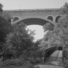
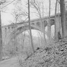
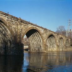
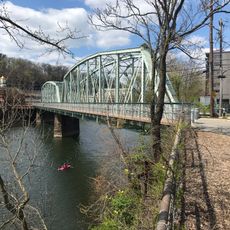
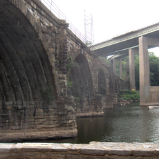
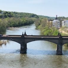
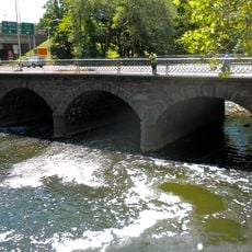
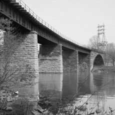
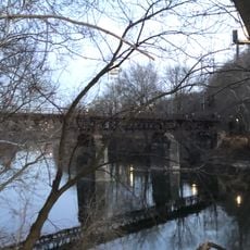
The Wissahickon Trail is a hiking and walking path in Pennsylvania that follows the Wissahickon Creek through a wooded valley connecting Philadelphia to Montgomery County. The path alternates between packed dirt sections and paved stretches, with bridges crossing the creek at several points along the way.

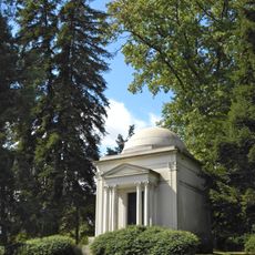
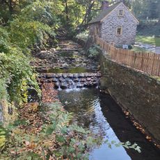
The valley was home to Lenape communities before European settlers arrived in the 1600s and built grain and paper mills along the creek. By the early 20th century, the Fairmount Park Commission took over the land and turned it into protected public parkland.

The trail is a longtime gathering place for people from Philadelphia and the surrounding towns, who come on weekends to walk, run, or ride horses through the wooded sections. The sound of Wissahickon Creek running alongside the path is something most visitors notice right away.

The trail has multiple entry points spread along its length, so you can choose where to start depending on how far you want to walk. Some sections are flat and accessible, while others involve steeper ground and are better suited for those comfortable with uneven terrain.

Along the trail stands a stone equestrian statue known as "Deerskin," carved in the 19th century, which is one of the few outdoor stone statues of its kind still standing in an American urban park. Many people walk past it without realizing it was placed there long before the trail itself was formally established.

The community of curious travelers

AroundUs brings together thousands of curated places, local tips, and hidden gems, enriched daily by 60,000 contributors worldwide.

Start exploring
Location
GPS coordinates
40.01640,-75.20590
Latest update
March 3, 2026 13:56
Around this place
Laurel Hill Cemetery
United States of America

Laurel Hill Cemetery

2.1 km
West Laurel Hill Cemetery
United States of America

West Laurel Hill Cemetery

1.5 km
Wyck House
United States of America

Wyck House

2.4 km
Historic RittenhouseTown
United States of America

Historic RittenhouseTown

1.9 km
Wissahickon Memorial Bridge
United States of America

Wissahickon Memorial Bridge

1.2 km
Manayunk Bridge
United States of America

Manayunk Bridge

2 km
Alden Park Manor
United States of America

Alden Park Manor

2 km
Walnut Lane Bridge
United States of America

Walnut Lane Bridge

1.8 km
Ravenhill
United States of America

Ravenhill

817 m
Falls Bridge
United States of America

Falls Bridge

1.1 km
Chain Bridge at Falls of Schuylkill
United States of America

Chain Bridge at Falls of Schuylkill

1.6 km
Paper Mill Run
United States of America

Paper Mill Run

2.2 km
Chamounix
United States of America

Chamounix

2.3 km
Walnut Lane Memorial Bridge
United States of America

Walnut Lane Memorial Bridge

2.4 km
Thomas Mifflin School
United States of America

Thomas Mifflin School

1.2 km
United States of America

Paul J. Gutman Library

1.4 km
Philadelphia and Reading Railroad, Schuylkill River Viaduct
United States of America

Philadelphia and Reading Railroad, Schuylkill River Viaduct

1.6 km
The Monastery
United States of America

The Monastery

2.2 km
Pencoyd Bridge
United States of America

Pencoyd Bridge

651 m
The Lilacs
United States of America

The Lilacs

2.1 km
Twin Bridges
United States of America

Twin Bridges

1.5 km
St. Josaphat Roman Catholic Church in Philadelphia
United States of America

St. Josaphat Roman Catholic Church in Philadelphia

1.7 km
Green Lane Bridge
United States of America

Green Lane Bridge

2.2 km
Ridge Avenue Bridge in Philadelphia
United States of America

Ridge Avenue Bridge in Philadelphia

218 m
Philadelphia and Reading Railroad, Bridge at West Falls
United States of America

Philadelphia and Reading Railroad, Bridge at West Falls

1.6 km
City Avenue Bridges
United States of America

City Avenue Bridges

546 m
Dobson Mills
United States of America

Dobson Mills

1.9 km
Mule Bridge
United States of America

Mule Bridge

1.3 km
Show the full map
Reviews
Share your experience

No review yet

Discussions
Start a discussion...

No discussion yet

« Wissahickon Trail - Hiking trail in Montgomery County, Pennsylvania, US » is provided by Around Us (aroundus.com). Images and texts are derived from Wikimedia project under a Creative Commons license. You are allowed to copy, distribute, and modify copies of this page, under the conditions set by the license, as long as this note is clearly visible.

Discover hidden gems everywhere you go!

From secret cafés to breathtaking viewpoints, skip the crowded tourist spots and find places that match your style. Our app makes it easy with voice search, smart filtering, route optimization, and insider tips from travelers worldwide. Download now for the complete mobile experience.

Around Us App Screenshot

A unique approach to discovering new places

Le Figaro

All the places worth exploring

France Info

A tailor-made excursion in just a few clicks

20 Minutes

Around Us
Travel Guide & Maps
Download

Send to your phone

QR Code
1

Open the camera app on your mobile.

2

Point at the QR code with your camera. A notification will appear.

3

Tap the notification to open the link.