Chest opened
+${chestReward.xp} XP
Explorer
NOUVEAU ×${chestReward.collectible.quantity}
tapez pour fermer

See the monuments around you in AR Open chests in the app

Around Us is built for your phone — point your camera at the streets and discover the monuments and places around you in augmented reality. Around Us is built for your phone — chests unlock when you walk, explore and capture nearby places.

Enable Location

We need your location to show you interesting places around you

Discover nearby places

Find interesting locations and hidden gems around you

Precise directions

Get accurate directions and distances to places

Your location is never shared with other users. It's only used when you tap the location button.

Log in to your account

Start exploring — it's free

Trusted by 85,723 travelers worldwide

Continue with Google
Continue with Apple
or

We will send you a code to connect

By continuing, you accept our Terms and Conditions and our Privacy Policy

Check your inbox

We've sent a pincode in your inbox. Please enter the code below.

Windmill Point Light
Discussion Reviews Photo
2.2k Popularity

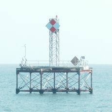
Windmill Point Light, Lighthouse at Rappahannock River mouth, Lancaster County, US.

Windmill Point Light is a lighthouse with an octagonal tower standing at the mouth of the Rappahannock River in Lancaster County. The blue limestone structure marks the location where the river meets open water and serves as a navigation aid for passing vessels.

Three lightships marked this dangerous location starting in 1839 before a permanent structure was built to better guide vessels through the waters. The lighthouse was constructed in 1869 to replace the temporary floating markers that had previously warned of the Rappahannock Spit shoal.

The lighthouse keeper's residence served the customs service during the Prohibition period to monitor and prevent illegal activities in the waterways.

The lighthouse operates with modern solar-powered equipment and is actively used for vessel navigation in the area. Visitors should be aware that access depends on weather conditions and shipping activity, as it remains a functioning navigation aid.

Winter ice severely damaged the structure in 1917, leading to extensive repairs that took until 1921 to complete.

The community of curious travelers

AroundUs brings together thousands of curated places, local tips, and hidden gems, enriched daily by 60,000 contributors worldwide.
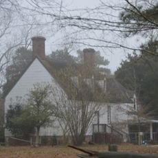
Start exploring
Location
GPS coordinates
37.59680,-76.23590
Latest update
August 31, 2026 00:08
Around this place
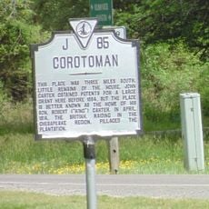
Corotoman
United States of America

Corotoman

12.1 mi
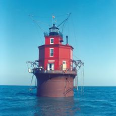
Wolf Trap Light
United States of America

Wolf Trap Light

14.5 mi
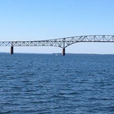
Robert O. Norris Bridge
United States of America

Robert O. Norris Bridge

10.4 mi
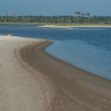
Bethel Beach Natural Area Preserve
United States of America

Bethel Beach Natural Area Preserve

13 mi
Toddsbury
United States of America

Toddsbury

16.3 mi
United States of America

Stingray Point Light

3.1 mi
Lower Church
United States of America

Lower Church

12.7 mi
USS Aquamarine
United States of America

USS Aquamarine

11.8 mi
Lancaster Court House Historic District
United States of America

Lancaster Court House Historic District

17.3 mi
Burgh Westra
United States of America

Burgh Westra

17.1 mi
Mary Ball Washington Museum and Library
United States of America

Mary Ball Washington Museum and Library

17.3 mi
Great Wicomico River Light
United States of America

Great Wicomico River Light

14.4 mi
F.D. Crockett
United States of America

F.D. Crockett

5.8 mi
Poplar Grove Mill and House
United States of America

Poplar Grove Mill and House

14.7 mi
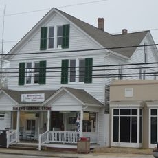
Sibley's and James Store Historic District
United States of America

Sibley's and James Store Historic District

12.1 mi
Reedville Historic District
United States of America

Reedville Historic District

17.1 mi
Billups House
United States of America

Billups House

11.1 mi
Mathews County Courthouse Square
United States of America

Mathews County Courthouse Square

12.3 mi
Springdale
United States of America

Springdale

13.1 mi
Fort Cricket Hill
United States of America

Fort Cricket Hill

8.5 mi
Riverlawn
United States of America

Riverlawn

14.2 mi
Bluff Point Graded School No. 3
United States of America

Bluff Point Graded School No. 3

9.6 mi
Steuart Blakemore Building
United States of America

Steuart Blakemore Building

17.3 mi
Elva C
United States of America

Elva C

17.2 mi
Clifton
United States of America

Clifton

10.9 mi
Mathews Downtown Historic District
United States of America

Mathews Downtown Historic District

12.3 mi
Deltaville Maritime Museum
United States of America

Deltaville Maritime Museum

5.8 mi
Reedville Fishermen's Museum
United States of America

Reedville Fishermen's Museum

17.2 mi
Show the full map
Reviews
Share your experience

No review yet

Discussions
Start a discussion...

No discussion yet

« Windmill Point Light - Lighthouse at Rappahannock River mouth, Lancaster County, US » is provided by Around Us (aroundus.com). Images and texts are derived from Wikimedia project under a Creative Commons license. You are allowed to copy, distribute, and modify copies of this page, under the conditions set by the license, as long as this note is clearly visible.

Discover hidden gems everywhere you go!

From secret cafés to breathtaking viewpoints, skip the crowded tourist spots and find places that match your style. Our app makes it easy with voice search, smart filtering, route optimization, and insider tips from travelers worldwide. Download now for the complete mobile experience.
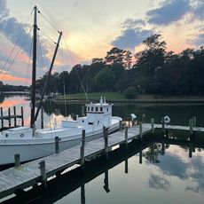
Around Us App Screenshot

A unique approach to discovering new places

Le Figaro

All the places worth exploring

France Info

A tailor-made excursion in just a few clicks

20 Minutes

Around Us
Travel Guide & Maps
Download

Send to your phone

QR Code
1

Open the camera app on your mobile.

2

Point at the QR code with your camera. A notification will appear.

3

Tap the notification to open the link.