Log in to your account

AroundUs is a community-driven map of interesting places, built by curious explorers like you. It grows with every review, story, and photo you share.
Connect to save your favorite spots, contribute locations, and create personalized routes.
Continue with Google
Continue with Apple
Continue with X
Continue with Facebook
Continue with email
By continuing, you accept our Terms and Conditions and our Privacy Policy
Create an account

Middle Fork State Fish and Wildlife Area

Add to collection
Map
Suggest a change
Share

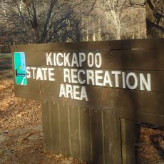
Middle Fork State Fish and Wildlife Area, Protected area in Vermilion County, Illinois.

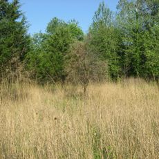
Middle Fork State Fish and Wildlife Area is a protected area in Vermilion County covering about 2,700 acres of varied terrain including forests, grasslands, and a working river. The land combines natural habitat with managed farmland to support local wildlife and outdoor access.

The Illinois Department of Natural Resources created this conservation area in 1986 following the end of mining operations in the region. This reclamation effort transformed abandoned industrial land into functioning wildlife habitat.

The site maintains 35 miles of marked trails for horseback riding and offers specialized equestrian camping facilities for outdoor recreation enthusiasts.

The area offers over 35 miles of marked trails suitable for hiking and horseback riding across varied terrain. Visitors should prepare for changing weather and check local access rules, particularly during hunting seasons.

The Middle Fork of the Vermilion River flows through this area and holds special protection status as both a State and National Scenic River. This designation safeguards the riverbanks from development and ensures visitors encounter a stable, natural watercourse.

Location: Illinois

Inception: 1986

GPS coordinates: 40.25940,-87.79390

Latest update: December 14, 2025 11:01

Photos
Around this place
Octave Chanute Aerospace Museum
United States of America

Octave Chanute Aerospace Museum

30.7 km
Kickapoo State Recreation Area
United States of America

Kickapoo State Recreation Area

16.6 km
Danville National Cemetery
United States of America

Danville National Cemetery

23.4 km
Fischer Theater
United States of America

Fischer Theater

20.2 km
Paxton Carnegie Public Library
United States of America

Paxton Carnegie Public Library

33.9 km
Kennekuk Cove County Park
United States of America

Kennekuk Cove County Park

8.3 km
Fountain County Courthouse
United States of America

Fountain County Courthouse

36.4 km
Carnegie Library of Covington
United States of America

Carnegie Library of Covington

36.5 km
Danville Public Library
United States of America

Danville Public Library

20.1 km
Paxton Water Tower and Pump House
United States of America

Paxton Water Tower and Pump House

33.9 km
Stone Arch Bridge
United States of America

Stone Arch Bridge

21.2 km
Danville Branch, National Home for Disabled Volunteer Soldiers Historic District
United States of America

Danville Branch, National Home for Disabled Volunteer Soldiers Historic District

23.1 km
Fithian House
United States of America

Fithian House

19.9 km
United States of America

First National Bank Building

20.5 km
Collins Archeological District
United States of America

Collins Archeological District

7.2 km
Holland Apartments
United States of America

Holland Apartments

20 km
Adams Building
United States of America

Adams Building

20.3 km
Williams Chapel
United States of America

Williams Chapel

26.4 km
Hoopes-Cunningham Mansion
United States of America

Hoopes-Cunningham Mansion

25.5 km
A. Herr and E. E. Smith Public Library
United States of America

A. Herr and E. E. Smith Public Library

37.1 km
Hoopeston Carnegie Public Library
United States of America

Hoopeston Carnegie Public Library

25.7 km
Fountain County Clerk's Building
United States of America

Fountain County Clerk's Building

36.3 km
West Lebanon-Pike Township Public Library
United States of America

West Lebanon-Pike Township Public Library

34.6 km
Covington Courthouse Square Historic District
United States of America

Covington Courthouse Square Historic District

36.4 km
Dunnan-Hampton House
United States of America

Dunnan-Hampton House

34.7 km
Covington Residential Historic District
United States of America

Covington Residential Historic District

36.4 km
William C.B. Sewell House
United States of America

William C.B. Sewell House

36.6 km
Building at 210–212 West North Street
United States of America

Building at 210–212 West North Street

20.2 km
Show the full map
Reviews

Visited this place? Tap the stars to rate it and share your experience / photos with the community! Try now! You can cancel it anytime.

« Middle Fork State Fish and Wildlife Area - Protected area in Vermilion County, Illinois » is provided by Around Us (aroundus.com). Images and texts are derived from Wikimedia project under a Creative Commons license. You are allowed to copy, distribute, and modify copies of this page, under the conditions set by the license, as long as this note is clearly visible.

Discover hidden gems everywhere you go!

From secret cafés to breathtaking viewpoints, skip the crowded tourist spots and find places that match your style. Our app makes it easy with voice search, smart filtering, route optimization, and insider tips from travelers worldwide. Download now for the complete mobile experience.

Around Us App Screenshot

A unique approach to discovering new places

Le Figaro

All the places worth exploring

France Info

A tailor-made excursion in just a few clicks

20 Minutes